


The third and final installment of Planetizen's examination of the role of the planning profession in both perpetuating and solving traffic congestion.
This article is part three of three in a series on the role of the field of planning in studying, creating, and responding to congestion. Part one, published on April 13, 2022, dug into the causes of congestion. Part two, published on April 20, 2022, examined failed approaches to congestion. The final installment of the series reveals the only proven methods for reducing congestion.
Why is congestion relief so elusive? The world has no shortage of promised solutions to congestion. The world also has no shortage of congestion.
A complex collection of delusions informs planning and policy responses to traffic congestion. These delusions are willful in some cases, but not all, and can be perpetuated both by individuals and the public at large. In a world full of wishful thinking and wasted promises, congestion is another inconvenient truth. It's time for straight talk.
The only way to reduce congestion is to drive less.
Because vehicle miles traveled (VMT) cause both congestion and greenhouse gas (GHG) emissions (and no, electric cars won't end the GHG emissions of a car-centric transportation system), the climate crisis demands the truth about congestion.
The only way to reduce congestion is to drive less.
Land Use and Development Misconceptions
Before we switch the focus of this series to factors that have been empirically proven to reduce congestion, we should rummage through the contents of one more mixed bag: the ability of land use planning to create or limit congestion.
For decades now, new development has been held up and obstructed out of concern for its potential to add vehicle trips to roads. Congestion is such a central concern of planning for new land uses—residential, retail, commercial, and industrial—that many environmental laws depend entirely on a metric known as Level of Service (LOS) to measure the impact of proposed development plans (LOS is graded with letter grades—the system for measuring congestion described in part one of this series).
For decades, and in many places still to this day, the status quo of land use planning has worked as follows: Traffic congestion is the primary talking point used by development opponents (also sometimes called NIMBYs) to turn public and political sentiment against a specific development. Laws that used LOS as the sole measure of development impact (the California Environmental Quality Act (CEQA) was for many years the most prominent example) add legal clout to their concerns. Where developments will worsen LOS (i.e., create congestion), they don't get built. When developments are approved, they are forced to include investments that widen roads and remove obstacles to traffic flow—mitigation techniques shown in parts one and two of this series to induce traffic and worsen congestion and traffic safety. To repeat the maxim, "You can't build your way out of congestion."
The proclivities of the land use planning—rejecting all infill development proposals and pushing development to sprawl ever farther out into the periphery—offer more examples of the status quo exacerbating the problem it promises to fix. There is still traffic congestion in the suburbs, after all, despite the false promise of escape. Congestion actually shifted to the suburbs during the Covid-19 pandemic, despite so many people working from home. Moreover, traffic flows spread out over more of the day, lessening traffic during morning peak hours, but also adding congestion when previously there had been none and worsening by the afternoon commute. This "peak spreading," as the phenomenon is known, is blamed in part on the proliferation of vehicles devoted to home delivery of food and consumer products and on more day-to-day tasks being performed in cars.
One of the false promises of sprawl is to lessen pressure on the urban core by spreading car trips out over a larger geographic area, but all of those new residents on the periphery come into the core eventually, whether for work, play, or civic responsibility. The game "Mini Metro," which debuted in 2014, artfully demonstrated how new sources of traffic on the periphery create congestion in the core.
Too many of the core tenets of the traditionally car-centric practice of planning in the United States contribute to congestion to list here, but one in particular bears special mention: parking. Parking is required in copious, unscientific amounts by almost every zoning code in the United States (zoning codes being the legal tool for the implementation of land use plans). For decades there was no land use planning in the United States without a large allowance for parking. However, over the years, parking has been shown to induce car trips and, it follows, cause congestion. There are so many cars on the road, in part, because there are so many parking spaces. (Read the High Cost of Free Parking by Donald Shoup if you haven't already.) The field of planning is beginning to wake up to the effects of the compulsory inclusion of parking in zoning codes, and numerous cities have implemented parking reforms in recent years and months.
The central assumption of the sprawling expansion of the built environment in the United States—that moving development outside of the city would mitigate traffic congestion—proves faulty. An essential component of land use plan implementation—i.e., the parking requirements of zoning codes—creates congestion. Moreover, the idea that density causes congestion has proven to be a less than reliable assumption.
Planning as it has been practiced for over a century causes congestion.
Strategic and Integrated Land Use and Transportation Planning
The historic role of land use planning in creating congestion does not mean that the field can't overcome its failures. In addition to the mountain of evidence of the negative congestion effects of poor land use planning, there is an equally impressive collection of studies and research to suggest that a different model of land use planning can reduce, or at least mitigate, congestion.
Transit Oriented Development
Let's start at the figurative and literal intersection of land use and transportation planning: transit oriented development (TOD). TOD is planned and designed to facilitate the easy access of local residents and workers to the local public transit system. Researchers have repeatedly found evidence that TOD reduces automobile trips.
As explained by researchers in Transfers Magazine in Spring 2021, the effectiveness of TOD in reducing automobile trips depends on economic factors. Their findings can be summarized as follows:
- Households with higher incomes drive more, regardless of where they live.
- Controlling for income, TOD residents always drive less than non-TOD residents.
- The difference in vehicle miles traveled between TOD and non-TOD households widens as income rises.
- The lowest-income households use public transit more frequently than other households, regardless of location in a TOD.
- At every income level, TOD residents take substantially more daily transit trips than non-TOD households, with the largest increase occurring at the lowest income level.
The researchers used these findings to conclude that if the only goal were to reduce vehicle trips, TOD should focus on attracting wealthier residents. However, if the goal is to increase transit use, TODs should prioritize lower-income residents. Obviously, congestion gets extremely hard to fix when environmental goals are in direct contradiction with social equity goals. But the researchers say that these two goals can be met by simply building a lot of TOD, accessible at a variety of income levels.
"In principle, nothing stops cities from attaining both goals. If cities create dense mixed-income neighborhoods, with ample supplies of both affordable and market-rate units that house a broad range of income groups, they can attain both their environmental and equity goals." -Marlon Boarnet, Andrew Eisenlohr, Raphael W. Bostic, Seva Rodnyansky, Evgeny Burinskiy, Hue-Tam Jamme, and Raúl Santiago-Bartolomei.
In more evidence of the relative, not absolute, value of TOD in reducing automobile trips, trip destination determines mode choice more than the origin. The destination preference is apparent in the relative importance of employment density (as compared to residential density) in producing transit tips. The history of land use and development in California since the state adopted SB 375, a law requiring the reduction of Vehicle Miles Traveled (VMT) in local and regional transportation plans, further evidences the relative importance of commercial and office TOD for the reduction of VMT. For many people, it's the transit oriented workplace, more than the transit oriented home space, that gets them on the train or bus and out of a car.
The most effective transit oriented development, as it turns out, is a transit oriented destination.
TOD is a relatively new concept in the planning lexicon so researchers, planners, and designers are still gathering evidence about where TOD goes wrong and how to get it right. But as TOD becomes more popular, researchers are learning more about how to design and plan developments to ensure a large number of transit oriented residents and workers maximize non-automobile trips. Design decisions as varied as sidewalk width, vehicle lane width, leading pedestrian intervals at crosswalks, bike lanes, and universal access for those with disabilities can ensure more people feel comfortable leaving the car behind for trips on foot, bike, or transit.
Street Grids, Density, and Mixed-Use Developments
TOD is only one component of an alternative to sprawling, car-centric land use patterns. The larger project of planning and developing walkable, mixed-use developments in a more dense, compact arrangement is sometimes referred to as Smart Growth. Advocates for Smart Growth (which includes a priority on TOD) claim that the reduction of VMT is one of the primary benefits of a more compact approach to land use planning and development. While there is evidence that the strategies of Smart Growth reduces VMT, researchers are still looking for proof that the resulting concentration of vehicle trips doesn't offset the VMT reductions. To be fair, most of the built environment of the United States is still too car-centric and automobile dependent for islands of mixed-use density and walkable neighborhoods to begin to scratch the surface of the congestion problem.
The Center for Neighborhood Technology (CNT) has co-opted the term "location efficiency" (from a 1994 paper on the location efficiency of mortgages) to describe the benefits of mixed-use urban density—benefits which include the reduction of VMT. CNT used the concept to work with the Brookings Institution to create a tool called the Housing and Transportation Affordability Index that bakes the trip reductions enabled by compact development into calculations about the cost of living. Over and over again, sprawling land use is shown to significantly induce VMT that would have been prevented by compact, transit oriented, mixed-use development development patterns.
The differences between sprawl and Smart Growth extend beyond density and transit adjacency, down to the arrangement of streets. Here too, however, we find a dearth of authoritative evidence to decide whether a uniform street grid, the preferred street layout of Smart Growth, is preferable to the arterials, collector streets, and cul-de-sacs of sprawl. A 2018 article by Robert Steuteville makes the case that urban street grids can handle more traffic that the sprawling alternative, citing the example of Ithaca, New York to make the case, but much of the research comparing the urban street grid to sprawling street layouts focuses on traffic safety and public health (spoiler: the urban street grid is safer and healthier).
But it's a dearth, not a complete lack, of evidence. Steuteville also notes that a handbook from the Institute of Transportation Engineers ("the primary professional organization for street and road designers") does credit street grids for reducing congestion, but stops short of quantifying the extra capacity provided by the street grid.
"The lack of research on capacity is a sign that we have not fully faced up to the mistakes that were made in the middle of the 20th Century," writes Steuteville. The misconception about the capacity of urban street grids to handle a large amount of multi-modal traffic, however, is another delusion that determines planning decisions and perpetuates the status quo of congestion.
By the standards we evaluated other congestion relief measures in parts one and two of this series, reducing VMT is not the same as reducing congestion. But unlike many of the other proposed congestion relief measures we've examined, TOD and Smart Growth aren't actively exacerbating the congestion problem—they provide viable alternatives to congestion where otherwise there would be none. Every trip that residents and workers take on transit, bike, or foot in transit oriented or Smart Growth communities is one less trip that they would be taking in an automobile in a typical sprawling development.
Transportation Demand Management
What if instead of requiring parking spaces and road widening projects, zoning codes and development agreements required things like bike parking facilities, transit passes, or shuttle services? Some cities have begun to implement these kinds of reforms, at least for some development types and in certain parts of the city. In October 2021, the city of Boston released a new set of review guidelines for developments of more than 50,000 square feet in size, supplemented by a new Transportation Demand Management "Points System" to help developers ensure that new developments provide access to public transit and active transportation modes and reduce VMT. Developments of this size in the city are required to work with city planners to reduce the transportation impacts of proposed developments, producing a legal agreement called a Transportation Access Plan Agreement (TAPA), to be approved by the Boston Transportation Department (BTD) during the development approval process. The guidelines include recently approved maximum parking ratios that model parking requirements on a development’s walkability and mobility choices, as well as a suite of Transportation Demand Management (TDM) options including subsidized transit passes, bike share passes, carpooling, car share, and parking pricing.
The definition of TDM, separate from the Boston zoning context, includes telecommuting, public transit, taxis, carsharing, paratransit, ridesharing, walking, and biking, according to Mobility Lab. All of these various options have in common the intention to reduce congestion.
Even though implementation has been incremental where it has been codified, like in Boston, TDM strategies as a part of the zoning code represent a fundamental shift in planning practice, and a substantive acknowledgement that the status quo or widening roads and removing traffic controls is not providing solutions to congestion.
What Reduces Congestion?
Any effective congestion reduction efforts must reduce the amount of travel in cars. There is no way around that basic fact, no matter how hard some—in private industry, political office, or the general public—attempt to deny it.
This fact of modern life can sometimes be obfuscated by the varying effectiveness of the projects and programs designed to reduce Vehicle Miles Traveled (VMT). But researchers and planners are starting to get a picture of what works and what doesn't, as well as which strategies for land use and transportation planning are worthwhile for other kinds of benefits, like affordability and greenhouse gas emission reductions, even if they won't solve congestion entirely by themselves.
A study published in February 2022 by the Case Studies on Transport Policy journal examined the results of 800 peer-reviewed reports and case studies from Europe, ranking congestion programs based on how effectively they reduced car trips. You'll notice some of the concepts discussed in the article and the previous two articles in this series—but most of the list is made up of Transportation Demand Management strategies like those discussed in the previous section of this article. The complete rankings read like this (read more about the research and its findings in an article for the Conversation):
- Congestion Pricing (12-33% reduction in city-center cars)
- Parking and Traffic Controls (11-19% reduction in city-center cars)
- Limited Traffic Zones (10-20% reduction in city-center cars)
- Workplace Mobility Services (37% drop in car commuters)
- Workplace Parking Charges (8-25% reduction in car commuters)
- Workplace Travel Planning (3-18% drop in car use by commuters)
- University Travel Planning (7-27% reduction in car use by university commuters)
- University Mobility Services (24% drop in students commuting by car)
- Car Sharing (12-15 private cars replaced by each shared car)
- School Travel Planning (5-11% reduction in car use for school trips)
- Personalized Travel Planning (6-12% drop in car use share among residents)
- App-Based Incentives (73% - proportion of app users declaring reduced car use)
All of these concepts are intended to reduce the number of car trips as measured by the reduction of car trips, not measures of congestion relief, like Level of Service (LOS). In case it's not obvious yet: because of the economic and environmental externalities of automobile dependency, congestion is no longer the main concern about excessive car use. This point is critical to the entire exercise of this three-part series: VMT is worth reducing for reasons of sustainability and equity, not congestion. And yet, so much of the world is built around the erroneous assumption that the world can be built to accommodate vehicles while avoiding congestion.
At the top of that list is a term that this series hasn't yet addressed: congestion pricing. Congestion pricing, also sometimes referred to as cordon pricing or road tolling, is what some researchers call the only proven policy mechanism for reducing congestion. Most of what we have written so far has been building to this moment.
Congestion Pricing
A study published in 2008 by the RAND Corporation broke the news to Angelenos trapped in what many studies called the worst traffic in the nation at the time: "The prospects for building the way out of congestion are limited," said the report in it's own version of the "You can't build your way out of congestion" maxim repeated above. Moreover, according to the report, the best way to reduce demand for roadways during peak hours was to charge for the use of roads.
Pricing not only works to reduce congestion in the short run, according to the study, but it is the only congestion relief strategy flexible enough to resist the "triple convergence" that usually follows congestion relief: "travelers who had previously altered their travel patterns to avoid congestion will notice the improvement and return to driving along the once-busiest routes during the peak hours. Some will shift from other times of travel, some from other routes of travel, and some from other modes of travel (such as subways or commuter rail)."
A more recent article by Joe Cortright for the City Observatory points to Louisville as a "surefire" example of the success of congestion pricing in actually achieving its promised goal to reduce congestion. Traffic on Interstate 65 fell by half after Indiana and Ohio instituted a $1 to $2 toll on a bridge across the Ohio River. in 2021 Unfortunately, the states implemented the tolls after the states spent a billion dollars widening their highways. Cortright suggests that the states implemented the tolls more to raise money to build more highways rather than to reduce congestion, so count another one for the status quo.
There are various manifestations of the congestion pricing concept in practice, and in development, around the world. Congestion pricing usually refers to a toll charged along a specific corridor, although the term is often used as a catchall phrase to refer to any pricing scheme meant to create a new cost, and thus a disincentive, for driving. A key aspect of congestion pricing is a dynamic pricing scheme—the flexibility to raise or lower prices based on demand to ensure that traffic stays free flowing. Dynamic pricing schemes can lead to some very high prices—but they also work to reduce vehicle trips and, thus, congestion. The trip reduction benefit resulting from dynamic pricing on high-demand corridors has been proven by toll roads in Virginia in recent years.
Then there's cordon pricing, like the congestion programs in London and under consideration in New York City, which implements a charge to drive into a predetermined area, or "zone," of a given city. In New York City, the cordon zone would include a slice of Manhattan below 60th Street. Los Angeles is considering congestion pricing along some of its freeways as well as cordon pricing for its downtown.
In addition to reducing congestion, the money raised from congestion pricing can be used to fund public transit or other alternative transportation infrastructure, in addition to covering more of the cost of maintaining the existing streets and roads that cars use for travel (a task for which the gas tax is wildly inadequate). The cordon pricing scheme under consideration in New York City would generate sorely needed money for the MTA bus and subway systems, for example. The New York City congestion pricing plan also exemplifies another key characteristic of congestion pricing: a lack of political support. After the plan initially failed in the New York State Legislature in 2008, the plan won approval in 2019 before facing delays delayed first by the Trump administration and then the Covid-19 pandemic. As of this writing, the Environmental Assessment for the plan is expected in December 2022.
Some of the political opposition to the implementation of congestion pricing can be traced to concerns about equity. Adding a toll to enter roads or zones around a city increases the costs of automobile travel, an impact felt more significantly by low-income people already forced to pay the costs of owning and operating an automobile due to the car-centric infrastructure and land use of the built environment. It would seem that, like the example of Transit Oriented Development shared earlier in this article, the ability to reduce greenhouse gas emissions by reducing VMT counteracts a commitment to social equity.
Advocates and researchers, however, say that the equity discussion isn't as black and white as it appears on the surface level. Researchers from the University of California, Los Angeles in April 2022 published a report with specific details about how to mitigate concerns about equity while pricing congestion in the Los Angeles region (spoiler alert: the report suggests that revenue generated by tolls could ultimately solve the burdens created for the 13 percent of the population most impacted by the change). The nonprofit TransForm in 2019 released a report and toolkit to help transportation planners set congestion charges equitably, while taking into account a holistic assessment of the costs of mobility.
An October 2021 article by David Zipper for the Washington Post suggests that in some cases the equity angle can be misleading. Fewer than half of the households in New York own cars, points out Zipper, and, in the point made in the TOD section above, affluent people drive more. Zipper also quotes University of California, Los Angeles professor Michael Manville, an ardent supporter of congestion pricing, who in Spring 2019 wrote that "Free roads are not a good way to help poor people."
"Virtually every fairness-based criticism of priced roads — they help the rich more than the poor, they prevent some people from traveling, they actively harm the poor — also applies to free roads. On free roads, the rich drive more than the poor. Unpriced roads get congested, and congestion prevents some people from traveling. Congestion also creates pollution, and the pollution actively harms poor people." -Michael Manville
I Would Do Anything for Congestion Relief, But I Won't Do That
Recession
In an economy and a society defined by automobile dependency, empty roads aren't usually a good sign.
When looking for periods of relative relief from congestion, one could simply look to the history of economic recessions. Numerous studies have documented both the decline in driving during recessions, likely due to high unemployment reducing the number of commuters and financial stress pushing people to ride transit (more buried at the end of this report), and the increase in congestion when the economy recovers (it took until 2015 for Vehicle Miles Traveled to recover from the Great Recession of 2008, according to INRIX and the Texas A&M Transportation Institute). In the past, the decline in driving during a recession would lower traffic fatalities. The pandemic reversed that pattern, as traffic fatalities rose even as Vehicle Miles Traveled declined during the pandemic, a sign of more reckless driving and what some psychologists call an "arousal breakout").
There are a few cities around the country, with far less congestion than one might expect from a globally recognized city—cities like Detroit, Buffalo, or Cleveland. These Legacy Cities, also known as Rust Belt cities, are currency occupied by far fewer residents than in the mid-20th century. Congestion still happens in cities that have lost population—much of the population that left these cities moved to suburbs on the peripheries of their respective metropolitan areas, and many Rust Belt cities have allowed transit systems to fall into disrepair, or nonexistence, due to decades of neglect. But their example shows that one proven method of congestion relief is for huge portions of a population to move away, taking their tax dollars with them, along with the decline and fall of entire industries.
Streets and roads emptied of cars at the beginning of the Covid-19 pandemic, too. While some celebrated the sudden decline of traffic as a boon for the planet (e.g., clean air in Los Angeles, dolphins in the Venice canals), the earliest weeks of the pandemic in the United States—one of the most surreal and frightening periods in living memory—were defined by disparate impacts in who was getting sick and dying, who got to stay at home, and who was left to fend for themselves. The supposed environmental benefits of the early pandemic turned out to be mostly illusory, anyway. Congestion relief was not a pandemic silver lining.
Until fundamental cultural and economic changes are made, the end of congestion is a very bad sign.
Congestion
One of the most powerful deterrents for car trips is congestion itself.
While many drivers might suspect that streets and roads are left deliberately clogged by incompetence or malfeasance, the annals of planning history include one famous example of urban planners embracing congestion to discourage automobile trips and set land use and development priorities that reflect this voice.
That city is Vancouver, British Columbia, where in the year 2000 one city planner had the chutzpah to say "congestion is our friend" in describing the city's efforts to discourage driving in the city's downtown.
A 1983 paper by Ross Blunden used a different turn of phrase when describing the potential benefit of congestion in deterring more congestion: "there are two kinds of congestion—one arising from inefficiency and a much more dramatic kind that arises from pressure of demand. The former is an enemy and must be confronted, the latter needs to be embraced as an ally."
When traffic congestion gets worse and lasts for more of the day, argues Blunden, "public transport alternatives (if any) become more attractive."
As far back as 1983, Blunden was lamenting the car-centric focus of transportation planning. Despite the end of the highway building era that brought "super-imposing massive rural type freeways on established urban land use and transport structure," according to Blunden, "the transport planner is still ready to prescribe a major bridge or a clover-leaf interchange to solve a bottleneck problem."
In many places, not much has changed. But more and more often, planners are rejecting the status quo of car-centric planning. There is enough evidence of the damage done by the assumptions and dogma of that status quo to build momentum for a new way of planning and building.
Misinformation: Congestion Edition
If only congestion were a question of picking among a menu of projects and programs with a demonstrated ability to reduce congestion. In the United States, and much of the world, however, congestion problems are routinely sold as congestion solutions. One of the main causes of congestion is misinformation—willful or unintentional.
Some of the myths that drive the status quo of congestion in this country are deliberately created by conflicted political and financial interests. It's easy to make money on roads and cars if you've been making money off roads and cars for a century (the same is true for getting elected).
Other myths are maintained by the commonality of the experience. All drivers get stuck in traffic, form biased opinions about it, and then share those opinions with other like-minded people. Talking about traffic is like talking about the weather.
The difference is that we leave predictions about the weather to meteorologists, not to a small group of people with controlling financial interest in the sun or the clouds.
Even then, most people stop listening when meteorologists connect the solutions to congestion with the solutions to climate change.
This is the third in a series of articles on the role of planning in addressing traffic congestion (part one and part two can be read on Planetizen).

How Planning Fails to Solve Congestion
Solutions for congestion are never as simple and easy as armchair planners and engineers would like you to believe—especially those who suggest that congestion can be solved by forever building more roadway capacity.

Planning and the Complicated Causes and Effects of Congestion
What do planners know about congestion, and what can they do about it? Explanations and solutions are less obvious than they seem (part one of a three-part series).
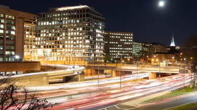
Car Commutes and Congestion Are Back in D.C.
Low transit ridership and a more dispersed daytime workforce are creating new headaches for car commuters in the D.C. area—in a story likely to be repeated all over the country as work returns to the office.

Planetizen Federal Action Tracker
A weekly monitor of how Trump’s orders and actions are impacting planners and planning in America.

Maui's Vacation Rental Debate Turns Ugly
Verbal attacks, misinformation campaigns and fistfights plague a high-stakes debate to convert thousands of vacation rentals into long-term housing.

San Francisco Suspends Traffic Calming Amidst Record Deaths
Citing “a challenging fiscal landscape,” the city will cease the program on the heels of 42 traffic deaths, including 24 pedestrians.

Defunct Pittsburgh Power Plant to Become Residential Tower
A decommissioned steam heat plant will be redeveloped into almost 100 affordable housing units.

Trump Prompts Restructuring of Transportation Research Board in “Unprecedented Overreach”
The TRB has eliminated more than half of its committees including those focused on climate, equity, and cities.

Amtrak Rolls Out New Orleans to Alabama “Mardi Gras” Train
The new service will operate morning and evening departures between Mobile and New Orleans.
Urban Design for Planners 1: Software Tools
This six-course series explores essential urban design concepts using open source software and equips planners with the tools they need to participate fully in the urban design process.
Planning for Universal Design
Learn the tools for implementing Universal Design in planning regulations.
Heyer Gruel & Associates PA
JM Goldson LLC
Custer County Colorado
City of Camden Redevelopment Agency
City of Astoria
Transportation Research & Education Center (TREC) at Portland State University
Jefferson Parish Government
Camden Redevelopment Agency
City of Claremont