


Motor vehicle crashes claim over 30,000 lives per year, with related costs in the hundreds of billions. While we sometimes view that frightening statistic as inevitable, there are reasons to reexamine speed limits and how we set them.
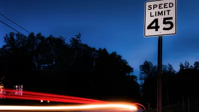
In this article, Anna Maria Barry-Jester asks the question: where do speed limits come from? "Given the social and economic toll of speeding, one might assume that we set speed limits with careful calculations aimed at maximizing safety." However, she continues, "in most places, speed limits are largely determined by the speed most people feel safe traveling."
This average comfortable speed sits at a hypothetical 85th percentile: given the road, 85% of drivers will cruise below it and 15 percent will speed above it. But road engineers know this, and build margins of "safety" into new roads: "[the 85th percentile is] used to design a road to meet that speed at a minimum, with a factor of safety allowing for faster travel."
The article discusses a historical shift from keeping roads safe from cars, to keeping them safe for cars. "City speed limits were set below 20 mph until automakers and industry groups realized that such low limits were going to hurt sales. To change public opinion, campaigns were started to criminalize pedestrians in the road (jaywalking) and to shift the blame for accidents from cars to 'reckless drivers.'"
Nowadays, people are less willing to accept the auto-centric status quo, at least in cities. Recent efforts like New York's Vision Zero plan mark departures from our "culture of acceptance" around traffic fatalities.
FULL STORY: Why The Rules Of The Road Aren’t Enough To Prevent People From Dying

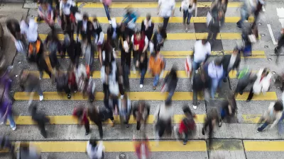
Big Cities Make Pedestrian Safety a Priority
New data released Dec. 19 by NHTSA shows increased safety for those traveling by car, but pedestrian fatalities are 15% higher than in 2009. Plans by San Francisco, Los Angeles, New York, and Chicago to increase ped safety are described by the WSJ.
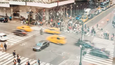
NYC Pedestrian Deaths Rose in 2024
The city’s Vision Zero efforts seem to have stalled.
Audit: Portland’s Vision Zero Needs More Data, Funding
A city audit found that the program has failed to reduce traffic deaths and could benefit from a more systematic approach. Meanwhile, PBOT says it needs more state funding to support road safety projects.

Planetizen Federal Action Tracker
A weekly monitor of how Trump’s orders and actions are impacting planners and planning in America.

Map: Where Senate Republicans Want to Sell Your Public Lands
For public land advocates, the Senate Republicans’ proposal to sell millions of acres of public land in the West is “the biggest fight of their careers.”

Restaurant Patios Were a Pandemic Win — Why Were They so Hard to Keep?
Social distancing requirements and changes in travel patterns prompted cities to pilot new uses for street and sidewalk space. Then it got complicated.

Platform Pilsner: Vancouver Transit Agency Releases... a Beer?
TransLink will receive a portion of every sale of the four-pack.

Toronto Weighs Cheaper Transit, Parking Hikes for Major Events
Special event rates would take effect during large festivals, sports games and concerts to ‘discourage driving, manage congestion and free up space for transit.”

Berlin to Consider Car-Free Zone Larger Than Manhattan
The area bound by the 22-mile Ringbahn would still allow 12 uses of a private automobile per year per person, and several other exemptions.
Urban Design for Planners 1: Software Tools
This six-course series explores essential urban design concepts using open source software and equips planners with the tools they need to participate fully in the urban design process.
Planning for Universal Design
Learn the tools for implementing Universal Design in planning regulations.
Heyer Gruel & Associates PA
JM Goldson LLC
Custer County Colorado
City of Camden Redevelopment Agency
City of Astoria
Transportation Research & Education Center (TREC) at Portland State University
Camden Redevelopment Agency
City of Claremont
Municipality of Princeton (NJ)