


The 300-foot wide Queens Boulevard has been known as the Boulevard of Death. Since 1990, it has claimed 186 lives, 74 percent being pedestrians, including 18 in 1997 alone. A series of safety improvements have brought fatalities to zero since 2014.
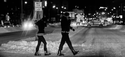
"The Boulevard of Death has become the Boulevard of Life,” declared Mayor Bill de Blasio in an interview with Winnie Hu, a reporter on The New York Times Metro desk, focusing on transportation and infrastructure.
Queens Boulevard has become the poster child for Mr. de Blasio’s ambitious Vision Zero campaign to eliminate traffic deaths citywide through a host of enforcement measures and safety improvements, including redesigning streets and re--timing walk signals to give pedestrians a head start in crosswalks.
“Queens Boulevard is the ultimate example of what was wrong in this city for decades,” he said. “I love my city but something was broken that we had a street called the Boulevard of Death and we accepted that."
To deal with the 12-lane, 300-foot width, the New York City Department of Transportation installed pedestrian countdown signals, increased the pedestrian crossing time, installed sidewalk bulb-outs, "widened medians and built protective barriers around them," adds Hu. "More crosswalks were added and fencing installed along the entire boulevard to deter jay walking."
Lanes were removed and reconfigured. Red light cameras were added. But six pedestrians died in 2013. De Blasio, who took office the next year, lowered the speed limit from 30 to 25 mph.
Since then, city transportation officials have invested $4 million to redesign the boulevard, including putting in bike lanes and more crosswalks and places for pedestrians to wait in the median while crossing, and redesigned car lanes to reduce conflicts between local and through traffic. They added cameras to catch speeding drivers near two schools.
The bike lanes were particularly noteworthy because they showed the commitment of the mayor toward remaking the Boulevard of Death for cyclists. He overrode the community board who had removed them during the planning process. Take a Streetfilm tour here with Ryan Russo from the NYC DOT.
The biggest changes are still to come to Queens Boulevard. In 2019, the city expects to begin a $255-million project that will add wide, tree-lined medians, benches and a continuous bike and walking path.
Vision Zero fatality update
Notwithstanding the success on Queens Boulevard, the city has a long ways to go in reducing traffic deaths to zero by 2024.
"After two years of major declines in New York City’s traffic deaths, the number of people killed in crashes dropped slightly last year [to 231] while pedestrian deaths rose," reported Emma G. Fitzsimmons on Jan. 10, 2017. "Pedestrian deaths, which accounted for the largest share of fatalities, increased last year to [148], from 139 in 2015."
"This year’s numbers are more promising, with 198 overall traffic deaths as of Nov. 21, or 11 fewer than the same time last year," reports Hu. "Of those, 92 involved pedestrians, or 41 fewer than the year before, while 19 involved cyclists, or two more than the year before."
Hat tip to Peter Flieg.
FULL STORY: No Longer New York City’s ‘Boulevard of Death’

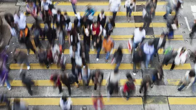
Big Cities Make Pedestrian Safety a Priority
New data released Dec. 19 by NHTSA shows increased safety for those traveling by car, but pedestrian fatalities are 15% higher than in 2009. Plans by San Francisco, Los Angeles, New York, and Chicago to increase ped safety are described by the WSJ.
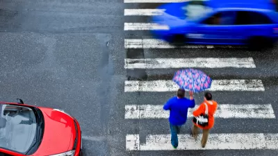
Pedestrian Deaths Last Year Projected to Be Highest Since 1990
Among the factors that stand out in the "Spotlight on Highway Safety" report released Thursday by the Governors Highway Safety Association is increased "death by SUV," which kill at a higher rate than cars. Distraction, however, is hard to prove.
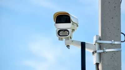
Philly Speed Camera Program Cuts Fatalities in Half
Excessive speeding along dangerous segments of Roosevelt Boulevard dropped by 90 percent after the city installed automated enforcement cameras.

Planetizen Federal Action Tracker
A weekly monitor of how Trump’s orders and actions are impacting planners and planning in America.

Restaurant Patios Were a Pandemic Win — Why Were They so Hard to Keep?
Social distancing requirements and changes in travel patterns prompted cities to pilot new uses for street and sidewalk space. Then it got complicated.

Maui's Vacation Rental Debate Turns Ugly
Verbal attacks, misinformation campaigns and fistfights plague a high-stakes debate to convert thousands of vacation rentals into long-term housing.

In California Battle of Housing vs. Environment, Housing Just Won
A new state law significantly limits the power of CEQA, an environmental review law that served as a powerful tool for blocking new development.

Boulder Eliminates Parking Minimums Citywide
Officials estimate the cost of building a single underground parking space at up to $100,000.

Orange County, Florida Adopts Largest US “Sprawl Repair” Code
The ‘Orange Code’ seeks to rectify decades of sprawl-inducing, car-oriented development.
Urban Design for Planners 1: Software Tools
This six-course series explores essential urban design concepts using open source software and equips planners with the tools they need to participate fully in the urban design process.
Planning for Universal Design
Learn the tools for implementing Universal Design in planning regulations.
Heyer Gruel & Associates PA
JM Goldson LLC
Custer County Colorado
City of Camden Redevelopment Agency
City of Astoria
Transportation Research & Education Center (TREC) at Portland State University
Jefferson Parish Government
Camden Redevelopment Agency
City of Claremont