


After the local community board removed a protected bike lane from its plans for the redesign of Queens Boulevard, Mayor Bill de Blasio restored it, under the premise of saving lives.
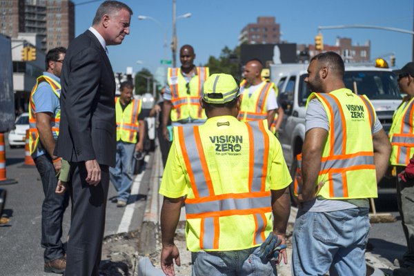
credit: NYC Office of the Mayor
Opposition to bike lanes is nothing new in New York City. Perhaps the most vocal opposition was against the Prospect Park West bike lane in Brooklyn in 2010. While opposition to such lanes continues (even against Prospect Park West), as evidenced in Queens by Dan Rivoli, mobility reporter for the New York Daily News, the need for bike safety trumps it when backed by a strong leader and committed staff.
"The city Department of Transportation will put in a new bike lane along part of Queens Blvd. even though the local community board doesn’t want it, Mayor de Blasio said Wednesday [May 11]," writes Rivoli. "The decision was announced after the chair of Queens Community Board 4 in Corona and Elmhurst removed the bike lane from a package of street safety designs to improve the notorious Boulevard of Death before voting to approve the changes Tuesday night.
Despite the community board's vote on the safety package without the bike lane, de Blasio said it was going in anyway as part of his Vision Zero* pedestrian and bicycle safety agenda.
“I respect those who disagree with us, but in the end, the safety of our neighbors and our children is the most fundamental responsibility we have in this work,” de Blasio said in a statement.
I have instructed the Department of Transportation to move forward on the next phase of safety enhancements to Queens Boulevard, including a protected bike lane for cyclists,” he said.
The article contains a map showing the three sections, known as operational projects, of Queens Blvd. that have been or will be redesigned. Operational Project 1, a 1.3 mile stretch, is finished and is a success by any standard. It won Streetsblog's 2015 Streetsie award for "Best Urban Street Transformation" and third place in People for Bike's third (2015) annual list of "10 Best New Bike Lanes." Take a Streetfilm tour here with Ryan Russo from the NYC DOT.
The restored protected bike lane will run on Operational Project 2, "from 74th St. to Eliot Ave. near the Long Island Expressway," writes Rivoli. "The rest of Queens Blvd. [Operational Project 3] up to Union Turnpike will get a bike lane in 2017."
Rivoli's requests for comments from the community board were not returned. "Community boards have advisory roles in city planning, but opposition from these local bodies have led the city to scale back safety projects in the past," he notes.
Why the deadly moniker?
"Since 1990, 185 New Yorkers have lost their lives on Queens Blvd., mainly pedestrians," states Mayor de Blasio at the ceremony (YouTube, at 9:34 in the 41:42 minute video) in Woodside marking the opening of the first completed stretch of the redesigned road. Transportation commissioner Polly Trottenberg, as well as community advocates, are credited for the completion of the project in addition to the mayor. More information on the boulevard here.
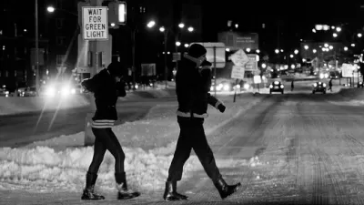
Vision Zero: According to the city webpage, "approximately 4,000 New Yorkers are seriously injured and more than 250 are killed each year in traffic crashes. Being struck by a vehicle is the leading cause of injury-related death for children under 14, and the second leading cause for seniors. On average, vehicles seriously injure or kill a New Yorker every two hours."
Hat tip to Mark Boshnack, Oneonta Daily Star
FULL STORY: De Blasio strong-arms development of Queens Blvd. bike lane in Vision Zero push, despite community objection

A Vision Zero Success Story in New York
The 300-foot wide Queens Boulevard has been known as the Boulevard of Death. Since 1990, it has claimed 186 lives, 74 percent being pedestrians, including 18 in 1997 alone. A series of safety improvements have brought fatalities to zero since 2014.
Quick Build Initiative Transforming the Streets of San Francisco
Street improvements to benefit cyclists and pedestrians have been moving rapidly in San Francisco since the June approval of the Vision Zero quick-build initiative, a two-year plan to expedite safety project on high-injury corridors.
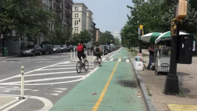
Got Protected Bike Lanes?
While Angie Schmitt doesn't ask this question in her article on the movement behind these lanes, she writes that cities without them "are being left behind". They're popular because they effectively address the #1 reason for not riding: safety

Planetizen Federal Action Tracker
A weekly monitor of how Trump’s orders and actions are impacting planners and planning in America.

San Francisco's School District Spent $105M To Build Affordable Housing for Teachers — And That's Just the Beginning
SFUSD joins a growing list of school districts using their land holdings to address housing affordability challenges faced by their own employees.

The Tiny, Adorable $7,000 Car Turning Japan Onto EVs
The single seat Mibot charges from a regular plug as quickly as an iPad, and is about half the price of an average EV.

Trump Approves Futuristic Automated Texas-Mexico Cargo Corridor
The project could remove tens of thousands of commercial trucks from roadways.

Austin's First Single Stair Apartment Building is Officially Underway
Eliminating the requirement for two staircases in multi-story residential buildings lets developers use smaller lots and more flexible designs to create denser housing.

Atlanta Bus System Redesign Will Nearly Triple Access
MARTA's Next Gen Bus Network will retool over 100 bus routes, expand frequent service.
Urban Design for Planners 1: Software Tools
This six-course series explores essential urban design concepts using open source software and equips planners with the tools they need to participate fully in the urban design process.
Planning for Universal Design
Learn the tools for implementing Universal Design in planning regulations.
Smith Gee Studio
City of Charlotte
City of Camden Redevelopment Agency
City of Astoria
Transportation Research & Education Center (TREC) at Portland State University
US High Speed Rail Association
City of Camden Redevelopment Agency
Municipality of Princeton (NJ)