


The San Francisco Municipal Transportation Agency voted 6-0 on March 3 to approve a controversial plan to redesign 1.3 miles of Polk Street, one of the most dangerous corridors for biking and walking in The City. It only took 2.5 years.
"Debate over the embattled pedestrian- and bike-safety project, which drew criticism from businesses and cyclists alike, had stretched over 2½ years," writes Joe Fitzgerald Rodriguez for The Examiner. "In the end, neither side got everything it wanted."
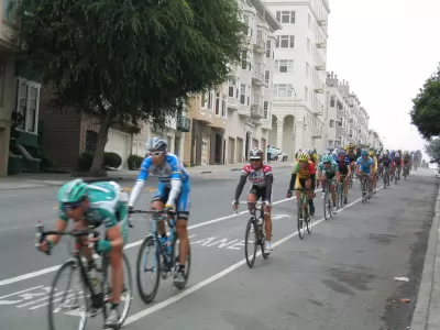
Credit: SFMTA
At City Hall on Tuesday night, the SFMTA voted 6-0 to approve the hybrid plan for the 20 blocks north of McAllister Street [McAllister Street is on north perimeter of City Hall] to Union Street, split into two sections: McAllister to Pine Street, and Pine to Union Street [see Streetsblog image]. The lower two blocks won the coveted 2014 bike award from People for Bikes.
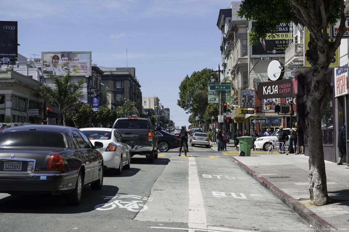
The approved plan will result in a raised, protected bike lane on northbound Polk Street from McAllister to Pine streets, a morning commute-only bike lane from Pine to Broadway, high visibility crosswalks, sidewalk bulbouts, bus stop consolidation and more, at a cost of $8 million.
"From 2006-11 there were 122 collisions on the small stretch of Polk alone, equating to two collisions per month, advocates say," writes Rodriguez. "In public comment, Nicole Schneider of advocacy group Walk San Francisco recalled the car collision death of 6-year-old Sofia Liu on Polk Street on New Year's Eve 2013, a reminder that brought a hush to the room."
As San Francisco Chronicle's transportation reporter, Michael Cabanatuan, wrote before Tuesday's meeting, "(t)he plan that MTA planners devised could be described as a compromise that leaves no one happy. But Tom Maguire, the agency’s sustainable streets director, insists the goal has been safety in keeping with the city’s commitment to Vision Zero, an effort to eliminate traffic-related fatalities by 2020."
The packed meeting attracted seventy speakers from both sides—those wanting fully protected bike lanes on both sides of the 20 blocks to Union Street [also see Steetsblog's Aaron Bialick's piece on the "watered-down" plan, and neighborhood business people and residents, particularly from nearby Russian Hill, who were opposed to the loss of 140 parking spaces. [See Planetizen blogger Ian Sac's piece on this aspect of the controversy].
In the end, SFMTA planner Luis Montoya's compromise plan survived as presented after an unsuccessful amendment by SFMTA Vice Chairman Cheryl Brinkman to "continue to plan for a continuous protected bike lane on the east side of the narrow, busy street," writes Cabanatuan.
"Construction is scheduled to start in 2016 and last about 18 months," adds Cabanatuan.
FULL STORY: Long battle results in protected bicycle lanes for Polk Street

It Takes a Fatality to Remove On-Street Parking
On March 8, 30-year-old Tess Rothstein of Berkeley was riding a rented Ford GoBike in San Francisco's SoMa district when a car door suddenly opened, forcing her outside the narrow white line of the conventional bike lane into the path of a truck.
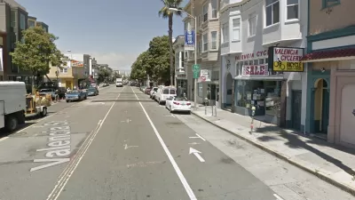
Latest San Francisco Bike Battlefront: Valencia Street
With most private auto traffic banned on Market Street in downtown, a battle is brewing in the Mission District between Valencia Street merchants, led by a bike store owner, and cyclists who support converting a bike lane into a cycletrack.
New Auto Restrictions On San Francisco's Market Street Go Into Effect Today
Private autos will have restricted access to a congested stretch of downtown San Francisco's main drag, Market Street, beginning August 11, in an attempt to make the street safer for non-motorists.

Planetizen Federal Action Tracker
A weekly monitor of how Trump’s orders and actions are impacting planners and planning in America.

Maui's Vacation Rental Debate Turns Ugly
Verbal attacks, misinformation campaigns and fistfights plague a high-stakes debate to convert thousands of vacation rentals into long-term housing.

San Francisco Suspends Traffic Calming Amidst Record Deaths
Citing “a challenging fiscal landscape,” the city will cease the program on the heels of 42 traffic deaths, including 24 pedestrians.

Defunct Pittsburgh Power Plant to Become Residential Tower
A decommissioned steam heat plant will be redeveloped into almost 100 affordable housing units.

Trump Prompts Restructuring of Transportation Research Board in “Unprecedented Overreach”
The TRB has eliminated more than half of its committees including those focused on climate, equity, and cities.

Amtrak Rolls Out New Orleans to Alabama “Mardi Gras” Train
The new service will operate morning and evening departures between Mobile and New Orleans.
Urban Design for Planners 1: Software Tools
This six-course series explores essential urban design concepts using open source software and equips planners with the tools they need to participate fully in the urban design process.
Planning for Universal Design
Learn the tools for implementing Universal Design in planning regulations.
Heyer Gruel & Associates PA
JM Goldson LLC
Custer County Colorado
City of Camden Redevelopment Agency
City of Astoria
Transportation Research & Education Center (TREC) at Portland State University
Jefferson Parish Government
Camden Redevelopment Agency
City of Claremont