


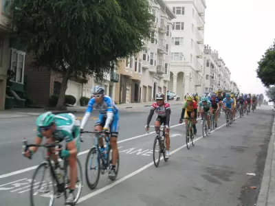
The SF Examiner reports on America's top-rated bike lane, as rated by People for Bikes. The protected contraflow lane runs from Market Street to Grove Street, all of two blocks; only one block in opposite direction is separated
"The project, completed in May, is one of many funded through a $248 million voter-approved bond," writes Joe Fitzgerald Rodriguez for the Examiner. "Tyler Frisbee, the new policy director at the San Francisco Bicycle Coalition (SFBC), said safety improvements will soon proliferate "along the entire stretch of Polk Street."
I hope so—the street needs it! According to SFBC, it is considered "one of the top five most dangerous streets in San Francisco for people biking." That said, lower Polk, where it meets Market and Fell Streets, is truly a world apart from the rest of the corridor in terms of bike infrastructure, and it's easy to see why it impressed People for Bikes.
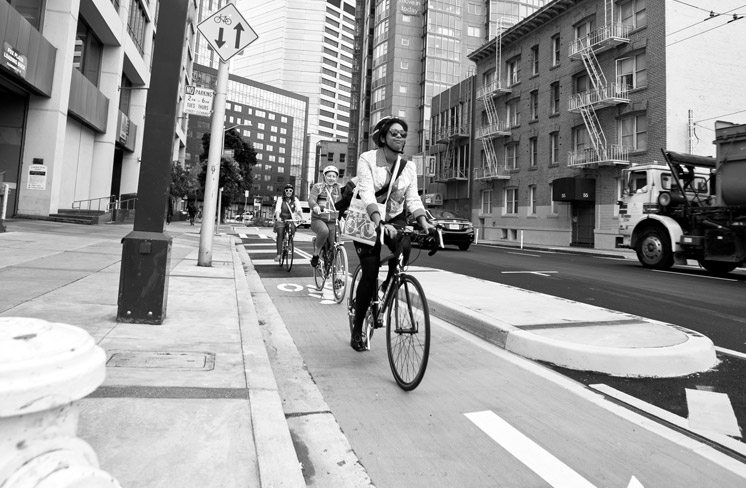
credit: San Francisco Bicycle Coalition
THE IMPORTANCE OF GOOD DESIGN: A beautiful, inviting design is what separates the Polk Street bikeway from the other handful of protected bikeways in the city. The bikeway itself is physically separated from car traffic with a curb and landscaped median filled with succulents. [SFBC]
As posted here earlier, People for Bikes determined the ten best bicycle lanes in the country. While the competition was tough, San Francisco's new contraflow lane scored highest. Michael Anderson, Green Lane Project staff writer for the organization, wrote, "San Francisco's legendarily cautious public process kept this project in the works for 15 years, but when it finally opened last spring, Streetsblog called it "the best segment of bicycle infrastructure in San Francisco."
According to the San Francisco Municipal Transportation Agency (SFMTA) May 1 press release, "The highlight of the project is a new separated northbound bike lane, also known as a contra-flow lane, because it allows people biking to safely travel against vehicle traffic on the one-way corridor."
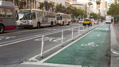
Lower Polk, from just below City Hall at Grove Street, to Hayes Street, and then to where it terminates at Market and Fell Streets, is one-way, (see map), unlike the remainder of the street which runs to the Bay near Fisherman's Wharf. The protected bikes lanes run on both sides of the street, with the northbound lane running against traffic, hence the contra-flow name.
Streetsblog's Angie Schmitt noted in July that contra flow and buffered lanes are "only just now getting official recognition from powerful standard-setters inside the U.S. engineering establishments." [Also posted here.]
"Polk Street near Market Street was a stressful ride among traffic, with numerous bus routes and active loading zones, the SFMTA noted in a news release. Now the bike lane protects cyclists along its three blocks length," writes Rodriguez.
So, why is the new bike infrastructure limited to the lower three blocks? Community opposition—from merchants who viewed protected bike lanes as a threat to their businesses. As we posted here in March, 2013, "to the more than 300 vocal denizens of Polk Gulch who packed a standing-room-only neighborhood meeting last week, the proposal is a commerce killer, one that would create 'a freeway for bikes,' with little benefit to shops along the route."
Aaron Bialick of SF Streetsblog captured the problem in his April, 2013 piece. "The (SFMTA), it seems, has backed down from making bicycling on Polk safe enough for a broader range of San Franciscans, in order to placate merchants who have vociferously opposed removing a small percentage of parking to make room for safety improvements that could actually boost business on a street where 85 percent of people arrive without a car."
The new Polk Street bike infrastructure also includes bicycle traffic signals—at Market and Fell Streets, and at Hayes and Grove Streets for the contra flow lanes.
At Market and Fell Streets, there is an excellent confluence of cycle tracks due to the protected bike lanes on Market Street. However, first-time users may be baffled, as I was. Cyclists are directed to first cross Fell Street, obeying the new bike traffic signals, rather than cross directly into or across Market Street. And just as for motorists on Fell Street, left turns onto Market are prohibited.
Hat tip to AASHTO Daily Transportation Update.
FULL STORY: SF bike lane wins national recognition

It Takes a Fatality to Remove On-Street Parking
On March 8, 30-year-old Tess Rothstein of Berkeley was riding a rented Ford GoBike in San Francisco's SoMa district when a car door suddenly opened, forcing her outside the narrow white line of the conventional bike lane into the path of a truck.
Streamlining Protected Bike Lanes, San Francisco Style
Cutting the board of the San Francisco Municipal Transportation Agency out of the approvals process for implementing bike lanes in San Francisco could shave three months off the delivery schedule.

Protected Bike Lane Plan Shelved in San Francisco
Bike advocates say a protected bike lane near the downtown Caltrain station can't wait. The San Francisco Municipal Transportation Agency (SFMTA) says the project will have to wait.

Montreal Mall to Become 6,000 Housing Units
Place Versailles will be transformed into a mixed-use complex over the next 25 years.

Planetizen Federal Action Tracker
A weekly monitor of how Trump’s orders and actions are impacting planners and planning in America.

DARTSpace Platform Streamlines Dallas TOD Application Process
The Dallas transit agency hopes a shorter permitting timeline will boost transit-oriented development around rail stations.

Without International Immigrants, the Rural US Population Would Be Falling 58%
Census data shows that population growth in rural areas is due in large part to international migrants.

Dead End: Nine Highways Ready for Retirement
The Freeways Without Futures report describes the nation’s most promising highway removal proposals.

Congressman Proposes Bill to Rename DC Metro “Trump Train”
The Make Autorail Great Again Act would withhold federal funding to the system until the Washington Metropolitan Area Transit Authority (WMATA), rebrands as the Washington Metropolitan Authority for Greater Access (WMAGA).
Urban Design for Planners 1: Software Tools
This six-course series explores essential urban design concepts using open source software and equips planners with the tools they need to participate fully in the urban design process.
Planning for Universal Design
Learn the tools for implementing Universal Design in planning regulations.
City of Mt Shasta
City of Camden Redevelopment Agency
City of Astoria
Transportation Research & Education Center (TREC) at Portland State University
City of Camden Redevelopment Agency
Municipality of Princeton (NJ)
Regional Transportation Commission of Southern Nevada