


The report ranks the most dangerous states and metro areas for pedestrians, who died at higher rates during the pandemic despite reduced driving.
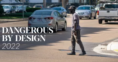
The Dangerous By Design 2022 report from Smart Growth America highlights the “preventable epidemic of people struck and killed by walking,” ranking the most dangerous U.S. states and metro areas for traffic deaths between 2016 and 2020.
According to a press release announcing the report, “While the COVID-19 pandemic upended many aspects of daily life, including how people get around, one terrible, long-term trend was unchanged: states and metro areas are getting more dangerous for pedestrians almost across the board.”
In 2020, over 6,500 pedestrians were struck and killed by vehicles, a 4.5 percent increase from 2019, despite a decrease in driving. “With data on walking patterns from StreetLight, and special inserts from NACTO, Strong Towns, America Walks, and the Fines and Fees Justice Center, this year’s report examines where and why streets are dangerous—and what needs to be done to reverse the accelerating trend.”
Low-income communities are significantly less likely to have access to parks and other opportunities for safe recreational walking and are less likely to have sidewalks, marked crosswalks, and street design to support safer, slower speeds. Lower-income neighborhoods are also much more likely to contain major arterial roads built for high speeds and higher traffic volumes at intersections, exacerbating dangerous conditions for people walking.
The report notes that “Older adults and people walking in low-income neighborhoods were also struck and killed at much higher rates than other populations in 2020, as with past years.” While disparities in traffic deaths are nothing new, “the pandemic perpetuated existing disparities in who is being killed at the highest rates: Black and Native Americans.”
Read the full report here.
FULL STORY: Dangerous by Design 2022


4 Proven Steps for Improved Pedestrian Safety
Experts from the National Association of City Transportation Officials (NACTO) present four steps for reducing the number of pedestrians killed by drivers.
Jacksonville Takes Action on Vision Zero
The city is implementing its first-ever Vision Zero Action Plan in an effort to reduce pedestrian and cyclist deaths and serious injuries.

Pittsburgh Agencies Collaborate on Vision Zero Projects
The city reduced pedestrian deaths to seven in 2023.

Maui's Vacation Rental Debate Turns Ugly
Verbal attacks, misinformation campaigns and fistfights plague a high-stakes debate to convert thousands of vacation rentals into long-term housing.

Planetizen Federal Action Tracker
A weekly monitor of how Trump’s orders and actions are impacting planners and planning in America.

San Francisco Suspends Traffic Calming Amidst Record Deaths
Citing “a challenging fiscal landscape,” the city will cease the program on the heels of 42 traffic deaths, including 24 pedestrians.

Adaptive Reuse Will Create Housing in a Suburban Texas Strip Mall
A developer is reimagining a strip mall property as a mixed-use complex with housing and retail.

Study: Anti-Homelessness Laws Don’t Work
Research shows that punitive measures that criminalized unhoused people don’t help reduce homelessness.

In U.S., Urban Gondolas Face Uphill Battle
Cities in Latin America and Europe have embraced aerial transitways — AKA gondolas — as sustainable, convenient urban transport, especially in tricky geographies. American cities have yet to catch up.
Urban Design for Planners 1: Software Tools
This six-course series explores essential urban design concepts using open source software and equips planners with the tools they need to participate fully in the urban design process.
Planning for Universal Design
Learn the tools for implementing Universal Design in planning regulations.
Heyer Gruel & Associates PA
JM Goldson LLC
Custer County Colorado
City of Camden Redevelopment Agency
City of Astoria
Transportation Research & Education Center (TREC) at Portland State University
Jefferson Parish Government
Camden Redevelopment Agency
City of Claremont