


The city reduced pedestrian deaths to seven in 2023.

In a piece for Pittsburgh CityPaper, Colin Williams describes how a multi-pronged effort by city agencies and road safety advocates has helped Pittsburgh lower its pedestrian death rate and inch closer to Vision Zero.
“Similar to other civic issues, Vision Zero requires collaboration among agencies that don’t always share the same priorities or systems, including the city government and the relatively new Department of Mobility and Infrastructure (or DOMI, created in 2017); advocacy groups like BikePGH and Pittsburghers for Public Transit (PFPT); PennDOT; and the Pittsburgh Bureau of Police,” Williams writes. For example, roughly half of the 10 percent of roadways where the vast majority of deaths and major injuries occur are managed by PennDOT.
Williams outlines the various tools and databases that PennDOT and local agencies use to aggregate crash data and understand where the most incidents occur and what safety interventions have the biggest impact. “As the city moves ahead with a proposed red-light camera program, many such interventions have gone in, including the two-way conversion of the former Penn Circle, traffic calming along streets such as Stanton Ave. and Grandview Ave., and pedestrian safety installations in Central Lawrenceville. The city continues to install leading pedestrian interval signals at crosswalks that give walkers and rollers a headstart on motorists.”
FULL STORY: Ending pedestrian deaths in Pittsburgh is a team effort


Pedestrian Deaths Drop, Remain Twice as High as in 2009
Fatalities declined by 4 percent in 2024, but the U.S. is still nowhere close to ‘Vision Zero.’
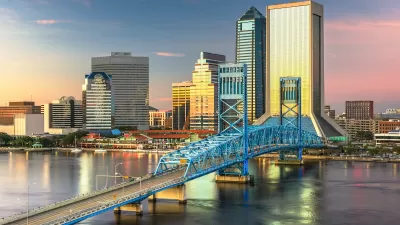
Jacksonville Takes Action on Vision Zero
The city is implementing its first-ever Vision Zero Action Plan in an effort to reduce pedestrian and cyclist deaths and serious injuries.

Pedestrian Deaths Tick Down — But Rose 58 Percent in the Last Decade
Road fatalities fell by a meager 4 percent in the first half of 2023.

Maui's Vacation Rental Debate Turns Ugly
Verbal attacks, misinformation campaigns and fistfights plague a high-stakes debate to convert thousands of vacation rentals into long-term housing.

Planetizen Federal Action Tracker
A weekly monitor of how Trump’s orders and actions are impacting planners and planning in America.

Chicago’s Ghost Rails
Just beneath the surface of the modern city lie the remnants of its expansive early 20th-century streetcar system.

Bend, Oregon Zoning Reforms Prioritize Small-Scale Housing
The city altered its zoning code to allow multi-family housing and eliminated parking mandates citywide.

Amtrak Cutting Jobs, Funding to High-Speed Rail
The agency plans to cut 10 percent of its workforce and has confirmed it will not fund new high-speed rail projects.

LA Denies Basic Services to Unhoused Residents
The city has repeatedly failed to respond to requests for trash pickup at encampment sites, and eliminated a program that provided mobile showers and toilets.
Urban Design for Planners 1: Software Tools
This six-course series explores essential urban design concepts using open source software and equips planners with the tools they need to participate fully in the urban design process.
Planning for Universal Design
Learn the tools for implementing Universal Design in planning regulations.
planning NEXT
Appalachian Highlands Housing Partners
Mpact (founded as Rail~Volution)
City of Camden Redevelopment Agency
City of Astoria
City of Portland
City of Laramie