


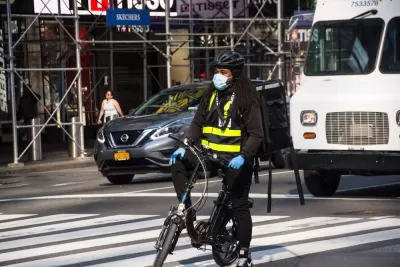
It's another one of those crises within a crisis, but driving has been more dangerous during the pandemic.
Christina Goldbaum revisits one of the tragedies inside the tragedy from the pandemic during 2020: increasing numbers of traffic fatalities.
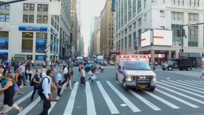
Goldbaum cites the example of New York City specifically: "243 people died in traffic crashes in New York City in 2020 — making it the deadliest year on record since Mayor Bill de Blasio introduced his signature plan to improve street safety in 2014," but the trend was evident in locations all over the country.
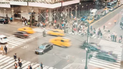
Given how many fewer drivers were on the road this year, the traffic fatalities of 2020 defied precedent and logic. "Economic downturns and reduced congestion typically lead to fewer fatal crashes, federal researchers say. But during the pandemic, it seemed that drivers who felt cooped up in their homes flocked to wide open streets," writes Goldbaum. New York officials cited in the article say that most fatal crashes in 2020 involved vehicles traveling at high speeds, late at night, outside the urban core of Manhattan.
The article describes the causes of these effects, but much of the evidence is circumstantial. Police did write a lot more tickets for speeding in California, New York City, and Georgia, according to evidence cited in the article, but police in Minneapolis were widely reported as decreasing traffic enforcement after nationwide protests in response to the killing of George Floyd.
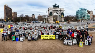
The article concludes with a soundbite from Danny Harris, executive director of Transportation Alternatives, making an appeal to reject the car-centric status quo of pre-pandemic life in the United States.
It's also worth noting that with hospitals and intensive care units full all over the country, now is not a good time
FULL STORY: Why Emptier Streets Meant an Especially Deadly Year for Traffic Deaths

New York City Traffic Fatalities Pass 2019 Totals
The visions of a car-free utopia that might have seemed like a potential silver lining in March and April have given away to a tragic reality.
NYC Pedestrian Deaths Rose in 2024
The city’s Vision Zero efforts seem to have stalled.
Traffic Fatalities Set Records as Pandemic-Era Road Carnage Shows No Signs of Stopping
An estimated 42,915 people died in automobile crashes in 2021, according to recent federal data. The increasing fatalities continue a trend that began with the outset of the pandemic.

Planetizen Federal Action Tracker
A weekly monitor of how Trump’s orders and actions are impacting planners and planning in America.

Map: Where Senate Republicans Want to Sell Your Public Lands
For public land advocates, the Senate Republicans’ proposal to sell millions of acres of public land in the West is “the biggest fight of their careers.”

Restaurant Patios Were a Pandemic Win — Why Were They so Hard to Keep?
Social distancing requirements and changes in travel patterns prompted cities to pilot new uses for street and sidewalk space. Then it got complicated.

Platform Pilsner: Vancouver Transit Agency Releases... a Beer?
TransLink will receive a portion of every sale of the four-pack.

Toronto Weighs Cheaper Transit, Parking Hikes for Major Events
Special event rates would take effect during large festivals, sports games and concerts to ‘discourage driving, manage congestion and free up space for transit.”

Berlin to Consider Car-Free Zone Larger Than Manhattan
The area bound by the 22-mile Ringbahn would still allow 12 uses of a private automobile per year per person, and several other exemptions.
Urban Design for Planners 1: Software Tools
This six-course series explores essential urban design concepts using open source software and equips planners with the tools they need to participate fully in the urban design process.
Planning for Universal Design
Learn the tools for implementing Universal Design in planning regulations.
Heyer Gruel & Associates PA
JM Goldson LLC
Custer County Colorado
City of Camden Redevelopment Agency
City of Astoria
Transportation Research & Education Center (TREC) at Portland State University
Camden Redevelopment Agency
City of Claremont
Municipality of Princeton (NJ)