


A new online tool allows cities to measure progress in providing access to alternative forms of transportation.
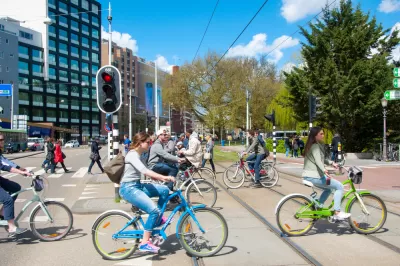
Adele Peters shares news of a new report and online tool from the Institute for Transportation and Development Policy that measures how well cities connect residents to their jobs through public transit, walking, or biking.
The "Indicators for Sustainable Mobility," as the tool is called, "considered 12 different factors, including how close homes and jobs are to rapid transit, how many people have access to transit that runs frequently at rush hour, the size of city blocks, and how many people could get to work in a half an hour or an hour by walking, biking on protected bike lanes, or on public transit," according to Peters.
Peters uses the comparative power of the tool to compare the transit access successes of the city of Minneapolis, for instance, to cities with a lot more work to do, like Nashville and Indianapolis.
Andrew Small also picked up on the news of the new tool from the Institute for Transportation and Development Policy, and focused on the lessons cities could apply when deciding how to improve access to alternative transportation.
"The key, the reports stresses, is getting a better balance between jobs, low-income households, and people in proximity to public transit," writes Small.
FULL STORY: Which cities make it easiest to commute without a car?

Op-Ed: Don't Reverse the Progress Made by 'Pandemic Streets'
In many cities, the public realm saw a drastic shift towards pedestrian-oriented infrastructure. The L.A. Times editorial board argues we should keep it that way.
Seattle Mayor Raises Transportation Levy by $100 Million
The proposal sent to City Council includes more funding for multimodal transportation and road safety.

Two Midtown Atlanta Complete Streets Projects to Break Ground in 2024
The projects include new bike lanes, expanded sidewalks, and other Complete Streets infrastructure.

Planetizen Federal Action Tracker
A weekly monitor of how Trump’s orders and actions are impacting planners and planning in America.

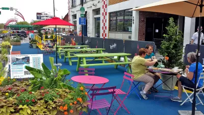
Restaurant Patios Were a Pandemic Win — Why Were They so Hard to Keep?
Social distancing requirements and changes in travel patterns prompted cities to pilot new uses for street and sidewalk space. Then it got complicated.

Map: Where Senate Republicans Want to Sell Your Public Lands
For public land advocates, the Senate Republicans’ proposal to sell millions of acres of public land in the West is “the biggest fight of their careers.”

Orange County, Florida Adopts Largest US “Sprawl Repair” Code
The ‘Orange Code’ seeks to rectify decades of sprawl-inducing, car-oriented development.

Maui's Vacation Rental Debate Turns Ugly
Verbal attacks, misinformation campaigns and fistfights plague a high-stakes debate to convert thousands of vacation rentals into long-term housing.

San Francisco Suspends Traffic Calming Amidst Record Deaths
Citing “a challenging fiscal landscape,” the city will cease the program on the heels of 42 traffic deaths, including 24 pedestrians.
Urban Design for Planners 1: Software Tools
This six-course series explores essential urban design concepts using open source software and equips planners with the tools they need to participate fully in the urban design process.
Planning for Universal Design
Learn the tools for implementing Universal Design in planning regulations.
Heyer Gruel & Associates PA
JM Goldson LLC
Custer County Colorado
City of Camden Redevelopment Agency
City of Astoria
Transportation Research & Education Center (TREC) at Portland State University
Camden Redevelopment Agency
City of Claremont
Municipality of Princeton (NJ)