


Paris and New York City are two of the world's more successful pedestrian cities, with each boasting several kinds of data that show the predominance of alternative transportation. An article compares public space in each for lessons.
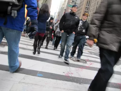
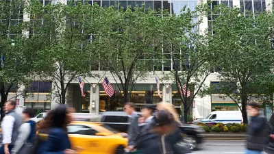
"In Paris, where I hail from, 60% of journeys are by foot - far beyond car trips (7%) – and 60% of Parisians do not own a car," writes Clémence Morlet, and in New York City, "53% of those who live and work in Manhattan never use a car, bus, subway or train in their everyday trips but instead walk, ride a bicycle or motorcycle, take a taxicab, or work at home."
Given the large population of pedestrians making use of the public spaces in these cities, Morlet asks, "How do they support this large pedestrian population and decrease auto-dominance in public space?"
In Paris, for instance, the Pedestrian Paris Initiative has been "shifting the focus from other modes of transportation to pedestrians." That includes clearing sidewalks of obstacles as well as widening sidewalks. Moreover, "The municipal government has also focused on creating a balance in the street between motorized vehicles, public transportation, bikes, and pedestrians, in part by implementing lower speed limit areas."
As for New York, according to Morlet, "New York City has implemented complete-streets roadway design that accommodates all users: pedestrians, people on bikes, and drivers," citing the New York City Department Transporttion efforts like the 2008 report World Class Streets: Remaking New York City’s Public Realm and the 2009 Street Design Manual. Among other case studies, Morlet examines the success of the 59 public plazas created by NYC DOT since 2007: "Post-project surveys show the plazas are mainly supported by New Yorkers (up to 72%) and 76% of New Yorkers live now within ten minutes of open space (up from 70 in 2007). Moreover, the improvements generally resulted in an increase in retail sales at locally-based businesses; like in Pearl Street in Brooklyn where local retail sales have increased by 172%, compared to 18% borough-wide."
FULL STORY: Shared Space and Slow Zones: Comparing Public Space in Paris and New York

The Spread of Ciclovia
Temporary street closures for pedestrian use -- an idea that spawned in Bogota, Colombia -- are occurring in cities all over the world. The trend is expected to continue.
NYC Congestion Pricing Under Threat — Again
President Trump is attempting to make good on a campaign promise to kill New York City’s congestion pricing program, but the mechanism for ending it remains unclear.
NYC Officials Split on Jaywalking Decriminalization
While some council members say the ‘outdated’ practice disproportionately impacts Black and Latino residents, law enforcement officials say its a necessary measure for road safety.

Planetizen Federal Action Tracker
A weekly monitor of how Trump’s orders and actions are impacting planners and planning in America.

Map: Where Senate Republicans Want to Sell Your Public Lands
For public land advocates, the Senate Republicans’ proposal to sell millions of acres of public land in the West is “the biggest fight of their careers.”

Restaurant Patios Were a Pandemic Win — Why Were They so Hard to Keep?
Social distancing requirements and changes in travel patterns prompted cities to pilot new uses for street and sidewalk space. Then it got complicated.

Platform Pilsner: Vancouver Transit Agency Releases... a Beer?
TransLink will receive a portion of every sale of the four-pack.

Toronto Weighs Cheaper Transit, Parking Hikes for Major Events
Special event rates would take effect during large festivals, sports games and concerts to ‘discourage driving, manage congestion and free up space for transit.”

Berlin to Consider Car-Free Zone Larger Than Manhattan
The area bound by the 22-mile Ringbahn would still allow 12 uses of a private automobile per year per person, and several other exemptions.
Urban Design for Planners 1: Software Tools
This six-course series explores essential urban design concepts using open source software and equips planners with the tools they need to participate fully in the urban design process.
Planning for Universal Design
Learn the tools for implementing Universal Design in planning regulations.
Heyer Gruel & Associates PA
JM Goldson LLC
Custer County Colorado
City of Camden Redevelopment Agency
City of Astoria
Transportation Research & Education Center (TREC) at Portland State University
Camden Redevelopment Agency
City of Claremont
Municipality of Princeton (NJ)