


A recent article examines the ways New York City and Paris support large-scale pedestrian use and support the shared use of public space.
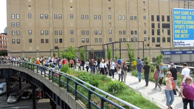
Native Parisian Clémence Morlet describes some of the innovative and ambitious programs in paris to make the streets of paris a more multi-modal and shared experience.
The Pedestrian Paris Initiative, for instance, “is changing Paris streets by freeing and activating the public space through wider sidewalks, reused former parking strips in adding café terraces, benches, greenery, fountains, or bike racks to enhance street activities and uses. ‘Pedestrian Paris’ has also focused on new and fairer mobility rules between motorized vehicles, public transportation, bikes, and pedestrians, implementing lower speed limit areas with new bicycle and pedestrian street rights.”
As for transforming public spaces into shared spaces, “[the] Pedestrian Paris Initiative was followed by a street-sharing action plan launched in 2013 with quantified and short-term targets to extend 20 MPH zones, create new shared spaces, and implement specific rights for people on bikes and pedestrians. In practice, a shared space has to be opened to any modes of transportation under a 12 MPH speed limit with pedestrians having priority over any other users. Pedestrians can circulate on the pavement if they do not stand and bikes can circulate in both directions in every street with free right turns (at crossroads with traffic lights).”
Progams in New York that compare to those ambitious programs, according to Morlet, include the Plaza and Neighborhood Slow Zone Programs.
FULL STORY: Shared Spaces and Slow Zones: Comparing Public Space in Paris and New York

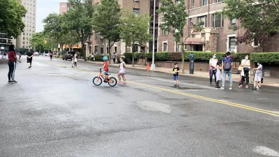
NYC Open Streets Organizers Call for City Support
The number of open streets projects has dropped year after year as volunteer groups struggle to fund and staff them.
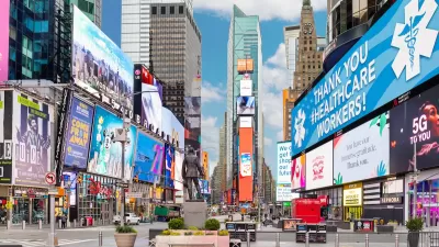
NYC Officials Announce Broadway Pedestrianization Project
Two blocks of the marquee street will become mostly car-free public spaces.
NYC Announces $30M for Open Streets Projects
The funding is designed to support open streets and public space projects in underresourced neighborhoods.

Planetizen Federal Action Tracker
A weekly monitor of how Trump’s orders and actions are impacting planners and planning in America.

Map: Where Senate Republicans Want to Sell Your Public Lands
For public land advocates, the Senate Republicans’ proposal to sell millions of acres of public land in the West is “the biggest fight of their careers.”

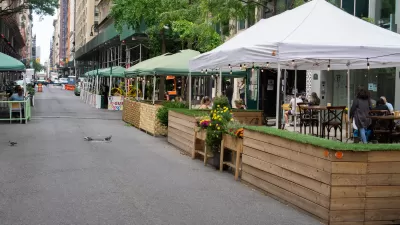
Restaurant Patios Were a Pandemic Win — Why Were They so Hard to Keep?
Social distancing requirements and changes in travel patterns prompted cities to pilot new uses for street and sidewalk space. Then it got complicated.

Platform Pilsner: Vancouver Transit Agency Releases... a Beer?
TransLink will receive a portion of every sale of the four-pack.

Toronto Weighs Cheaper Transit, Parking Hikes for Major Events
Special event rates would take effect during large festivals, sports games and concerts to ‘discourage driving, manage congestion and free up space for transit.”

Berlin to Consider Car-Free Zone Larger Than Manhattan
The area bound by the 22-mile Ringbahn would still allow 12 uses of a private automobile per year per person, and several other exemptions.
Urban Design for Planners 1: Software Tools
This six-course series explores essential urban design concepts using open source software and equips planners with the tools they need to participate fully in the urban design process.
Planning for Universal Design
Learn the tools for implementing Universal Design in planning regulations.
Heyer Gruel & Associates PA
JM Goldson LLC
Custer County Colorado
City of Camden Redevelopment Agency
City of Astoria
Transportation Research & Education Center (TREC) at Portland State University
Camden Redevelopment Agency
City of Claremont
Municipality of Princeton (NJ)