


Road infrastructure that fails to make dangerous driving behavior feel risky to drivers is ineffective in protecting pedestrians and people on bikes.
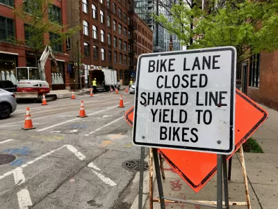
An article by Colin Anderson in Streetsblog Chicago illustrates the problem with the city’s pedestrian infrastructure, claiming that car-oriented design fails to prioritize pedestrian safety and contributes to rising rates of pedestrian and cyclist deaths.
According to Anderson, “There’s nothing about the street layout or infrastructure that leverages risk homeostasis to force motorists to slow down, let alone stop for pedestrians.” Anderson explains, “Painted bike lanes do not pose any risk to a driver or their car, which is why they are simply ignored, while concrete-protected bike lanes give drivers real consequences for getting too close.” The blame lies with state agencies, too: “Another crucial but less obvious roadblock to safer street design is the Illinois Department of Transportation, which often blocks meaningful pedestrian and bike safety improvements to the Chicago roads they control if there’s any risk that the changes might increase trip times for drivers.”
We need infrastructure that has safety, not danger, built into it.
To Anderson, the key to effective infrastructure is making dangerous behavior feel risky to drivers. “Fortunately, there are many, many traffic calming features which provide physical cues that force drivers to slow down, and these can be implemented in ongoing cyclical maintenance.” The lack of implementation of these types of low-tech projects is simply a lack of political will and poor coordination between government officials and agencies, Anderson writes, putting some of Chicago’s most vulnerable communities at disproportionate risk for traffic violence.
FULL STORY: Visualizing how current Chicago infrastructure fails people walking and biking

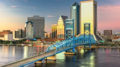
Jacksonville Takes Action on Vision Zero
The city is implementing its first-ever Vision Zero Action Plan in an effort to reduce pedestrian and cyclist deaths and serious injuries.
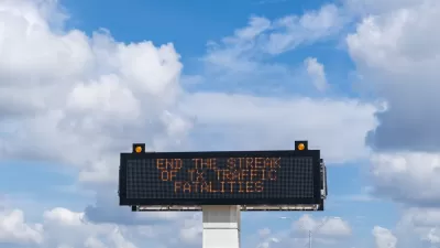
Texas Road Safety Messaging Blames Pedestrians, Ignores Structural Flaws
Critics of the state’s ‘Be Safe. Drive Smart.’ campaign say the messaging puts the onus on pedestrians and cyclists while failing to address the lack of robust pedestrian and bike infrastructure in many of its cities.
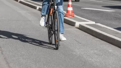
Southeast LA Road Safety Advocates Call for Improved Infrastructure
Streets in southeastern Los Angeles County have a severe lack of protected bike lanes and traffic safety measures, leading to high numbers of fatalities in a community where many residents depend on walking and biking for daily needs.

Montreal Mall to Become 6,000 Housing Units
Place Versailles will be transformed into a mixed-use complex over the next 25 years.

Planetizen Federal Action Tracker
A weekly monitor of how Trump’s orders and actions are impacting planners and planning in America.

DARTSpace Platform Streamlines Dallas TOD Application Process
The Dallas transit agency hopes a shorter permitting timeline will boost transit-oriented development around rail stations.

Interactive Map Reveals America's “Shade Deserts”
Launched by UCLA and American Forests to combat heat-related deaths, the tool maps the shade infrastructure for over 360 U.S. cities.

Bicycles and Books — In Sacramento, Libraries Now Offer Both
Adult library card holders can check out e-bikes and e-trikes for up to one week.

Colorado Landfills Emit as Much Pollution as 1M Cars
Landfills are the third-largest source of methane pollution in Colorado, after agriculture and fossil fuel extraction.
Urban Design for Planners 1: Software Tools
This six-course series explores essential urban design concepts using open source software and equips planners with the tools they need to participate fully in the urban design process.
Planning for Universal Design
Learn the tools for implementing Universal Design in planning regulations.
City of Mt Shasta
City of Camden Redevelopment Agency
City of Astoria
Transportation Research & Education Center (TREC) at Portland State University
US High Speed Rail Association
City of Camden Redevelopment Agency
Municipality of Princeton (NJ)