


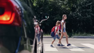
The city is creating its first Department of Transportation and using hundreds of millions in federal funding to launch road safety projects.

In the first of a multi-part series, Streetsblog USA’s Kea Wilson explains how St. Louis, Missouri plans to spend $300 million in street safety infrastructure funds aimed at reducing traffic deaths and making the city’s dangerous streets safer for people walking and biking.
Like other cities, St. Louis is benefiting from millions in federal infrastructure and transportation funding from the American Rescue Act and other federal programs. “After decades of disinvestment in sustainable mobility, it’s fair to say that the Jones administration is attacking the problems of car dependency on a number of policy fronts, too, developing its first-ever transportation and mobility plan while simultaneously overhauling its land use and zoning plans.”
Meanwhile, “The regional light rail network, Metrolink, is in the final stages of planning the first rail route to connect the overwhelmingly Black north side and with the central corridor and the southern half of the city, bridging the infamous Delmar Divide; the Missouri Department of Transportation is even talking about building its first-ever protected bike lane on a state-owned road.”
Wilson explains that the city, which has lost hundreds of thousands of residents since the 1950s, struggles with understaffing and an outdated ‘ward capital system’ for distributing transportation funding. It is now in the process of establishing its first Department of Transportation. “The new projects still need to be perfected, nevermind actually built. The city will need to contend with a state government that’s investing far more money into widening 250 miles of a single interstate than traffic-calming the dangerous roads within St. Louis that it maintains.”
FULL STORY: Deep Dive: St. Louis Launches $300M Sea Change for Sustainable Transportation

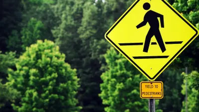
US Street Design Manual Inches Toward Safer Roads
The guiding document for U.S. road design is starting to recognize the needs of people walking and biking, but safe streets advocates say more significant changes are needed to reduce the high number of pedestrian deaths and improve connectivity for all road users.
Pedestrian Deaths Tick Down — But Rose 58 Percent in the Last Decade
Road fatalities fell by a meager 4 percent in the first half of 2023.
How Cities are Spending Safe Streets Funds
New federal grant programs are injecting millions of dollars into road safety projects in an effort to stem the alarming growth of traffic deaths on U.S. roads.

Planetizen Federal Action Tracker
A weekly monitor of how Trump’s orders and actions are impacting planners and planning in America.

Restaurant Patios Were a Pandemic Win — Why Were They so Hard to Keep?
Social distancing requirements and changes in travel patterns prompted cities to pilot new uses for street and sidewalk space. Then it got complicated.

Map: Where Senate Republicans Want to Sell Your Public Lands
For public land advocates, the Senate Republicans’ proposal to sell millions of acres of public land in the West is “the biggest fight of their careers.”

Maui's Vacation Rental Debate Turns Ugly
Verbal attacks, misinformation campaigns and fistfights plague a high-stakes debate to convert thousands of vacation rentals into long-term housing.

San Francisco Suspends Traffic Calming Amidst Record Deaths
Citing “a challenging fiscal landscape,” the city will cease the program on the heels of 42 traffic deaths, including 24 pedestrians.

California Homeless Arrests, Citations Spike After Ruling
An investigation reveals that anti-homeless actions increased up to 500% after Grants Pass v. Johnson — even in cities claiming no policy change.
Urban Design for Planners 1: Software Tools
This six-course series explores essential urban design concepts using open source software and equips planners with the tools they need to participate fully in the urban design process.
Planning for Universal Design
Learn the tools for implementing Universal Design in planning regulations.
Heyer Gruel & Associates PA
JM Goldson LLC
Custer County Colorado
City of Camden Redevelopment Agency
City of Astoria
Transportation Research & Education Center (TREC) at Portland State University
Camden Redevelopment Agency
City of Claremont
Municipality of Princeton (NJ)