


A change in the city’s speed limits has been shown to reduce the likelihood of injuries during collisions.
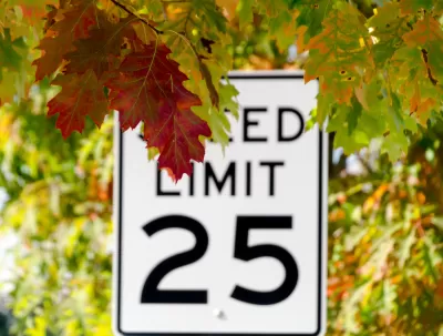
A new study from the Insurance Institute for Highway Safety (IIHS) reveals that lowering speed limits on Seattle streets, part of the ‘Safe System’ approach that prioritizes road design and policies that limit the damage caused by human error, improved safety. “In downtown Seattle, lowering default speed limits reduced the likelihood that a crash would involve an injury by a fifth on arterial roads, IIHS researchers found. Outside of the city center, where the new limits were less consistently implemented and publicized, there were smaller injury reductions, but these were not statistically significant.”
The study credits the success in part to the city’s information campaign. “To make drivers aware of the change, the city conducted a public outreach campaign and installed gateway signs indicating the new citywide limits on arterial roads into the city, highway off-ramps and ferry terminals,” and installed new 25 mph signs on downtown arterials.
The study is the first to attempt to quantify the effect of lower speed limits on injury rates, not just on peeding. As the press release explains, “Higher speeds make crashes more likely by reducing the time a driver has to react and increasing the distance required to stop the vehicle. Higher speeds also increase the energy involved in a crash, raising the odds of an injury.”
FULL STORY: Lowering speed limits makes Seattle streets safer

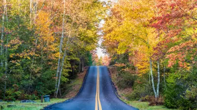
Study: Road Design, Speed Key Factors in Pedestrian Deaths
A recent study emphasizes the importance of good road design and low speed limits in keeping pedestrians safe.
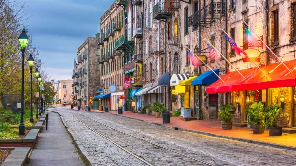
Savannah Reduces Speed Limits on Almost 100 City Streets
The historic Georgia city is lowering speed limits in an effort to reduce road fatalities.
‘Safe Land Use:’ A Key to Road Safety
How approaching transportation planning through a public health lens can reduce traffic deaths.

Planetizen Federal Action Tracker
A weekly monitor of how Trump’s orders and actions are impacting planners and planning in America.

Map: Where Senate Republicans Want to Sell Your Public Lands
For public land advocates, the Senate Republicans’ proposal to sell millions of acres of public land in the West is “the biggest fight of their careers.”

Restaurant Patios Were a Pandemic Win — Why Were They so Hard to Keep?
Social distancing requirements and changes in travel patterns prompted cities to pilot new uses for street and sidewalk space. Then it got complicated.

Platform Pilsner: Vancouver Transit Agency Releases... a Beer?
TransLink will receive a portion of every sale of the four-pack.

Toronto Weighs Cheaper Transit, Parking Hikes for Major Events
Special event rates would take effect during large festivals, sports games and concerts to ‘discourage driving, manage congestion and free up space for transit.”

Berlin to Consider Car-Free Zone Larger Than Manhattan
The area bound by the 22-mile Ringbahn would still allow 12 uses of a private automobile per year per person, and several other exemptions.
Urban Design for Planners 1: Software Tools
This six-course series explores essential urban design concepts using open source software and equips planners with the tools they need to participate fully in the urban design process.
Planning for Universal Design
Learn the tools for implementing Universal Design in planning regulations.
Heyer Gruel & Associates PA
JM Goldson LLC
Custer County Colorado
City of Camden Redevelopment Agency
City of Astoria
Transportation Research & Education Center (TREC) at Portland State University
Camden Redevelopment Agency
City of Claremont
Municipality of Princeton (NJ)