


Signs of the times, and more evidence of the essential service provided by public transit throughout the pandemic.
Jose Martinez and Dimitri Fautsch report on the shifting ridership on the New York subway, which during the pandemic has been significantly influenced to public health concerns, stay-at-home orders, and reduced service.
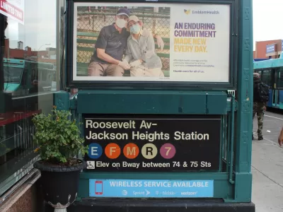
Now, 16 months after the pandemic started to take a toll on the city, subway ridership is shifting in measurable ways—most notably to subway stations in Queens are, for the first time, now among the ten busiest in the city.
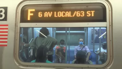
"The Jackson Heights-Roosevelt Avenue/74th Street complex on the E, F, M, R and No. 7 lines and the 7’s Flushing-Main Street terminal round out the top 10 stations in the annual accounting of station-by-station usage — whose top stations have traditionally been in Manhattan," according to the article.
"The figures also show how the pandemic has flattened demand during the traditional rush hours in the subway, a trend that some transit analysts believe could eventually lead the MTA to redistribute subway service throughout the day," add Martinez and Fautsch.
Human experience backs up the data. The article includes a soundbite from one home-health aide, who says, " I don’t have a car, I have to get to work […] I have no other option but the subway and a lot of people [in Queens] kept going to work."
More from Planetizen on the subject of shifting ridership patterns and the essential service of public transit during the pandemic:
- Who's Still Riding Transit During the Pandemic? Evidence From Toronto (April 9, 2020)
- The Geography of Occupations: Some Neighborhoods Will Suffer More Than Others Under COVID-19 (April 10, 2020)
- Opinion: Transit Has Always Been an Essential Service (April 13, 2020)
- Public Transit in Crisis: Low-Income Riders Have the Most to Lose From Service Cuts (August 19, 2020)
- Transportation Equity Lessons from the Pandemic (January 12, 2021)
- The Realities of Pandemic Public Transit Service (March 2, 2021)
FULL STORY: Queens Grabs Bigger Share of Subway Ridership as Pandemic Shifts Commutes


Tracking the New York Subway's Uneven Recovery
Ridership on the New York Subway has a long way to go to return to pre-pandemic normal, and the setbacks of recent months haven't helped the cause.
Overnight Subway Service Returning in New York City
A big piece of the process of reopening New York City for business is scheduled for May 17, but numerous challenges remain in getting the city that never sleeps back on track.

The NYC Subway's Uneven Recovery
As subway riders return in fits and starts, some stations are experiencing a much faster recovery than others.

Planetizen Federal Action Tracker
A weekly monitor of how Trump’s orders and actions are impacting planners and planning in America.

Map: Where Senate Republicans Want to Sell Your Public Lands
For public land advocates, the Senate Republicans’ proposal to sell millions of acres of public land in the West is “the biggest fight of their careers.”

Restaurant Patios Were a Pandemic Win — Why Were They so Hard to Keep?
Social distancing requirements and changes in travel patterns prompted cities to pilot new uses for street and sidewalk space. Then it got complicated.

Platform Pilsner: Vancouver Transit Agency Releases... a Beer?
TransLink will receive a portion of every sale of the four-pack.

Toronto Weighs Cheaper Transit, Parking Hikes for Major Events
Special event rates would take effect during large festivals, sports games and concerts to ‘discourage driving, manage congestion and free up space for transit.”

Berlin to Consider Car-Free Zone Larger Than Manhattan
The area bound by the 22-mile Ringbahn would still allow 12 uses of a private automobile per year per person, and several other exemptions.
Urban Design for Planners 1: Software Tools
This six-course series explores essential urban design concepts using open source software and equips planners with the tools they need to participate fully in the urban design process.
Planning for Universal Design
Learn the tools for implementing Universal Design in planning regulations.
Heyer Gruel & Associates PA
JM Goldson LLC
Custer County Colorado
City of Camden Redevelopment Agency
City of Astoria
Transportation Research & Education Center (TREC) at Portland State University
Camden Redevelopment Agency
City of Claremont
Municipality of Princeton (NJ)