


The yongeTOmorrrow project is heading toward the finish line with widespread support from advocates, but a few want the plan to go one step further.
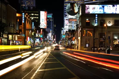
Albert Koehl and Michael Black write an opinion piece to support a car-free Yonge Street in Downtown Toronto.
The occasion for the opinion piece is the yongeTOmorrrow project, which recently took form as a final environmental assessment, and would transform 1 km stretch of the street into a more pedestrian-friendly environment. But it doesn't go so far as to go car free—hence the complaint by Koehl and Black.
According to a separate news article on the plan by David Nickle, yongeTOmorrrow would reduce the street to two vehicle lanes, wide sidewalks significantly, and block some sections of the street to car traffic at certain times during the day.
Koehl and Black focus on how much more the project could be by going entirely car free.
A car-free Yonge would open space for benches, trees, and patios — benefitting both local residents and visitors to attractions, such as Massey Hall, Yonge-Dundas Square and the Eaton Centre. It would also connect to Ryerson University's small car-free area, which is enjoyed by thousands of students.
The environmental assessment was presented at the Toronto City Council's Infrastructure and Environment Committee Meeting on Monday, January 11th.
FULL STORY: Don’t fear a car free Yonge St.

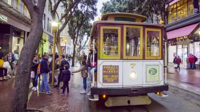
San Francisco Returns $15 Million Federal Grant for Market Street Improvements
San Francisco was awarded a federal grant in 2018 that it was forced to return in 2022 because it couldn't start construction by 2025.
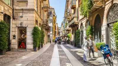
Milan Commits to a Less Car-Centric New Normal
Milan is making changes to its streets to ensure that the city's residents and employment base don't overwhelm the city with new automobile traffic when the city reopens for business.
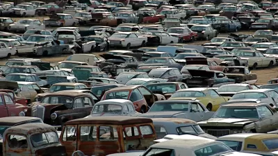
3 Ways to Overcome a Century of Car-Centric Planning
The consequences of car-centric planning are clear, a century after cars took over streets and lives across this country. According to this article, so to is a new way forward.

Planetizen Federal Action Tracker
A weekly monitor of how Trump’s orders and actions are impacting planners and planning in America.

Maui's Vacation Rental Debate Turns Ugly
Verbal attacks, misinformation campaigns and fistfights plague a high-stakes debate to convert thousands of vacation rentals into long-term housing.

San Francisco Suspends Traffic Calming Amidst Record Deaths
Citing “a challenging fiscal landscape,” the city will cease the program on the heels of 42 traffic deaths, including 24 pedestrians.

Amtrak Rolls Out New Orleans to Alabama “Mardi Gras” Train
The new service will operate morning and evening departures between Mobile and New Orleans.

The Subversive Car-Free Guide to Trump's Great American Road Trip
Car-free ways to access Chicagoland’s best tourist attractions.

San Antonio and Austin are Fusing Into one Massive Megaregion
The region spanning the two central Texas cities is growing fast, posing challenges for local infrastructure and water supplies.
Urban Design for Planners 1: Software Tools
This six-course series explores essential urban design concepts using open source software and equips planners with the tools they need to participate fully in the urban design process.
Planning for Universal Design
Learn the tools for implementing Universal Design in planning regulations.
Heyer Gruel & Associates PA
JM Goldson LLC
Custer County Colorado
City of Camden Redevelopment Agency
City of Astoria
Transportation Research & Education Center (TREC) at Portland State University
Jefferson Parish Government
Camden Redevelopment Agency
City of Claremont