


Federal funding for Sound Transit's Federal Way Link extension and a new transit-oriented land use plan are changing the future of Federal Way.
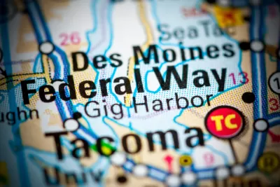
A pair of articles updates the status of concurrent transit and land use planning efforts around the planned Link extension to the city of Federal Way, located between Seattle and Tacoma.
First, Stephen Fesler details the initial stages of a subarea planning process for the "City South" area in Federal Way. The plan is already being touted as a way to "[expand] the status quo land use or moving toward development of a mixed-use, transit-oriented district," but four distinct alternatives are currently under consideration, according to the article. Federal Way recently wrapped up an initial online open house to solicit feedback on the subarea plan.
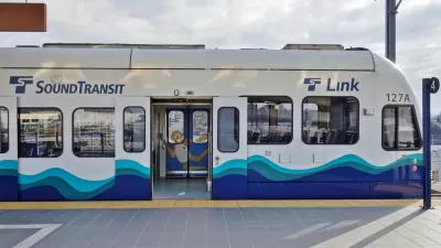
In the second article, Doug Trumm reports that the U.S. Department of Transportation had agreed to fund the Federal Way Link extension to the tune of a $790 million grant and a $629 million loan.
"With $1.4 billion in federal backing, the 7.8-mile extension should be able to advance as planned to a 2024 opening. Major construction will start next year," reports Trumm.
Trumm sets the funding announcement in context of the Trump administration's reluctance to fund Congress-approved allocations for transit. With the Federal Way funding on the way and the Lynwood Link receiving tardy funding that slightly delayed its opening, Seattle region transit projects seems to have escaped its worst fears for transit projects under the Trump administration's control of the U.S. Department of Transportation.
FULL STORY: Federal Way Is Planning a Transit-Oriented District

$158 Million in American Rescue Plan Funding Going to Seattle-Area Light Rail Projects
New Capital Investment Grant funding was announced earlier this month.

Sooner Rather Than Later: Support Builds for Eastside-Only Light Rail in Seattle
The Eastside Link light rail route, now known as Line 2, is delayed. A Sound Transit board officials is suggesting that some of the route can open soon, while the rest of the route is prepped to open later.
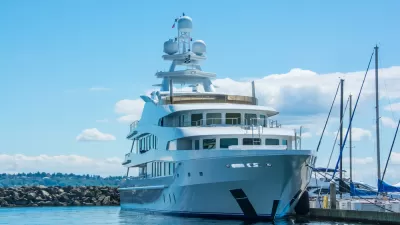
Superyachts Calling the Shots for How Light Rail Gets Built in Seattle
Determinations made by the Coast Guard to accommodate superyachts will affect the price of light rail and other bridge projects in Seattle and environs.

Planetizen Federal Action Tracker
A weekly monitor of how Trump’s orders and actions are impacting planners and planning in America.

Chicago’s Ghost Rails
Just beneath the surface of the modern city lie the remnants of its expansive early 20th-century streetcar system.

San Antonio and Austin are Fusing Into one Massive Megaregion
The region spanning the two central Texas cities is growing fast, posing challenges for local infrastructure and water supplies.

Since Zion's Shuttles Went Electric “The Smog is Gone”
Visitors to Zion National Park can enjoy the canyon via the nation’s first fully electric park shuttle system.

Trump Distributing DOT Safety Funds at 1/10 Rate of Biden
Funds for Safe Streets and other transportation safety and equity programs are being held up by administrative reviews and conflicts with the Trump administration’s priorities.

German Cities Subsidize Taxis for Women Amid Wave of Violence
Free or low-cost taxi rides can help women navigate cities more safely, but critics say the programs don't address the root causes of violence against women.
Urban Design for Planners 1: Software Tools
This six-course series explores essential urban design concepts using open source software and equips planners with the tools they need to participate fully in the urban design process.
Planning for Universal Design
Learn the tools for implementing Universal Design in planning regulations.
planning NEXT
Appalachian Highlands Housing Partners
Mpact (founded as Rail~Volution)
City of Camden Redevelopment Agency
City of Astoria
City of Portland
City of Laramie