


A new book argues that buses are an integral part of successful mobility networks and that better bus systems improve cities in ways benefiting all residents.
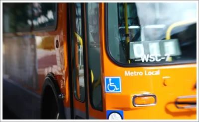
John Surico spoke with Steven Higashide of TransitCenter about his new book, Better Buses, Better Cities. Higashide says that buses and bus systems in the United States too often are considered the mode of last resort and a social service. As a result, buses are not at the forefront of transportation policy, particularly at the federal level.
But notes Higashide, buses play a much different role in mobility systems in other countries. "Often, you hear decision makers talk of the need for world-class transit—but if you look at great transit systems around the world, they all have much better and more bus service than we have in the U.S. Buses are world-class transit as well."
Buses should play a more prominent role in the Green New Deal, and strategies like tactical transit can help speed up the infrastructure and operations changes needed to improve transit, argues Higashide. "It’s really important for advocates and city leaders to understand that transit is the backbone of urban mobility. While microtransit and micromobility may have some role in filling in the gaps, they can’t replace the technology of buses and trains that can carry thousands or tens of thousands of people per hour."
FULL STORY: Why the Bus Got So Bad, and How to Save It


Opinion: To Increase Equity, Make Buses Free
With buses as a dominant transport mode for low-income households and "essential workers," free fares would increase access to economic opportunities and free up limited income for cash-strapped commuters.
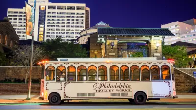
Philadelphia Leaders Dream Big With New Transit Plan
The plan, which looks more than two decades into the future, seeks to modernize the city's transit system, address inequities, and improve regional connectivity.
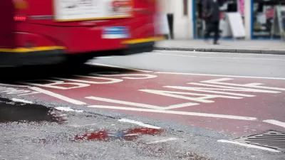
Pandemic Bus Lanes Show Promise as Permanent Solutions
As cities streamline approval processes for bus-only lanes during the pandemic, transit experts hope the projects will lead to lasting change.

Planetizen Federal Action Tracker
A weekly monitor of how Trump’s orders and actions are impacting planners and planning in America.

Maui's Vacation Rental Debate Turns Ugly
Verbal attacks, misinformation campaigns and fistfights plague a high-stakes debate to convert thousands of vacation rentals into long-term housing.

Restaurant Patios Were a Pandemic Win — Why Were They so Hard to Keep?
Social distancing requirements and changes in travel patterns prompted cities to pilot new uses for street and sidewalk space. Then it got complicated.

In California Battle of Housing vs. Environment, Housing Just Won
A new state law significantly limits the power of CEQA, an environmental review law that served as a powerful tool for blocking new development.

Boulder Eliminates Parking Minimums Citywide
Officials estimate the cost of building a single underground parking space at up to $100,000.

Orange County, Florida Adopts Largest US “Sprawl Repair” Code
The ‘Orange Code’ seeks to rectify decades of sprawl-inducing, car-oriented development.
Urban Design for Planners 1: Software Tools
This six-course series explores essential urban design concepts using open source software and equips planners with the tools they need to participate fully in the urban design process.
Planning for Universal Design
Learn the tools for implementing Universal Design in planning regulations.
Heyer Gruel & Associates PA
JM Goldson LLC
Custer County Colorado
City of Camden Redevelopment Agency
City of Astoria
Transportation Research & Education Center (TREC) at Portland State University
Jefferson Parish Government
Camden Redevelopment Agency
City of Claremont