


Our annual list of the 10 best planning, design, and development websites represents some of the top online resources for news, information and research on the built environment.

Every year, Planetizen recognizes ten websites as some of the best resources for urban planning, design and development. This list is based on nominations by Planetizen readers and staff, and judged against a common set of criteria, including content, design, and usability. We've listed the websites alphabetically, not in a particular order of rank.
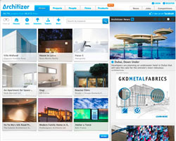
Architizer
Described by The New York Times as "A hybrid of Facebook, Flickr and LinkedIn for architects," Architizer provides a design-oriented mixing bowl for architects, clients, manufacturers, firms, and competition organizers. In the three short years since its launch, the site has established itself as a virtual meeting place, repository of news and insight, and database for architecture and urbanist projects and professionals. Visit Architizer to find a job, find out about the latest projects and opinions, find the perfect ceramic tile, or find out what your classmates are up to.
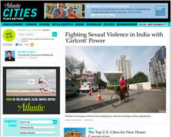
The Atlantic Cities
Part of the Atlantic Media Company family of publications, home to the venerable The Atlantic (formerly Atlantic Monthly) magazine, Atlantic Cities "explores the most innovative ideas and pressing issues facing today's global cities and neighborhoods." Launched in September 2011, and featuring regular contributors such as Richard Florida and former Planetizen contributing editor Nate Berg, the site has quickly become one of the prime sources for planning and development related reporting on the web.
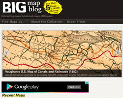
Big Map Blog
The Big Map Blog has amazingly detailed digital reproductions of historic maps from around the world, and they're available for download, for free. Curated by "59King," the focus of the site is straightforward "A.) enormous maps, and B.) access to the full-resolution file." New Maps are added to the site five days a week, so check back often for new additions. Personal favorites include the Hollywood Star Map of 1937, a map of the WWI American Expeditionary Force (1932), and Dutton's Panorama of the Grand Canyon (1882)
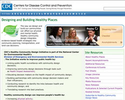
CDC Healthy Places
We've all likely struggled to use frustrating government websites that are a jumble of broken links, outdated information, and confusing navigation. That's what makes the Center for Disease Control and Prevention's (CDC) Designing and Building Healthy Places website a revelation. Though not the most sophisticated website from a design sense, Healthy Places provides an abundance of useful information and access to assistance. If you're looking for resources to help plan healthier communities or educate others, you'd be hard pressed to find a better site than this one-stop shop, which offers an incredible range of resources.
FastCoExist & CoDesign
www.fastcoexist.com
www.fastcodesign.com
Long a favorite of the digerati (see our 2010 honorable mentions list), the speed at which Fast Company retools its services to meet emerging trends lives up to the publication's name. Case in point, the recently re-diversified website, of which the Co.Exist and Co.Design subsidiaries are of specific import to those in the planning and development fields. Co.Design is "a daily exploration of the intersection of business and design, from architecture to electronics, consumer products to fashion." Co.Exist is "a daily tour of the latest world changing ideas and innovations in transportation, energy, education, food, and health." The perfect afternoon snack, these concise posts are high on fantastic images, bold web design, and plentiful hyperlinks.
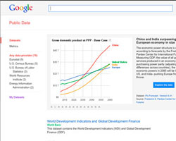
Google Public Data Explorer
Launched in March, 2010, this offering from the arbiter of information, "makes large, public-interest datasets easy to explore, visualize and communicate." The site provides access to high-quality data sets from providers such as Eurostat, the U.S. Census Bureau, and the World Bank, which can be used or explored in interactive and animated visualizations.
Perhaps of greater interest to planners, students, policy makers, and researchers is the capability for users to upload, visualize, and embed their own data. Make sure to visit the help page (not easy to locate from the main landing page) for instructions on how to format, publish, and share your own datasets.
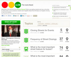
Mind Mixer
Crowdsourced Planning: coming soon to a General Plan update in a city near you! The last year has seen an explosion in the application of crowdsourcing platforms for planning, and the number of companies that provide such services, as the town hall meeting goes virtual. Seen increasingly as a way to augment, and supplant, traditional means of educating and engaging community members in the development of projects and plans, these platforms are intended to reach a wider group of citizens by providing individuals with access to information and opportunities to contribute to discussions at their leisure, from any internet enabled location.
Although the number of companies providing such services is mind-boggling, MindMixer's light bulbs may be the most ubiquitous. Currently providing the outreach platform for projects in Los Angeles, Omaha, and New York, there's a good chance you've been exposed to Mind Mixer's bold colors and virtual popularity contests over the past couple of years. Competing providers include IdeaScale, Crowdbrite, and MetroQuest, with each utilizing slightly different tools (such as voting, digital post it notes, and scenario simulation) to elicit feedback. While many of these companies partner with public agencies to bring a grassroots element to what are essentially top-down processes, sites such as Neighborland seek to crowdsource urban improvements from the ground-up.
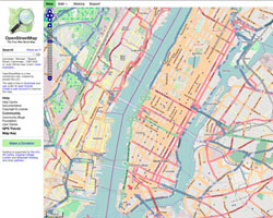
OpenStreetMap
While Google's mostly free mapping service is hugely popular and widely used, OpenStreetMap is offering stiff competition. Unlike commercial mapping services which may be cost-prohibitive or have legal or technical restrictions on how you use them, OpenStreetMap is a completely free worldwide map, created by a huge audience of contributors. It offers many of the same features as Google Maps, and in some cases, the quality of OpenStreetMap's crowdsourced map data can far exceed the quality of commercial mapping services, especially for maps outside the US.
On just one day in April, we counted over 280 user-submitted "Public GPS traces", or background edits to the map that are later used to revise and refine the map. Already some big companies -- Wikipedia, Apple, and Microsoft -- have started favoring OpenStreetMap.
Spacehive
One of the prominent Internet stories of the past year has been the dramatic rise in the crowdfunding site Kickstarter, on which more than 2 million people have contributed a combined $200 million to back 22,000 projects. The past year has also seen the emergence of sites that take the Kickstarter crowdfunding ethos and apply it to improvements to the physical environment.
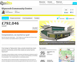
Primary among these is the British-based Spacehive, which bills itself as the "world's first funding platform for neighbourhood improvement projects." In March of this year, the site completed its first successful fundraising drive, gathering £792,000 for the construction of a new multi-purpose community centre in Glyncoch, Wales.
Ioby, an acronym for "in our backyard", funds similar projects (with donations of money or sweat) in the United States. Originally focused only on projects in New York City, ioby has since gone national and has raised a combined $262,640 for 123 successfully funded projects. Their biggest project to date is the Root For Trees Street Tree Signage Campaign, an effort to raise environmental consciousness by illustrating "important facts about trees and the numerous ways they support our lives."
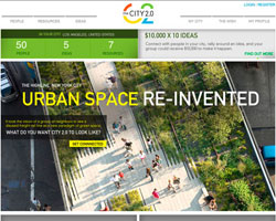
TED City 2.0
In a surprise move, TED (Technology, Entertainment, Design), the influential thought-leader lecture series, awarded its annual prize, meant to spotlight and reward "exceptional individuals," not to a person, but to an idea. The "recipient" of this year's $100,000 prize money and traditional "One Wish to Change the World," is the City 2.0, the "inclusive, innovative, healthy, soulful, thriving" future of the city. The companion to the prize is a website similar in ambition to New York City's Change by Us, but globally oriented to "Combine the reach of the cloud with the power of the crowd. Connect leaders, experts, companies, organizations and citizens. Share your tools, data, designs, successes, and ideas. Turn them into action."
Imagined as a global clearinghouse to attract and compile ideas, tools, success stories and resources from those interested in contributing to improving their cities, the website also operates a micro grant competition to determine which ten local projects have the best hope of spurring the creation of their City 2.0. Recipients will receive $10,000, to be awarded in July 2012.
PREVIOUS LISTS


Maui's Vacation Rental Debate Turns Ugly
Verbal attacks, misinformation campaigns and fistfights plague a high-stakes debate to convert thousands of vacation rentals into long-term housing.

Planetizen Federal Action Tracker
A weekly monitor of how Trump’s orders and actions are impacting planners and planning in America.

In Urban Planning, AI Prompting Could be the New Design Thinking
Creativity has long been key to great urban design. What if we see AI as our new creative partner?

King County Supportive Housing Program Offers Hope for Unhoused Residents
The county is taking a ‘Housing First’ approach that prioritizes getting people into housing, then offering wraparound supportive services.

Researchers Use AI to Get Clearer Picture of US Housing
Analysts are using artificial intelligence to supercharge their research by allowing them to comb through data faster. Though these AI tools can be error prone, they save time and housing researchers are optimistic about the future.

Making Shared Micromobility More Inclusive
Cities and shared mobility system operators can do more to include people with disabilities in planning and operations, per a new report.
Urban Design for Planners 1: Software Tools
This six-course series explores essential urban design concepts using open source software and equips planners with the tools they need to participate fully in the urban design process.
Planning for Universal Design
Learn the tools for implementing Universal Design in planning regulations.
planning NEXT
Appalachian Highlands Housing Partners
Mpact (founded as Rail~Volution)
City of Camden Redevelopment Agency
City of Astoria
City of Portland
City of Laramie