


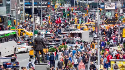
Des Moines is considering an ambitious complete streets makeover of its downtown streets.

Kim Norvell reports on the Connect Downtown plan under consideration in Des Moines, ahead of an expected adoption by the City Council in fall of 2017. The plan has been made public in a round of public open houses this month, with street changes proposed to increase safety and street life.
"Planners hope the changes, slated to be complete by 2030, will create a safer environment for pedestrians and cyclists, which in turn will encourage business growth and attract young, creative professionals who want to commute to their jobs on foot or by bike," explains Norvell.
The draft version of the plan could affect "[n]early every street in the downtown core would be touched," explains Norvell. The plan would convert existing one-way streets to two-way traffic, reduce traffic lanes on some streets, and create protected bike lanes for a "connected bike network."
Jeff Speck, well known to Planetizen readers as the author of Walkable City: How Downtown Can Save America, One Step at a Time, led a team of planners from San Francisco on a year of study prior to this point.
FULL STORY: Plan cuts downtown one-way streets, adds protected bike lanes

Redesigning Streets for Livability: A Global View
An excerpt from the introduction of the recent book, “Streets For All: 50 Strategies for Shaping Resilient Cities,” edited by Vinayak Bharne and Shyam Khandekar.
San Francisco Returns $15 Million Federal Grant for Market Street Improvements
San Francisco was awarded a federal grant in 2018 that it was forced to return in 2022 because it couldn't start construction by 2025.
Pedestrian-Friendly Makeover of a Busy Toronto Street Stops Short of the Car-Free Ideal
The yongeTOmorrrow project is heading toward the finish line with widespread support from advocates, but a few want the plan to go one step further.

Planetizen Federal Action Tracker
A weekly monitor of how Trump’s orders and actions are impacting planners and planning in America.

San Francisco's School District Spent $105M To Build Affordable Housing for Teachers — And That's Just the Beginning
SFUSD joins a growing list of school districts using their land holdings to address housing affordability challenges faced by their own employees.

The Tiny, Adorable $7,000 Car Turning Japan Onto EVs
The single seat Mibot charges from a regular plug as quickly as an iPad, and is about half the price of an average EV.

Seattle's Plan for Adopting Driverless Cars
Equity, safety, accessibility and affordability are front of mind as the city prepares for robotaxis and other autonomous vehicles.

As Trump Phases Out FEMA, Is It Time to Flee the Floodplains?
With less federal funding available for disaster relief efforts, the need to relocate at-risk communities is more urgent than ever.

With Protected Lanes, 460% More People Commute by Bike
For those needing more ammo, more data proving what we already knew is here.
Urban Design for Planners 1: Software Tools
This six-course series explores essential urban design concepts using open source software and equips planners with the tools they need to participate fully in the urban design process.
Planning for Universal Design
Learn the tools for implementing Universal Design in planning regulations.
Smith Gee Studio
City of Charlotte
City of Camden Redevelopment Agency
City of Astoria
Transportation Research & Education Center (TREC) at Portland State University
US High Speed Rail Association
City of Camden Redevelopment Agency
Municipality of Princeton (NJ)