


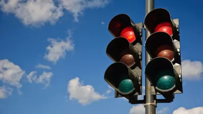
After completing an eight-year study of traffic collisions, the Seattle Department of Transportation realized that one way to immediately improve traffic safety would be to improve signalization an key intersections.
Ryan Packer reports on a new commitment in Seattle to reprioritize traffic light replacements as a component of the Seattle Department of Transportation's (SDOT) Vizion Zero initiative. Here Packer sets the context:
When the Seattle Department of Transportation (SDOT) announced the end of an eight-year study on traffic collision data, it had a very comprehensive set of data on where collisions took place, what modes were involved, and how the collisions occurred. The big question was: how would the department begin to apply the data across the city to reduce those collisions?
Packer follows up a post on the SDOT Blog announcing that the agency has targeted traffic signalization as a priority project in response to the data produced by that study. "Not only will they be using that more robust set of data to determine where to add signals, they will also be prioritizing the improvement of existing traffic signals to improve the left turn movements," according to Ryan Packer. SDOT has already identified ten highest priority intersections for new traffic signals. According to Packer, the whole process reflects "a big step toward a data-driven approach to the day-to-day business that SDOT engages in all the time: routine maintenance, system upgrades, and safety improvements."
FULL STORY: SDOT To Reprioritize Traffic Light Replacement


Seattle's Vision Zero Program Emphasizes Safe Systems Over Enforcement
Looking for traffic safety improvements while responding to 2020's Black Lives Matter protests, Seattle has spent much of the past two years implementing a Safe System approach to move closer to its Vision Zero goal to eliminate traffic fatalities.
Fixing Seattle's Most Dangerous Road
In-depth coverage of the improvement efforts underway on Seattle's Rainier Avenue.

Austin Left Turn Improvements Cut Serious Crashes by Half
Changes to left turn infrastructure and signal timing led to a 47 to 72 percent drop in fatal and serious injury crashes.

Planetizen Federal Action Tracker
A weekly monitor of how Trump’s orders and actions are impacting planners and planning in America.

Map: Where Senate Republicans Want to Sell Your Public Lands
For public land advocates, the Senate Republicans’ proposal to sell millions of acres of public land in the West is “the biggest fight of their careers.”

Restaurant Patios Were a Pandemic Win — Why Were They so Hard to Keep?
Social distancing requirements and changes in travel patterns prompted cities to pilot new uses for street and sidewalk space. Then it got complicated.

Platform Pilsner: Vancouver Transit Agency Releases... a Beer?
TransLink will receive a portion of every sale of the four-pack.

Toronto Weighs Cheaper Transit, Parking Hikes for Major Events
Special event rates would take effect during large festivals, sports games and concerts to ‘discourage driving, manage congestion and free up space for transit.”

Berlin to Consider Car-Free Zone Larger Than Manhattan
The area bound by the 22-mile Ringbahn would still allow 12 uses of a private automobile per year per person, and several other exemptions.
Urban Design for Planners 1: Software Tools
This six-course series explores essential urban design concepts using open source software and equips planners with the tools they need to participate fully in the urban design process.
Planning for Universal Design
Learn the tools for implementing Universal Design in planning regulations.
Heyer Gruel & Associates PA
JM Goldson LLC
Custer County Colorado
City of Camden Redevelopment Agency
City of Astoria
Transportation Research & Education Center (TREC) at Portland State University
Camden Redevelopment Agency
City of Claremont
Municipality of Princeton (NJ)