


Accounts of disgruntled residents responding by any means necessary to the flood of cars beckoned by the whims of navigation apps like Waze are spreading across the country.
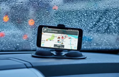
Steve Hendrix reports on the ongoing battle between residents of residential streets and navigation apps like Waze. Hendrix specifically cites the example of Timothy Connor, who lives in Takoma Park, Maryland and has become so frustrated by the number of cars on his street as a result of a nearby street repair.
Hendrix reports that Connor "borrowed a tactic he read about from the car wars of Southern California and other traffic-weary regions: He became a Waze impostor. Every rush hour, he went on the Google-owned social-media app and posted false reports of a wreck, speed trap or other blockage on his street, hoping to deflect some of the flow."
Eventually Waze discovered Connor's tactic and stopped registering his reports, "[making] Connor a casualty in the social-media skirmishes erupting across the country as neighborhoods try to contend with suddenly savvy drivers finding their way on routes that were once all but secret."
Hendrix looks around the country for more examples of the methods by which cities and residents are countering the traffic effects of navigation algorithms. Hendrix also reports Waze's response, both in suspending users suspected of "tampering with the map" and in adding new features to the app, like "alerts about school zones and other slow-speed zones…"
FULL STORY: Traffic-weary homeowners and Waze are at war, again. Guess who’s winning?

Cities Seeking New Weapons in the Battle Against Waze-Induced Traffic
Los Altos, California has erected a new roadblock in its ongoing effort to keep drivers from cutting through residential neighborhoods, beckoned by the popular navigation app Waze.
Flooded With Navigation App Users, a Town Closes Its Streets
Navigation apps like Waze often reroute drivers onto residential streets that would be quiet otherwise. With some residents unable to leave their driveways, the New Jersey borough of Leonia has taken an extreme measure against the problem.
Are Traffic Apps More a Problem Than a Solution?
The companies behind navigation apps say they want to decrease congestion in cities. But a tool that is essentially designed to help individuals isn’t going to provide a collective benefit.

Planetizen Federal Action Tracker
A weekly monitor of how Trump’s orders and actions are impacting planners and planning in America.

Map: Where Senate Republicans Want to Sell Your Public Lands
For public land advocates, the Senate Republicans’ proposal to sell millions of acres of public land in the West is “the biggest fight of their careers.”

Restaurant Patios Were a Pandemic Win — Why Were They so Hard to Keep?
Social distancing requirements and changes in travel patterns prompted cities to pilot new uses for street and sidewalk space. Then it got complicated.

California Homeless Arrests, Citations Spike After Ruling
An investigation reveals that anti-homeless actions increased up to 500% after Grants Pass v. Johnson — even in cities claiming no policy change.

Albuquerque Route 66 Motels Become Affordable Housing
A $4 million city fund is incentivizing developers to breathe new life into derelict midcentury motels.

DC Area County Eliminates Bus Fares
Montgomery County joins a growing trend of making transit free.
Urban Design for Planners 1: Software Tools
This six-course series explores essential urban design concepts using open source software and equips planners with the tools they need to participate fully in the urban design process.
Planning for Universal Design
Learn the tools for implementing Universal Design in planning regulations.
Heyer Gruel & Associates PA
JM Goldson LLC
Custer County Colorado
City of Camden Redevelopment Agency
City of Astoria
Transportation Research & Education Center (TREC) at Portland State University
Camden Redevelopment Agency
City of Claremont
Municipality of Princeton (NJ)