


The companies behind navigation apps say they want to decrease congestion in cities. But a tool that is essentially designed to help individuals isn’t going to provide a collective benefit.
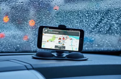
Laura Bliss looks at the impact of navigation apps such as Waze and the purported benefits that come from crowdsourced traffic data. Waze says it provides a social good, but it is a private company looking to a turn a profit. This means that the value of data, and not the value of transportation outcomes, will inevitably be what drives the use of the technology.
"This gets to the heart of the problem with any navigation app—or, for that matter, any traffic fix that prioritizes the needs of independent drivers over what’s best for the broader system. Managing traffic requires us to work together. Apps tap into our selfish desires," says Bliss.
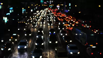
Bliss discusses the ideas of induced demand and the Nash equilibrium, where individual self-interest prevails, even when a different decision would help the larger group. "Road traffic is a great example: absent other incentives, I’m always going to choose the fastest route home that is available to me, even though taking a longer, more circuitous route would help spread out traffic and ease congestion for other drivers across my city."
And navigation systems help facilitate this behavior, since more drivers looking for faster routes leads to more traffic dumped on to residential roadways and congestion spread out on other parts of the network. The solution to urban traffic, says Bliss, might be more about redefining the problem as one of access instead of speed.
"It’s easy to believe we’re being guided on the smartest routes when we’re using them, even when the streets are as familiar to us as the scuffed leather of the steering wheel. But no single tool is going to 'solve' congestion, despite the claims of tech companies," argues Bliss. Instead, she says, tackling congestion involves thinking about how to increase mobility and offer alternatives to driving through land use, urban design, and multimodal transportation systems.
FULL STORY: Navigation Apps Changed the Politics of Traffic


Research Shows More Roads = More Driving
A national study shows, once again, that increasing road supply induces additional vehicle travel, particularly over the long run.

Why Traffic Never Gets Better
Despite abundant research showing that roadway expansions provide limited congestion relief and increase long-term traffic problems, they still occur due to wishful thinking: advocates claim that “this” project is different.
Congestion Growing in Sunbelt Cities
Cities with rapidly growing populations and inadequate public transit systems are seeing more gridlock despite changes in commuting patterns and the rise of remote work.

Planetizen Federal Action Tracker
A weekly monitor of how Trump’s orders and actions are impacting planners and planning in America.

Map: Where Senate Republicans Want to Sell Your Public Lands
For public land advocates, the Senate Republicans’ proposal to sell millions of acres of public land in the West is “the biggest fight of their careers.”

Restaurant Patios Were a Pandemic Win — Why Were They so Hard to Keep?
Social distancing requirements and changes in travel patterns prompted cities to pilot new uses for street and sidewalk space. Then it got complicated.

Platform Pilsner: Vancouver Transit Agency Releases... a Beer?
TransLink will receive a portion of every sale of the four-pack.

Toronto Weighs Cheaper Transit, Parking Hikes for Major Events
Special event rates would take effect during large festivals, sports games and concerts to ‘discourage driving, manage congestion and free up space for transit.”

Berlin to Consider Car-Free Zone Larger Than Manhattan
The area bound by the 22-mile Ringbahn would still allow 12 uses of a private automobile per year per person, and several other exemptions.
Urban Design for Planners 1: Software Tools
This six-course series explores essential urban design concepts using open source software and equips planners with the tools they need to participate fully in the urban design process.
Planning for Universal Design
Learn the tools for implementing Universal Design in planning regulations.
Heyer Gruel & Associates PA
JM Goldson LLC
Custer County Colorado
City of Camden Redevelopment Agency
City of Astoria
Transportation Research & Education Center (TREC) at Portland State University
Camden Redevelopment Agency
City of Claremont
Municipality of Princeton (NJ)