


GPS Navigation
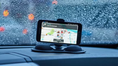
Are Traffic Apps More a Problem Than a Solution?
The companies behind navigation apps say they want to decrease congestion in cities. But a tool that is essentially designed to help individuals isn’t going to provide a collective benefit.
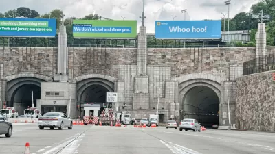
Waze Outfits NYC Tunnels with Beacons for Underground Navigation
The tech is part of a public-private partnership meant to improve connectivity to Waze and other navigation apps from underground.
'Father of GPS' awarded IEEE Medal of Honor
At the IEEE honors ceremony today [May 11] in San Francisco, Bradford Parkinson, a retired Air Force colonel who spent his life between maps and navigation systems, will be awarded the 2018 IEEE Medal of Honor,.
Drivers: Beware Following GPS Navigation Instructions Too Closely
For the second time at the same railroad crossing in Atherton, California, a motorist followed his GPS navigation onto Caltrain tracks. In both cases, the motorists fled their vehicles before being hit by an oncoming train.

Infrastructure Week Begins With Air Traffic Control Modernization
Infrastructure Week 2017 kicked-off Monday with the announcement that the president plans to privatize air traffic control. It won't be the first attempt at modernizing the antiquated system. Additional events planned Wednesday through Friday.
An App for Navigating While Walking
A new app called Walc makes navigating while walking easier to do. Even more ambitiously, Walc aims to make it easier to make the choice to walk, rather than drive.
Eliminating the Dangerous 'Waze Left'
Vocal users of the wildly popular navigation app Waze have pushed the company's developers to look for a solution to its routing algorithm's tendency to send drivers turning left through crowded intersections.
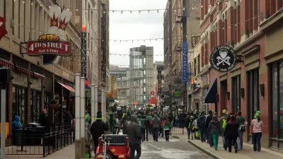
The Case for a Walkable Cleveland
In this long-form article, G.M. Donley reminds us why walkable and diverse communities have become such a planning staple. In Cleveland, New Urbanism contends with a history of sprawl and decreasing population.

Mental Maps Yield to GPS for Taxi Drivers
In the old days, every taxi driver in New York City was required to prove at least a basic working knowledge of the city's streets and landmarks. A new licensing exam does away with geography, assuming that taxis will rely on GPS.
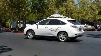
On the Self-Driving Car's Taste in Maps
The navigational software of successful driverless cars will make Google Maps seem like child's play. But can such a system replace or improve upon human instinct and adaptability?
What's Missed When Taking the Scenic Route?
An app that plots the most beautiful route across cities made news earlier this month, but one commenter worries about how taking the more scenic route could make it harder to improve quality of life in the "less-than-scenic" sections of cities.
An App that Calculates the Most Beautiful Route
New in flaneur-enabling technology: a team of intrepid aesthetes in Barcelona is working on a new app that would advance GPS mapping tools by providing the most beautiful route to a destination, rather than the shortest or least congested route.
Transit Apps For People With Disabilities
Google Transit has changed the way people plan their public transportation trips. Now there's an app, OnTheBus, for people with visual, hearing, physical and cognitive impairments. Zak Stone describes the tool.
Urban Design for Planners 1: Software Tools
This six-course series explores essential urban design concepts using open source software and equips planners with the tools they need to participate fully in the urban design process.
Planning for Universal Design
Learn the tools for implementing Universal Design in planning regulations.
Gallatin County Department of Planning & Community Development
Heyer Gruel & Associates PA
JM Goldson LLC
City of Camden Redevelopment Agency
City of Astoria
Transportation Research & Education Center (TREC) at Portland State University
Jefferson Parish Government
Camden Redevelopment Agency
City of Claremont


