


Vocal users of the wildly popular navigation app Waze have pushed the company's developers to look for a solution to its routing algorithm's tendency to send drivers turning left through crowded intersections.
"The navigation app Waze is beloved for exploiting shortcuts, avoiding traffic, and proving that the shortest distance between two points is not always a straight line," according to a post by David Yanofsky. "But its sinuous directions can also be a source of annoyance for drivers, who are often asked to make treacherous left turns through oncoming traffic at dicey intersections."
Yanofsky reports, however, that the company is studying ways to remove the so-called "Waze left" from its routing algorithm. The company is responding to user feedback and media pushback, given the much greater dangers associated with turning left. The article goes on to survey some of the user feedback available online, as well as some specific examples of "Waze lefts" as provided by streets found in the city of Los Angeles.
FULL STORY: The End of the 'Waze Left'


Are Traffic Apps More a Problem Than a Solution?
The companies behind navigation apps say they want to decrease congestion in cities. But a tool that is essentially designed to help individuals isn’t going to provide a collective benefit.
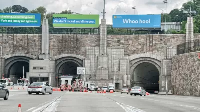
Waze Outfits NYC Tunnels with Beacons for Underground Navigation
The tech is part of a public-private partnership meant to improve connectivity to Waze and other navigation apps from underground.

Austin Left Turn Improvements Cut Serious Crashes by Half
Changes to left turn infrastructure and signal timing led to a 47 to 72 percent drop in fatal and serious injury crashes.

Planetizen Federal Action Tracker
A weekly monitor of how Trump’s orders and actions are impacting planners and planning in America.

Restaurant Patios Were a Pandemic Win — Why Were They so Hard to Keep?
Social distancing requirements and changes in travel patterns prompted cities to pilot new uses for street and sidewalk space. Then it got complicated.

Map: Where Senate Republicans Want to Sell Your Public Lands
For public land advocates, the Senate Republicans’ proposal to sell millions of acres of public land in the West is “the biggest fight of their careers.”

Orange County, Florida Adopts Largest US “Sprawl Repair” Code
The ‘Orange Code’ seeks to rectify decades of sprawl-inducing, car-oriented development.

Maui's Vacation Rental Debate Turns Ugly
Verbal attacks, misinformation campaigns and fistfights plague a high-stakes debate to convert thousands of vacation rentals into long-term housing.

San Francisco Suspends Traffic Calming Amidst Record Deaths
Citing “a challenging fiscal landscape,” the city will cease the program on the heels of 42 traffic deaths, including 24 pedestrians.
Urban Design for Planners 1: Software Tools
This six-course series explores essential urban design concepts using open source software and equips planners with the tools they need to participate fully in the urban design process.
Planning for Universal Design
Learn the tools for implementing Universal Design in planning regulations.
Heyer Gruel & Associates PA
JM Goldson LLC
Custer County Colorado
City of Camden Redevelopment Agency
City of Astoria
Transportation Research & Education Center (TREC) at Portland State University
Camden Redevelopment Agency
City of Claremont
Municipality of Princeton (NJ)