


The tech is part of a public-private partnership meant to improve connectivity to Waze and other navigation apps from underground.
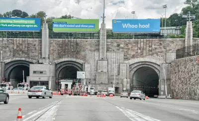
Waze has entered a partnership with the New York MTA and Port Authority aimed at improving navigation for drivers in New York City.
Several tunnels in the city now boast Waze Beacons, an open-source technology meant to allow users of navigation apps to stay connected even when they don't have a signal—particularly useful for drivers entering tunnels, the company expects. The tiny devices stick to tunnel walls and can support any navigation app, not just Waze. Chaim Gartenberg explains in The Verge:
"The Waze Beacons themselves are just battery-powered microcontrollers that use low-powered Bluetooth signals to communicate with smartphones, allowing for Waze to provide alternative location services to drivers even when out of GPS range (relying on Google’s near-field Eddystone technology to communicate)."
Boston, Chicago, and Pittsburgh are among the cities already using the private infrastructure, now also online in New York's Holland, Lincoln, Queens-Midtown, and Brooklyn-Battery Tunnels.
FULL STORY: Waze adds Beacons to NYC tunnels so drivers can stay connected to GPS apps

New York MTA Upholds Pause on Congestion Pricing, Scales Back Projects
The agency will not be able to go forward with former plans to improve station facilities and transit safety, and expand service.

New York MTA Makes Five Bus Routes Fare-Free
The state-funded effort is a way to assess how free fares impact ridership.
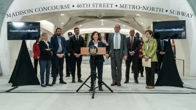
Long Island Rail Now Connects to Grand Central Terminal
A new rail service launched this week could save commuters as much as 40 minutes on trips between Long Island and Manhattan.

Maui's Vacation Rental Debate Turns Ugly
Verbal attacks, misinformation campaigns and fistfights plague a high-stakes debate to convert thousands of vacation rentals into long-term housing.

Planetizen Federal Action Tracker
A weekly monitor of how Trump’s orders and actions are impacting planners and planning in America.

Chicago’s Ghost Rails
Just beneath the surface of the modern city lie the remnants of its expansive early 20th-century streetcar system.

Bend, Oregon Zoning Reforms Prioritize Small-Scale Housing
The city altered its zoning code to allow multi-family housing and eliminated parking mandates citywide.

Amtrak Cutting Jobs, Funding to High-Speed Rail
The agency plans to cut 10 percent of its workforce and has confirmed it will not fund new high-speed rail projects.

LA Denies Basic Services to Unhoused Residents
The city has repeatedly failed to respond to requests for trash pickup at encampment sites, and eliminated a program that provided mobile showers and toilets.
Urban Design for Planners 1: Software Tools
This six-course series explores essential urban design concepts using open source software and equips planners with the tools they need to participate fully in the urban design process.
Planning for Universal Design
Learn the tools for implementing Universal Design in planning regulations.
planning NEXT
Appalachian Highlands Housing Partners
Mpact (founded as Rail~Volution)
City of Camden Redevelopment Agency
City of Astoria
City of Portland
City of Laramie