


Navigation Apps
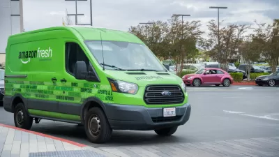
Better Maps Would Save Delivery Companies a Ton of Time and Money
A new report estimates the cost of inaccurate maps for delivery companies in the billions of dollars.
Are Traffic Apps More a Problem Than a Solution?
The companies behind navigation apps say they want to decrease congestion in cities. But a tool that is essentially designed to help individuals isn’t going to provide a collective benefit.
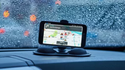
Google Maps for iPhone Now Reports DUI Checkpoints, Speed Traps
Navigation app Waze has long allowed users the ability to report various "inconveniences" on the road, like speed traps, checkpoints, and crashes. Now Google Maps users on iPhone can do the same.
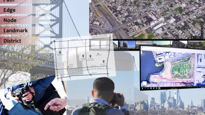
Analyzing Lynch's City Imageability in the Digital Age
Mahbubur Meenar of Rowan University writes about a recent article he co-authored in the Journal of Planning Education and Research
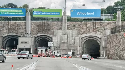
Waze Outfits NYC Tunnels with Beacons for Underground Navigation
The tech is part of a public-private partnership meant to improve connectivity to Waze and other navigation apps from underground.

Google Maps Goes Multi-Modal
A bunch of new features makes Google Maps user-friendly for transit commuters.
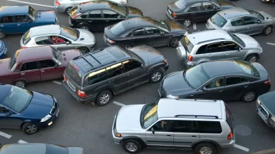
Navigation Apps Might Hurt Traffic Congestion More Than Help
Raise your hand if you envisioned a transportation network optimized to full efficiency by navigation apps.
Drivers: Beware Following GPS Navigation Instructions Too Closely
For the second time at the same railroad crossing in Atherton, California, a motorist followed his GPS navigation onto Caltrain tracks. In both cases, the motorists fled their vehicles before being hit by an oncoming train.
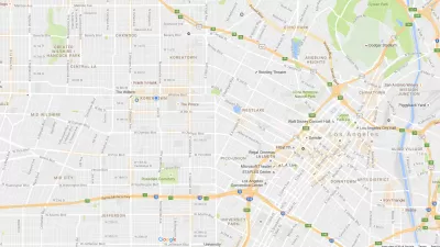
Flooded With Navigation App Users, a Town Closes Its Streets
Navigation apps like Waze often reroute drivers onto residential streets that would be quiet otherwise. With some residents unable to leave their driveways, the New Jersey borough of Leonia has taken an extreme measure against the problem.
Explained: Mobility as a Service
Mobility as a Service, or MaaS for short, is a buzzword you've probably seen a lot of in recent months.

Like Waze, But for Bikes
The mobile app LaneSpotter, described as a navigation app like Waze but for cyclists, has announced eight cities as the location for a pilot launch.
Cities Seeking New Weapons in the Battle Against Waze-Induced Traffic
Los Altos, California has erected a new roadblock in its ongoing effort to keep drivers from cutting through residential neighborhoods, beckoned by the popular navigation app Waze.
Google Maps Update Opens New Access to Mobility and Culture
Google Maps and other navigation and mapping apps have done a lot to inspire and educate people to make the most of their surroundings. New changes to the Google Maps app will add new functionality for those purposes.
Waze vs. Residential Neighborhoods
Accounts of disgruntled residents responding by any means necessary to the flood of cars beckoned by the whims of navigation apps like Waze are spreading across the country.
Urban Design for Planners 1: Software Tools
This six-course series explores essential urban design concepts using open source software and equips planners with the tools they need to participate fully in the urban design process.
Planning for Universal Design
Learn the tools for implementing Universal Design in planning regulations.
Heyer Gruel & Associates PA
JM Goldson LLC
Custer County Colorado
City of Camden Redevelopment Agency
City of Astoria
Transportation Research & Education Center (TREC) at Portland State University
Camden Redevelopment Agency
City of Claremont
Municipality of Princeton (NJ)


