


A new app called Walc makes navigating while walking easier to do. Even more ambitiously, Walc aims to make it easier to make the choice to walk, rather than drive.
"A navigation app called Walc, designed for pedestrians, was built on the idea that someone walking could use different directions than someone in a car," according to an article by Adele Peters.
Peters quotes Allison McGuire, founder of Walc, for insights into the concepts behind the pedestrian navigation app. McGuire makes this excellent point: "Time passes differently when you're walking—all of your senses are engaged and you gravitate toward visual cues to guide your way…You measure distance with time, blocks, steps, and even calories burned. When you're driving, you look out for signs and measure distance in miles."
So instead of receiving directions to turn north, the app uses more readily apparent landmarks, such as, for example, a McDonalds or a Starbucks, to provide its directions. Another helpful feature of the app: "With a new hands-free 'pocket' mode, you can leave your phone in a coat or bag and listen to directions as you look around, instead of staring at a screen."
FULL STORY: This Navigation App Is Designed For Pedestrians, Not Drivers

Best Apps for Urban Planning in 2022
Mobile apps continue to redefine the practices of planning—urban planning, regional planning, transportation planning, community planning, and rural planning included.
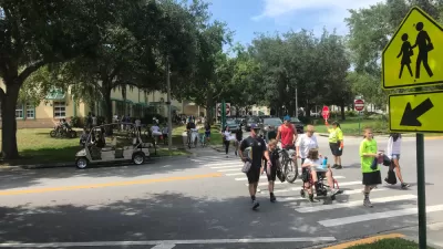
Earn Rewards for Traveling for by Foot, Bike, Bus, or Train
The city of Orlando is partnering with the Miles app.

New Google Map Layer Shows COVID-19 Infection Rates
A new layer showing the seven-day average of confirmed COVID-19 cases started rolling out to Android and iPhones last week.

Maui's Vacation Rental Debate Turns Ugly
Verbal attacks, misinformation campaigns and fistfights plague a high-stakes debate to convert thousands of vacation rentals into long-term housing.

Planetizen Federal Action Tracker
A weekly monitor of how Trump’s orders and actions are impacting planners and planning in America.

In Urban Planning, AI Prompting Could be the New Design Thinking
Creativity has long been key to great urban design. What if we see AI as our new creative partner?

Massachusetts Budget Helps Close MBTA Budget Gap
The budget signed by Gov. Maura Healey includes $470 million in MBTA funding for the next fiscal year.

Milwaukee Launches Vision Zero Plan
Seven years after the city signed its Complete Streets Policy, the city is doubling down on its efforts to eliminate traffic deaths.

Portland Raises Parking Fees to Pay for Street Maintenance
The city is struggling to bridge a massive budget gap at the Bureau of Transportation, which largely depleted its reserves during the Civd-19 pandemic.
Urban Design for Planners 1: Software Tools
This six-course series explores essential urban design concepts using open source software and equips planners with the tools they need to participate fully in the urban design process.
Planning for Universal Design
Learn the tools for implementing Universal Design in planning regulations.
Gallatin County Department of Planning & Community Development
Heyer Gruel & Associates PA
JM Goldson LLC
City of Camden Redevelopment Agency
City of Astoria
Transportation Research & Education Center (TREC) at Portland State University
Jefferson Parish Government
Camden Redevelopment Agency
City of Claremont