


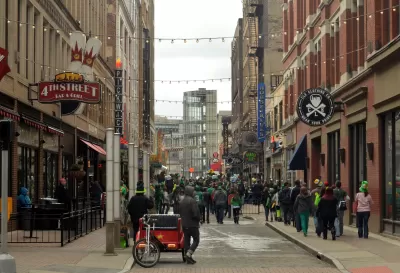
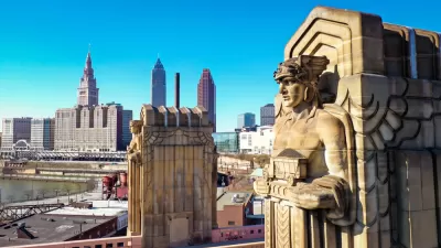
In this long-form article, G.M. Donley reminds us why walkable and diverse communities have become such a planning staple. In Cleveland, New Urbanism contends with a history of sprawl and decreasing population.
Though it has marvelous advantages, G.M. Donley observes that modern technology is often guilty of "isolating individuals physically from each other: each commuter traveling in his or her own car, every home a self-contained living and entertainment center, shopping trips carried out from the desktop, social interactions mediated through a little screen."
This can be a serious impediment to diversity: "People are comfortable living among like-minded people, and communication technology and transportation networks make that easier than ever before."
Throughout the article, Donley develops the context to examine how Cleveland—and other "rust belt" cities—might factor into the walkability debate.
- Cleveland has been a historical crossroads, astride key routes of transport but still independent from major centers—and by extension their major developers and inflated real estate prices.
- Walking is what we're meant to do: "humans evolved to walk a lot and our bodies and brains function best when we do that; our past century of not walking a lot has therefore begun to have serious consequences to health and well-being."
- "Efforts are already being made to equip key Cleveland neighborhoods with the fastest fiber-optic and wireless internet capability, to set the stage for future entrepreneurship and innovation. Those initiatives will be most fruitful if conceived around the priority of creating great environments for people on foot."
FULL STORY: Walking and Thinking: Technology and the New Navigation of Everyday Space

Parking Requirements Removed Near Cleveland Transit Stops
Transit oriented parking reform has arrived in Cleveland.
A Primer on Suburban Urbanism
How one master-planned development used lower-density urbanism principles to build a community focused on affordability, sustainability, and conservation.
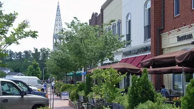
A ‘New Urbanism’ Travelogue
I visited three New Urbanist developments in North Carolina. Here's what I liked, what I didn't like, and what I learned.

Planetizen Federal Action Tracker
A weekly monitor of how Trump’s orders and actions are impacting planners and planning in America.

Chicago’s Ghost Rails
Just beneath the surface of the modern city lie the remnants of its expansive early 20th-century streetcar system.

San Antonio and Austin are Fusing Into one Massive Megaregion
The region spanning the two central Texas cities is growing fast, posing challenges for local infrastructure and water supplies.

Since Zion's Shuttles Went Electric “The Smog is Gone”
Visitors to Zion National Park can enjoy the canyon via the nation’s first fully electric park shuttle system.

Trump Distributing DOT Safety Funds at 1/10 Rate of Biden
Funds for Safe Streets and other transportation safety and equity programs are being held up by administrative reviews and conflicts with the Trump administration’s priorities.

German Cities Subsidize Taxis for Women Amid Wave of Violence
Free or low-cost taxi rides can help women navigate cities more safely, but critics say the programs don't address the root causes of violence against women.
Urban Design for Planners 1: Software Tools
This six-course series explores essential urban design concepts using open source software and equips planners with the tools they need to participate fully in the urban design process.
Planning for Universal Design
Learn the tools for implementing Universal Design in planning regulations.
planning NEXT
Appalachian Highlands Housing Partners
Mpact (founded as Rail~Volution)
City of Camden Redevelopment Agency
City of Astoria
City of Portland
City of Laramie