


Edward Brennan waged an extended turn-of-the-century campaign to clean up Chicago's then-confusing address numbering system. Though few recognize his name, Brennan's legacy lives on in modern Chicago.

Writing for WBEZ, Chris Bentley profiles Edward Brennan, the proto-planner Chicagoans have to thank for "one of the simplest street systems of any big city in the world, with every address emanating out from a central origin point at the intersection of State & Madison Streets."
A one-time delivery boy and bill collector, Brennan balked at his city's address numbering system, or rather lack thereof. In the late 1800s, Chicago was a patchwork of smaller towns recently annexed by the expanding metropolis. Streets kept their old address systems, and in many places suffered from multiple and duplicate names.
"But Brennan wouldn't accept the status quo. Beginning in the 1890s he started a scrapbook, collecting newspaper articles about problems with city navigation or delays due to address confusion [...] Brennan lobbied business leaders and newspaper editors for decades [...]"
Brennan's efforts eventually gathered steam, and he drafted a plan to re-number the streets. "It included four big ideas: All addresses would be centered around a 0,0 point at State and Madison Streets; street names would include the direction; even-numbered addresses would always be on the west and north sides of any street, with odd numbers on the east and south sides; house numbers would increase by 800 (or 8 blocks) every mile, although Brennan had originally proposed 1000 addresses per mile. Brennan's plan would also involve renaming many streets in order to cut confusion caused by duplication and other problems."
In 1908, the City Council passed Brennan's proposal, which went into effect with some controversy the next year. Although his name isn't widely recognized, Brennan remains an excellent example of activist planning from a citizen who recognized a problem and fought to implement a solution.
FULL STORY: The unsung hero of urban planning who made it easy to get around Chicago


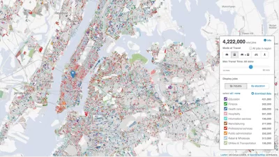
How an Urban Grid Becomes a Maze
Many rational, open grids can seem like a labyrinth to users. The labyrinth has emerged as an unplanned consequence of the evolution of cities, but solutions like GPS navigation and autonomous vehicles could mean relief.
A Central Hub for Open Data
Designed by researchers at the University of Chicago, the Plenario platform gathers all available open data for a specific area. Then it presents the data in an easy-to-use format.
Tracking Chicago’s Potholes
A new animated map presents the reported cases of potholes in Chicago since November—the maps colorful and provides insights into how the city, and our relationship to it, can change with time.

Planetizen Federal Action Tracker
A weekly monitor of how Trump’s orders and actions are impacting planners and planning in America.

Map: Where Senate Republicans Want to Sell Your Public Lands
For public land advocates, the Senate Republicans’ proposal to sell millions of acres of public land in the West is “the biggest fight of their careers.”

Restaurant Patios Were a Pandemic Win — Why Were They so Hard to Keep?
Social distancing requirements and changes in travel patterns prompted cities to pilot new uses for street and sidewalk space. Then it got complicated.

Platform Pilsner: Vancouver Transit Agency Releases... a Beer?
TransLink will receive a portion of every sale of the four-pack.

Toronto Weighs Cheaper Transit, Parking Hikes for Major Events
Special event rates would take effect during large festivals, sports games and concerts to ‘discourage driving, manage congestion and free up space for transit.”

Berlin to Consider Car-Free Zone Larger Than Manhattan
The area bound by the 22-mile Ringbahn would still allow 12 uses of a private automobile per year per person, and several other exemptions.
Urban Design for Planners 1: Software Tools
This six-course series explores essential urban design concepts using open source software and equips planners with the tools they need to participate fully in the urban design process.
Planning for Universal Design
Learn the tools for implementing Universal Design in planning regulations.
Heyer Gruel & Associates PA
JM Goldson LLC
Custer County Colorado
City of Camden Redevelopment Agency
City of Astoria
Transportation Research & Education Center (TREC) at Portland State University
Camden Redevelopment Agency
City of Claremont
Municipality of Princeton (NJ)