


Designed by researchers at the University of Chicago, the Plenario platform gathers all available open data for a specific area. Then it presents the data in an easy-to-use format.
The push for open data publication means very little if researchers can't actually use the data in accessible and meaningful ways. Useful insights often require putting local data into context with information from different places or different times. But in their raw form, datasets are often too specific to easily serve that purpose.
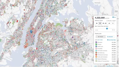
Plenario, a data platform currently in its alpha stage, intends to solve that problem for urban researchers. "With one query, users can access, combine, download and visualize disparate sets of data all in the same place [...] Plenario utilizes Amazon Web Services, a cloud-computing platform, as its scalable back-end infrastructure, which means that storage and computing power for more data sets is not a concern."
University of Chicago's Urban Center for Computation and Design (UrbanCCD) created and launched Plenario late last year. Users specify the neighborhoods or areas they wish to study by drawing a polygon on a map. The platform then delivers a summary of all the datasets available for that area, with links to the sets themselves.
Plenario is open to outside input, allowing users to "upload any publicly available URL for a data source that is either a Socrata or CKAN data set or in CSV format, so long as the data includes the fundamental dimensions of time and location."
FULL STORY: University of Chicago’s 'Plenario' Changes How We Use Open Data

New Center Seeks to Take the Guesswork out of Planning
Researchers at the University of Chicago are tackling a problem that is confronting the globe's biggest cities: how to turn the reams of data being collected and opened to the public and turn it into actionable information for decision-makers.

Next on the List for Data Startups: Managing Curb Space
The humble curb is getting crowded: not only with new modes of transportation, but also with a slew of new data tools aiming to keep track of it all.
Tracking Chicago’s Potholes
A new animated map presents the reported cases of potholes in Chicago since November—the maps colorful and provides insights into how the city, and our relationship to it, can change with time.

Planetizen Federal Action Tracker
A weekly monitor of how Trump’s orders and actions are impacting planners and planning in America.

Maui's Vacation Rental Debate Turns Ugly
Verbal attacks, misinformation campaigns and fistfights plague a high-stakes debate to convert thousands of vacation rentals into long-term housing.

San Francisco Suspends Traffic Calming Amidst Record Deaths
Citing “a challenging fiscal landscape,” the city will cease the program on the heels of 42 traffic deaths, including 24 pedestrians.

Defunct Pittsburgh Power Plant to Become Residential Tower
A decommissioned steam heat plant will be redeveloped into almost 100 affordable housing units.

Trump Prompts Restructuring of Transportation Research Board in “Unprecedented Overreach”
The TRB has eliminated more than half of its committees including those focused on climate, equity, and cities.

Amtrak Rolls Out New Orleans to Alabama “Mardi Gras” Train
The new service will operate morning and evening departures between Mobile and New Orleans.
Urban Design for Planners 1: Software Tools
This six-course series explores essential urban design concepts using open source software and equips planners with the tools they need to participate fully in the urban design process.
Planning for Universal Design
Learn the tools for implementing Universal Design in planning regulations.
Heyer Gruel & Associates PA
JM Goldson LLC
Custer County Colorado
City of Camden Redevelopment Agency
City of Astoria
Transportation Research & Education Center (TREC) at Portland State University
Jefferson Parish Government
Camden Redevelopment Agency
City of Claremont