


The York Regional Council took a significant step toward allowing development on a large chunk of the area's greenbelt—a move opponents say will set a dangerous precedent.
Fatime Syed reports for The Narwhal:
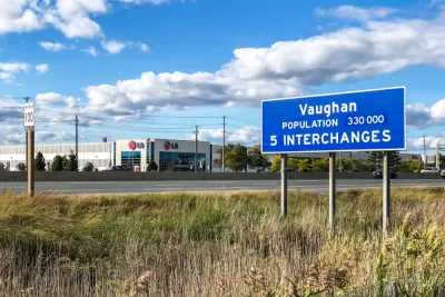
On Oct. 28, York Regional Council — the political body that includes mayors and regional representatives of nine municipalities just north of Toronto, including Markham and Vaughan— voted 13 to 5 in favour of Regional Official Plan Amendment 7, which proposed to change the designation of 1,400 acres of Greenbelt lands from agricultural to rural.
While four mayors voted to approve the amendment, Syed reports that local councilmembers from cities represented by those mayors oppose the development of the greenbelt. Supporting the amendment, however, are development interests with connections to Premier Doug Ford’s Progressive Conservative party. Ford ran for office on a platform that included a proposal to relax the boundaries of the Toronto Greenbelt for development.
Supporters of urban growth boundaries (another term for greenbelts) argue that the land use regulation tool is necessary as an antidote to sprawl. Opponents say fringe development can provide relief to expensive housing markets. In recent years, urban growth boundaries have emerged as a wildfire risk mitigation tool in cities located at the wildland-urban interface.
The Ontario Ministry of Municipal Affairs and Housing must still approve the amendment before it can take effect, reports Syed.
FULL STORY: In Ontario’s York Region, council just voted to allow development on 1,400 acres of Greenbelt farmland

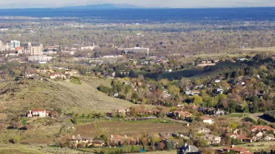
Different Approaches to Fast Growth in Idaho's Treasure Valley
Three cities on the periphery of the fast-growing Treasure Valley showcase different approaches to a sudden influx of newcomers.
Nowhere to Build but Up
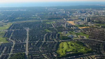
An old way of doing municipal business—generating development fees by opening farmland to development—is no longer paying dividends. Mississauga, Ontario serves as a cautionary tale for the bottom line of sprawl.
Urban Growth Boundaries Gone Awry: Protection Without Infill
Joe Mathews of Zócalo Public Square views with a great deal of skepticism the urban growth boundaries the voters of Ventura County adjacent to Los Angeles County have enacted since 1995 due to the lack of infill. Another measure is on the ballot.

Planetizen Federal Action Tracker
A weekly monitor of how Trump’s orders and actions are impacting planners and planning in America.

Map: Where Senate Republicans Want to Sell Your Public Lands
For public land advocates, the Senate Republicans’ proposal to sell millions of acres of public land in the West is “the biggest fight of their careers.”

Restaurant Patios Were a Pandemic Win — Why Were They so Hard to Keep?
Social distancing requirements and changes in travel patterns prompted cities to pilot new uses for street and sidewalk space. Then it got complicated.

Platform Pilsner: Vancouver Transit Agency Releases... a Beer?
TransLink will receive a portion of every sale of the four-pack.

Toronto Weighs Cheaper Transit, Parking Hikes for Major Events
Special event rates would take effect during large festivals, sports games and concerts to ‘discourage driving, manage congestion and free up space for transit.”

Berlin to Consider Car-Free Zone Larger Than Manhattan
The area bound by the 22-mile Ringbahn would still allow 12 uses of a private automobile per year per person, and several other exemptions.
Urban Design for Planners 1: Software Tools
This six-course series explores essential urban design concepts using open source software and equips planners with the tools they need to participate fully in the urban design process.
Planning for Universal Design
Learn the tools for implementing Universal Design in planning regulations.
Heyer Gruel & Associates PA
JM Goldson LLC
Custer County Colorado
City of Camden Redevelopment Agency
City of Astoria
Transportation Research & Education Center (TREC) at Portland State University
Camden Redevelopment Agency
City of Claremont
Municipality of Princeton (NJ)