


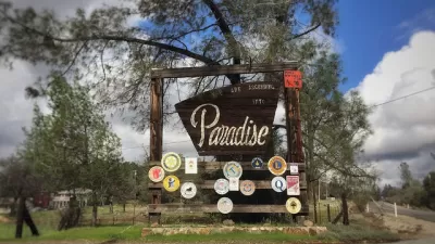
The Camp Fire in California devasted the town of Paradise. As rebuilding progresses, local leaders are looking to protect the town using nature-based fire resilience strategies.
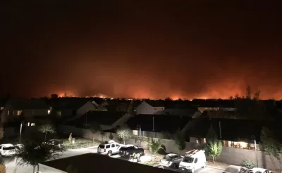
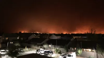
Laura Bliss reports on resiliency plans for Paradise, California, where in 2018 the Camp Fire destroyed the town, displaced 27,000 residents, and killed 85 people. Instead of the common managed retreat approach, Paradise is looking to prevention and mitigation strategies that assume people will live in areas vulnerable to wildfires.
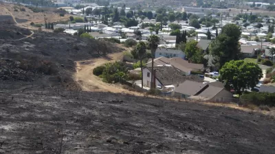
The Paradise Recreation and Park District is starting to acquire land and develop a greenbelt that would surround Paradise. "If the nascent plan is fully realized, a moat of green acreage could provide space for respite and play. It would also serve as a fuel break, an unofficial urban growth boundary, and an access point for crews to manage the area with landscaping, prescribed burning, and fire containment for when the next blaze comes," writes Bliss.
The plan still faces many challenges, including a lack of clear leadership and regulations as well as the financial resources needed to acquire and replant the land. Greenbelts are also a less conventional way to address the threat of wildfires.
"That points to the importance of pooling different sources of knowledge for managing fire — including firefighters, planners, residents, and the Indigenous people who originally settled and managed this part of North America — to develop new strategies for living on the front lines of a warming planet," adds Bliss.
FULL STORY: The Price of Saving Paradise

A New Approach to Wildfire Resilience: Property Buy Backs, Fire Resistant Parks
The city of Paradise is employing a natural hazard mitigation strategy long practiced in flood zones. The idea could be expanded in other places where wildland meets human development.
California's Fastest Growing City: Paradise
Paradise, California—devastated by the deadly Camp Fire of 2018—is attracting new and returning residents as the city rebuilds its housing stock.
Paradise Was Prepared for the Camp Fire, Report Says. It Wasn't Enough.
Sobering findings from a thorough examination of the causes of the 2018 Camp Fire.

Maui's Vacation Rental Debate Turns Ugly
Verbal attacks, misinformation campaigns and fistfights plague a high-stakes debate to convert thousands of vacation rentals into long-term housing.

Planetizen Federal Action Tracker
A weekly monitor of how Trump’s orders and actions are impacting planners and planning in America.

San Francisco Suspends Traffic Calming Amidst Record Deaths
Citing “a challenging fiscal landscape,” the city will cease the program on the heels of 42 traffic deaths, including 24 pedestrians.

Defunct Pittsburgh Power Plant to Become Residential Tower
A decommissioned steam heat plant will be redeveloped into almost 100 affordable housing units.

Trump Prompts Restructuring of Transportation Research Board in “Unprecedented Overreach”
The TRB has eliminated more than half of its committees including those focused on climate, equity, and cities.

Amtrak Rolls Out New Orleans to Alabama “Mardi Gras” Train
The new service will operate morning and evening departures between Mobile and New Orleans.
Urban Design for Planners 1: Software Tools
This six-course series explores essential urban design concepts using open source software and equips planners with the tools they need to participate fully in the urban design process.
Planning for Universal Design
Learn the tools for implementing Universal Design in planning regulations.
Heyer Gruel & Associates PA
JM Goldson LLC
Custer County Colorado
City of Camden Redevelopment Agency
City of Astoria
Transportation Research & Education Center (TREC) at Portland State University
Jefferson Parish Government
Camden Redevelopment Agency
City of Claremont