


Several large freeway expansion projects are in various stages of planning and development in the Louisville region of Kentucky. Critics say the projects reflect an obsolete approach to planning and will hurt the state and the city.
Marcus Green reports on an emerging debate and about land use and transportation in Kentucky, as the state is planning and building multiple massive highway widening projects in the Louisville area while facing financial challenges.
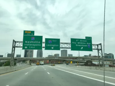
The big highway project closest to fruition in the Louisville area is the work of a plan called I-Move Kentucky. Green introduces the project:
Aiming to ease congestion and boost safety, Kentucky plans to launch an ambitious highway expansion project later this year called I-Move Kentucky. It would add lanes to I-71 between the Gene Snyder Freeway and Ky. 329 near Crestwood, widen parts of the Snyder and rebuild ramps at the freeway’s interchange with I-64.
While commuters are hopeful the project will reduce travel times along the corridors, advocacy organizations like Bicycling for Louisville are calling the project an example of misplaced priorities.
At the same time, the state is evaluating routes for another bypass around Louisville, including one corridor near eastern Jefferson County’s award-winning Floyds Fork parks system. Early cost estimates for the project, which has been likened to a new Snyder Freeway, range from $600 million to $1.6 billion.
As Green points out, the city has a goal to cut emissions by 80 percent by 2050, and highway projects like these won't help the city achieve those goals.
Regardless, the state will award a contract in October to launch construction in the I-Move Kentucky projects.
FULL STORY: Crossroads: New interstate projects drive debate over Louisville region’s future

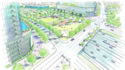
TxDOT Promises to Reverse Some of the Damage Caused by Urban Freeways in Dallas
The Texas Department of Transportation (TxDOT) is in the early stages of planning for two projects that could leverage plans to rebuild two freeways in the city with plan to reconnect the neighborhoods they severed.

$3.1 Billion for California Transportation Infrastructure
Federal and state funds were recently awarded to a large number of road projects around California.
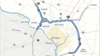
Maryland Highway Widening Plans Moving Forward Under New Governor
Maryland Governor Wes Moore is differentiating his new administration from his predecessor’s, but some projects, like the widening of federal highways in the Capital Beltway, stay the same.

Planetizen Federal Action Tracker
A weekly monitor of how Trump’s orders and actions are impacting planners and planning in America.

San Francisco's School District Spent $105M To Build Affordable Housing for Teachers — And That's Just the Beginning
SFUSD joins a growing list of school districts using their land holdings to address housing affordability challenges faced by their own employees.

The Tiny, Adorable $7,000 Car Turning Japan Onto EVs
The single seat Mibot charges from a regular plug as quickly as an iPad, and is about half the price of an average EV.

Seattle's Plan for Adopting Driverless Cars
Equity, safety, accessibility and affordability are front of mind as the city prepares for robotaxis and other autonomous vehicles.

As Trump Phases Out FEMA, Is It Time to Flee the Floodplains?
With less federal funding available for disaster relief efforts, the need to relocate at-risk communities is more urgent than ever.

With Protected Lanes, 460% More People Commute by Bike
For those needing more ammo, more data proving what we already knew is here.
Urban Design for Planners 1: Software Tools
This six-course series explores essential urban design concepts using open source software and equips planners with the tools they need to participate fully in the urban design process.
Planning for Universal Design
Learn the tools for implementing Universal Design in planning regulations.
Smith Gee Studio
City of Charlotte
City of Camden Redevelopment Agency
City of Astoria
Transportation Research & Education Center (TREC) at Portland State University
US High Speed Rail Association
City of Camden Redevelopment Agency
Municipality of Princeton (NJ)