


The Texas Department of Transportation (TxDOT) is in the early stages of planning for two projects that could leverage plans to rebuild two freeways in the city with plan to reconnect the neighborhoods they severed.
"The Texas Department of Transportation hopes to help restitch four Dallas neighborhoods during the next two decades with massive overhauls of interstates 30 and 345," reports Nic Garcia.
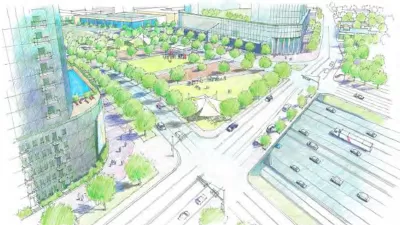
For Interstate 30, TxDOT is planning to reconstruct and widen stretches of freeway located east of downtown, where the freeway cuts through the South Dallas, Fair Park, and Deep Ellum neighborhoods. TxDOT it can complete the widening and rebuilding while hopes all three neighborhoods would be more accessible to each other by depressing the freeway below grade, redoing on ramps, adding pedestrian and bike bridges, and allowing for cap parks similar to Klyde Warren Park and the Southern Gateway.
On Interstate 345, a 1.4-mile freeway that moves 180,000 cars per day and acts as a wall between the central business district and the Deep Ellum neighborhood, the possibility of removing the elevated freeway and replacing with boulevards is on the table.
"Redesigning and rebuilding both highways was born out of work TxDOT completed in 2016, known as CityMAP," according to Garcia. "The two projects — which are estimated to cost well over $1 billion — are in their infancy. Environmental studies and federal approval are still years away before the department can lay a square foot of concrete. And there is little money set aside for this work."
In a high-profile setback for the automobile infrastructure status quo, in April the U.S. Department of Transportation halted TxDOT's work on a freeway widening project on Interstate 45 in Houston. The TxDOT is also still pursuing a widening project on Interstate 10 between Austin and Houston.
FULL STORY: These two highways tore Dallas neighborhoods apart. Can the damage be fixed?

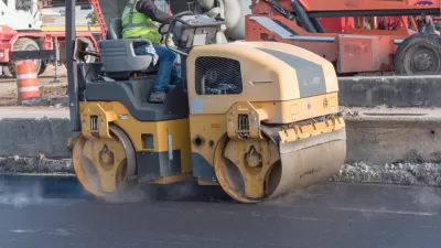
Construction Set to Begin on $1.6 Billion Highway Widening in Texas
Construction is expected to begin on the Southeast Connector highway widening project near Fort Worth in the spring and wrap up in 2027.
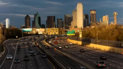
The City of Dallas Rejects the State of Texas on Plans to Widen Interstate 30
A plan to widen the Interstate 30 in Dallas is pitting state transportation officials, with ostensible goals to serve regional transportation needs, against local officials, who are more concerned with "neighborhood-centric ideals."
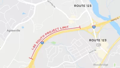
I-95 Widening Breaks Ground in Virginia
A mile-and-a-half-long section of Interstate 95, which handles 80,000 vehicle trips a day, will be expanded in Virginia. The project includes a new shoulder, lighting, and noise walls.

Maui's Vacation Rental Debate Turns Ugly
Verbal attacks, misinformation campaigns and fistfights plague a high-stakes debate to convert thousands of vacation rentals into long-term housing.

Planetizen Federal Action Tracker
A weekly monitor of how Trump’s orders and actions are impacting planners and planning in America.

Chicago’s Ghost Rails
Just beneath the surface of the modern city lie the remnants of its expansive early 20th-century streetcar system.

Bend, Oregon Zoning Reforms Prioritize Small-Scale Housing
The city altered its zoning code to allow multi-family housing and eliminated parking mandates citywide.

Amtrak Cutting Jobs, Funding to High-Speed Rail
The agency plans to cut 10 percent of its workforce and has confirmed it will not fund new high-speed rail projects.

LA Denies Basic Services to Unhoused Residents
The city has repeatedly failed to respond to requests for trash pickup at encampment sites, and eliminated a program that provided mobile showers and toilets.
Urban Design for Planners 1: Software Tools
This six-course series explores essential urban design concepts using open source software and equips planners with the tools they need to participate fully in the urban design process.
Planning for Universal Design
Learn the tools for implementing Universal Design in planning regulations.
planning NEXT
Appalachian Highlands Housing Partners
Mpact (founded as Rail~Volution)
City of Camden Redevelopment Agency
City of Astoria
City of Portland
City of Laramie