


The project is part of the city’s broader plan to improve bike and pedestrian infrastructure and road safety.
.jpg)
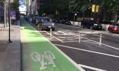
Oklahoma City began construction on its first parking-protected bike lane, a 1.8-mile stretch of Lottie Avenue and Madison Street that connects some of the city’s key destinations, reports Jessie Christopher Smith in The Oklahoman.
“We've implemented a lot of bike lanes now, but this is taking the next step of trying to create a bike lane that adds an extra layer of protection and really reflects the new best practices that have been happening,” said Justin Henry, a city transportation program planner.
According to the article, “The new Lottie bike lane is also expected to connect with the Springlake Bike Project, currently in design. The $800,000 project is being funded through the Association of Central Oklahoma Governments (ACOG) Air Quality Small Grants program and through the Better Streets, Safer City bond package passed by OKC voters in 2017.”
FULL STORY: A new kind of bike lane is being built in northeast OKC. Will it increase safety?

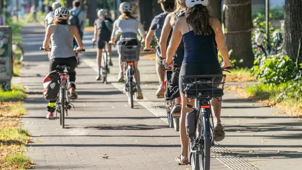
With Protected Lanes, 460% More People Commute by Bike
For those needing more ammo, more data proving what we already knew is here.
DC Backpedals on Bike Lane Protection, Swaps Barriers for Paint
Citing aesthetic concerns, the city is removing the concrete barriers and flexposts that once separated Arizona Avenue cyclists from motor vehicles.
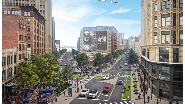
Downtown Cleveland Gets First Ever Protected Bike Lanes
The $200,000 “quick build” lanes are the first of 50 planned miles over five years.

Planetizen Federal Action Tracker
A weekly monitor of how Trump’s orders and actions are impacting planners and planning in America.

Map: Where Senate Republicans Want to Sell Your Public Lands
For public land advocates, the Senate Republicans’ proposal to sell millions of acres of public land in the West is “the biggest fight of their careers.”

Restaurant Patios Were a Pandemic Win — Why Were They so Hard to Keep?
Social distancing requirements and changes in travel patterns prompted cities to pilot new uses for street and sidewalk space. Then it got complicated.

Platform Pilsner: Vancouver Transit Agency Releases... a Beer?
TransLink will receive a portion of every sale of the four-pack.

Toronto Weighs Cheaper Transit, Parking Hikes for Major Events
Special event rates would take effect during large festivals, sports games and concerts to ‘discourage driving, manage congestion and free up space for transit.”

Berlin to Consider Car-Free Zone Larger Than Manhattan
The area bound by the 22-mile Ringbahn would still allow 12 uses of a private automobile per year per person, and several other exemptions.
Urban Design for Planners 1: Software Tools
This six-course series explores essential urban design concepts using open source software and equips planners with the tools they need to participate fully in the urban design process.
Planning for Universal Design
Learn the tools for implementing Universal Design in planning regulations.
Heyer Gruel & Associates PA
JM Goldson LLC
Custer County Colorado
City of Camden Redevelopment Agency
City of Astoria
Transportation Research & Education Center (TREC) at Portland State University
Camden Redevelopment Agency
City of Claremont
Municipality of Princeton (NJ)