


Dubbed the "Seattle Squeeze," heavier traffic is expected in the new year as the Alaskan Way Viaduct closes and downtown construction projects continue. While the city prepares, activists want to use the opportunity to encourage other modes.
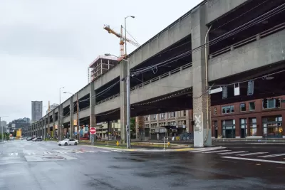
"On Jan. 11, 2019," Josh Cohen writes, "the Highway 99 Viaduct will close, three weeks before its replacement tunnel opens. With the Viaduct's more than 90,000 daily drivers spilling onto other streets and highways, January is sure to be a mess." On top of that, major construction projects will continue to impact traffic conditions until 2024, a period some are calling the "Seattle Squeeze."
During the Viaduct closure and beyond, the city is "desperate to get fewer people to drive solo." But as the city focuses most of its attention on mitigating the Squeeze's immediate effects, activists want to use the moment to change how Seattleites get around in a lasting way. They include Move All Seattle Sustainably (MASS), an advocacy group that has released a list of priorities for the city during the crunch.
Activists are focused on ways to improve bus service, build out bike lanes, and make it easier for commuters to walk to work. Making progress on those fronts, they argue, will make the city's long-term transportation goals more feasible as people contemplate getting out of their cars. Those goals include congestion pricing, "the centerpiece of [Mayor] Durkan's long term strategy." If implemented, Seattle would be the first U.S. city with such a policy.
FULL STORY: As Seattle’s traffic doom looms, some see a silver lining

Opinion: Los Angeles Must Prioritize Bikes and Buses
L.A. has a plan for improving mobility. Why are city leaders ignoring it?

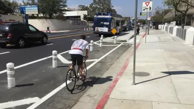
Feared Traffic Increase From New Bike Lanes Failed to Materialize
Data from a much-criticized bike lane project in Montgomery County shows no noticeable decrease in vehicle capacity and a sharp decrease in bike fatalities.
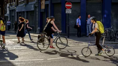
Bike Lanes Don't Cause Congestion
Research from Europe shows bike infrastructure doesn't add to urban traffic and can shift mode share from cars to bikes and reduce the need for solo car trips.

Planetizen Federal Action Tracker
A weekly monitor of how Trump’s orders and actions are impacting planners and planning in America.

Map: Where Senate Republicans Want to Sell Your Public Lands
For public land advocates, the Senate Republicans’ proposal to sell millions of acres of public land in the West is “the biggest fight of their careers.”

Restaurant Patios Were a Pandemic Win — Why Were They so Hard to Keep?
Social distancing requirements and changes in travel patterns prompted cities to pilot new uses for street and sidewalk space. Then it got complicated.

Albuquerque Route 66 Motels Become Affordable Housing
A $4 million city fund is incentivizing developers to breathe new life into derelict midcentury motels.

DC Area County Eliminates Bus Fares
Montgomery County joins a growing trend of making transit free.

Platform Pilsner: Vancouver Transit Agency Releases... a Beer?
TransLink will receive a portion of every sale of the four-pack.
Urban Design for Planners 1: Software Tools
This six-course series explores essential urban design concepts using open source software and equips planners with the tools they need to participate fully in the urban design process.
Planning for Universal Design
Learn the tools for implementing Universal Design in planning regulations.
Heyer Gruel & Associates PA
JM Goldson LLC
Custer County Colorado
City of Camden Redevelopment Agency
City of Astoria
Transportation Research & Education Center (TREC) at Portland State University
Camden Redevelopment Agency
City of Claremont
Municipality of Princeton (NJ)