


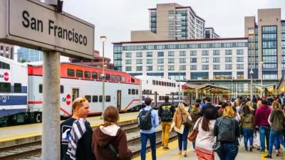
BART passengers could someday see a second route across the San Francisco Bay, with a parallel but totally new alignment and crossing points on the either side of the bay.
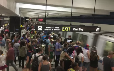
"BART officials are starting to study a second Transbay Tube," reports Michael Cabanatuan. That news follows "years of supposition and pie-in-the-sky conjecture from planners and passengers alike," according to Cabanatuan, but now the real planning can finally begin.
"Much of the talk about a new rail tunnel has centered on its location, or alignment, including where the BART lines would head once they emerge from the tube, and how they could connect with jobs and housing," according to Cabanatuan. The project could eventually cost $12 billion to $15 billion, and the possibilities for crossings and alignment are still wildly speculative, but lots of fun for fans of BART and The Bay Area, or public transit and metropolitan areas more generally.
As for the expected cost just to study the idea, "BART plans to pay for a variety of studies and some early engineering with some of the $200 million set aside in Measure RR, its $3.5 billion system modernization bond. Regional Measure 3, the Bay Area toll increase proposal on the June ballot, would set aside $50 million to further study the new tube, and Caltrans and the state Transportation Agency have said study money should be available as well, reports Cabanatuan.
Oddly enough, there's been renewed talk of a second Bay Bridge span in recent weeks—mostly speculative talk originating from the office of U.S. Senator Diane Feinstein that stands in obvious juxtaposition of the BART plan.
The source article includes a lot more detail about the various regional organizations and powers that will partner on the planning process and could eventually sway the final alignment of the second Transbay Tube.
FULL STORY: BART gets serious about a 2nd East Bay-S.F. Transbay Tube


BART Closes $35 Million Deficit
Cost control and revenue generation measures prevented service cuts.

Bay Area Proposal Calls for Combined Transit Agencies
A local legislator is asking for a plan to consolidate the region’s 27 separate transit agencies to improve financial stability and streamline service for riders.
One Rail System to Ring the Bay Area? Supporters See Reasons for Optimism
A plan to integrate the various regional transit providers in the San Francisco Bay Area could be the key to winning back transit riders in the post-pandemic world.

Planetizen Federal Action Tracker
A weekly monitor of how Trump’s orders and actions are impacting planners and planning in America.

Restaurant Patios Were a Pandemic Win — Why Were They so Hard to Keep?
Social distancing requirements and changes in travel patterns prompted cities to pilot new uses for street and sidewalk space. Then it got complicated.

Map: Where Senate Republicans Want to Sell Your Public Lands
For public land advocates, the Senate Republicans’ proposal to sell millions of acres of public land in the West is “the biggest fight of their careers.”

Maui's Vacation Rental Debate Turns Ugly
Verbal attacks, misinformation campaigns and fistfights plague a high-stakes debate to convert thousands of vacation rentals into long-term housing.

San Francisco Suspends Traffic Calming Amidst Record Deaths
Citing “a challenging fiscal landscape,” the city will cease the program on the heels of 42 traffic deaths, including 24 pedestrians.

California Homeless Arrests, Citations Spike After Ruling
An investigation reveals that anti-homeless actions increased up to 500% after Grants Pass v. Johnson — even in cities claiming no policy change.
Urban Design for Planners 1: Software Tools
This six-course series explores essential urban design concepts using open source software and equips planners with the tools they need to participate fully in the urban design process.
Planning for Universal Design
Learn the tools for implementing Universal Design in planning regulations.
Heyer Gruel & Associates PA
JM Goldson LLC
Custer County Colorado
City of Camden Redevelopment Agency
City of Astoria
Transportation Research & Education Center (TREC) at Portland State University
Camden Redevelopment Agency
City of Claremont
Municipality of Princeton (NJ)