


Technology
Regulation Not Keeping Pace with the Popularity of Drones
The use drones for planning and its related fields has obvious and immediate potential. So far, however, the use of drones lacks a coherent regulatory framework.
New App Shares Connected Car Data to Government, Businesses
This is what "smart cities" technology looks like: A new product called Inrix Insights offers planners and businesses a platform by which to access the data created by the use of connected cars.
Meet the World's First Self-Driving Big Rig
The world now includes a technology that raises the stakes of the collective interest in self-driving cars to a whole new weight class: a self-driving big rig.
NASA Looking for Help Planning the Built Environment—On Mars
You've got big ideas about how to make life better for lots of people. But are your ideas big enough for a home on Mars?
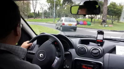
The New L.A. Story: Waze Partners with City; Neighbors Get Upset
A partnership between Waze and the city of Los Angeles has prompted a cry of "not on the street in front of my frontyard!" from residential neighborhoods around the city.
Cities Try to Turn on the Dark
Of all the inventions of the modern world, few have been so embraced as artificial light. But constant light, like that which floods city streets and illuminates buildings, is not necessarily healthy or safe. Some cities are trying to go dark.
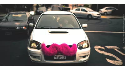
Uber Now Employs 20,000 in the Bay Area
With over 162,000 full- or part-time "driver partners" nationwide, Uber is an employment giant. The company's 20,000 Bay Area workers place it among the top five regional employers.
Wave of the Future? Tapping Wave Energy for Desalination
The future has arrived in Western Australia thanks to new technology created and implemented by Carnegie Wave Energy. The CETO project marries renewable power with desalination—a timely marriage when droughts and climate change take center stage.
New App Alerts Drivers Before Traffic Lights Turn Green
A suburban city in the East Bay Area will allow commuters to use a new app that links their smartphones to traffic lights.
Foresight and the Built Environment
In the ever changing global landscape, organizations need to anticipate and adapt to shifting circumstances to survive. AJ Artemel spoke to Dr. Gereon Uerz of the Arup Foresight + Innovation team to discuss how this can be realized.
Planning Better Bike Infrastructure with Wikimaps
Fairfax County, Virginia is taking an innovative approach to crowdsourcing feedback on how to improve bicycle infrastructure around transit stations.
Now Available on DART's Mobile Ticketing App: Uber
Transit planners who see transportation network companies as a potential benefit to public transit will want to pay attention to Uber's new partnership in Dallas.
How Cities Are Regulating the Sharing Economy
Compiled from interviews conducted with city officials, this National League of Cities report gives us a regulator's-eye-view of the sharing economy. Among the topics discussed are equity, taxation, and data transparency.
Details about ParkDC—Washington, D.C.'s Performance Parking Program
As the District Department of Transportation (DDOT) quickly approaches the May target for the launch of ParkDC, Greater Greater Washington takes a closer look at what the performance parking program will entail.

Boston Parking Meters to Get Smart
Over the next two years, Boston will replace its old parking meters with new ones connected to the internet. With this groundwork in place, pay-by-phone parking is the next step.
Farewell to the Trusty Map Book
From the years roughly spanning the invention of the automobile to the invention of the smartphone, every driver in Los Angeles traveled with a Thomas Bros. map book. Those days are gone, but nostalgia for physical maps remains.
Management, Not Technology, Will Solve California's Drought
It should come as no surprise that Eduardo Porter, who writes the Economic Scene column for The New York Times, is not enamoured by technological silver bullets like desalination as ways for California to survive it's four-year plus drought.
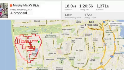
Fitness Apps Are the New Planning Tool
Many smartphone users have a fitness app that they use to track their routes and progress on fitness goals. The data in these apps is a gold mine for planners, helping lead to better infrastructure investments.
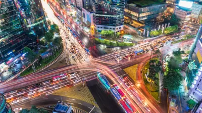
Data, Communications, and the Future of Urban Mobility
Qualcomm and Arup recently published a report on their vision for the future of connected cities. We spoke to Chris Luebkeman, Arup Fellow and Global Director of Foresight, Research and Innovation, and Qualcomm's Kiva Allgood to learn more.
Introducing the Latest City-Building Simulation Game
The "Cities: Skylines" city-building simulation game enters the scene long dominated by SimCity.
Urban Design for Planners 1: Software Tools
This six-course series explores essential urban design concepts using open source software and equips planners with the tools they need to participate fully in the urban design process.
Planning for Universal Design
Learn the tools for implementing Universal Design in planning regulations.
Heyer Gruel & Associates PA
JM Goldson LLC
Custer County Colorado
City of Camden Redevelopment Agency
City of Astoria
Transportation Research & Education Center (TREC) at Portland State University
Camden Redevelopment Agency
City of Claremont
Municipality of Princeton (NJ)


