


New York City intends to make sure that zoning codes are a tool for preventing the risks of flooding.
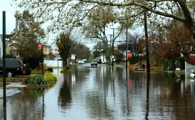
The New York Department of City Planning is currently working to update Flood Resilience Zoning rules adopted after Superstore Sandy. According to an explainers post on the NYC Planning website, the department is working with community members and property owners to create and approve a citywide zoning text amendment.
The Flood Resilience Zoning update is a part of the OneNYC plan, according to the post, and the new zoning amendment will be informed by the department's efforts "in specific neighborhoods – in residential, commercial and manufacturing areas – throughout the city’s floodplain…" The new zoning codes were preceded by climate resilience design guidelines published in June 2017.
In addition to explaining the risk of flooding in any given year in different parts of the city, the post also explains the relation between zoning and flood risks. According to the post, flood resilient zoning can reduce flood risk, promote resilient and vibrant neighborhoods, and plan for adaptation to climate change and sea level rise.
The department also created a video to explain these concepts and more in a visual format.
FULL STORY: Planning A Resilient New York City

How US Cities Can Prepare for Climate Disasters
Resilience, encompassing infrastructure, governance, economic strength, and social cohesion, is critical for cities to mitigate rising climate risks like flooding, wildfires, and heat, ensuring long-term recovery and adaptability.

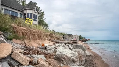
Climate Change Putting Coastal Infrastructure at Risk
More than 1,000 coastal facilities could flood as often as once a month as sea levels rise, according to a study from the Union of Concerned Scientists.
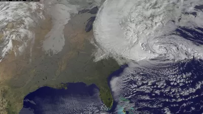
Army Corps Proposes Sea Barriers to Protect New York from Rising Seas
A massive infrastructure project is on the table in New York, after the U.S. Army Corps of Engineers released a new feasibility study.

Planetizen Federal Action Tracker
A weekly monitor of how Trump’s orders and actions are impacting planners and planning in America.

Maui's Vacation Rental Debate Turns Ugly
Verbal attacks, misinformation campaigns and fistfights plague a high-stakes debate to convert thousands of vacation rentals into long-term housing.

Restaurant Patios Were a Pandemic Win — Why Were They so Hard to Keep?
Social distancing requirements and changes in travel patterns prompted cities to pilot new uses for street and sidewalk space. Then it got complicated.

In California Battle of Housing vs. Environment, Housing Just Won
A new state law significantly limits the power of CEQA, an environmental review law that served as a powerful tool for blocking new development.

Boulder Eliminates Parking Minimums Citywide
Officials estimate the cost of building a single underground parking space at up to $100,000.

Orange County, Florida Adopts Largest US “Sprawl Repair” Code
The ‘Orange Code’ seeks to rectify decades of sprawl-inducing, car-oriented development.
Urban Design for Planners 1: Software Tools
This six-course series explores essential urban design concepts using open source software and equips planners with the tools they need to participate fully in the urban design process.
Planning for Universal Design
Learn the tools for implementing Universal Design in planning regulations.
Heyer Gruel & Associates PA
JM Goldson LLC
Custer County Colorado
City of Camden Redevelopment Agency
City of Astoria
Transportation Research & Education Center (TREC) at Portland State University
Jefferson Parish Government
Camden Redevelopment Agency
City of Claremont