


New research published in Applied Geography is a first step toward planning for the resilience of vulnerable populations as the heat rises in urban areas.

Annie Snead writes:
Although some people can just crank up the air-conditioning amid increasingly brutal heat, many cannot. Urban decision makers need to know where to focus resources as they plan their adaptation strategies, potentially as a matter of life and death. But how can they pinpoint the most vulnerable populations? In a recent study researchers answered this question for Philadelphia by mapping the places where residents are most at risk.
The study, by researchers at the Earth Institute at Columbia University and Battelle Memorial Institute, was recently published in Applied Geography. Among the findings of the study: a large spike in "extreme heat event" days in Philadelphia, while nearby rural areas showed no increases in extreme event heat days. Researchers also found an increase in "hotter than normal" nights.
Once the researchers combined the temperature data with demographic data, they "found that more than half a million people—about 10 percent of the population—inhabit neighborhoods that are most vulnerable to heat event health impacts," according to Snead.
FULL STORY: Too Sunny in Philadelphia? Satellites Zero In on Dangerous Urban Heat Islands


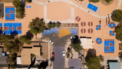
Public Parks as Climate Resilience Tools
Designed with green infrastructure, parks can mitigate flooding, reduce urban heat, and enhance climate resilience, offering cost-effective solutions to environmental challenges while benefiting communities.

Key Climate and Health Issues to Watch in 2025
The escalating health impacts of climate change, from extreme heat to sea level rise, highlight the urgent need for integrated medical education, proactive communication, and sustainable policy solutions to protect public health.
Cool Pavements Show Promise as Part of Urban Climate Resilience Strategy
Results from a pilot project in Los Angeles show that cool pavement treatments can serve as a key tool in a city’s climate resilience strategy.

Planetizen Federal Action Tracker
A weekly monitor of how Trump’s orders and actions are impacting planners and planning in America.

Map: Where Senate Republicans Want to Sell Your Public Lands
For public land advocates, the Senate Republicans’ proposal to sell millions of acres of public land in the West is “the biggest fight of their careers.”

Restaurant Patios Were a Pandemic Win — Why Were They so Hard to Keep?
Social distancing requirements and changes in travel patterns prompted cities to pilot new uses for street and sidewalk space. Then it got complicated.

Platform Pilsner: Vancouver Transit Agency Releases... a Beer?
TransLink will receive a portion of every sale of the four-pack.

Toronto Weighs Cheaper Transit, Parking Hikes for Major Events
Special event rates would take effect during large festivals, sports games and concerts to ‘discourage driving, manage congestion and free up space for transit.”

Berlin to Consider Car-Free Zone Larger Than Manhattan
The area bound by the 22-mile Ringbahn would still allow 12 uses of a private automobile per year per person, and several other exemptions.
Urban Design for Planners 1: Software Tools
This six-course series explores essential urban design concepts using open source software and equips planners with the tools they need to participate fully in the urban design process.
Planning for Universal Design
Learn the tools for implementing Universal Design in planning regulations.
Heyer Gruel & Associates PA
JM Goldson LLC
Custer County Colorado
City of Camden Redevelopment Agency
City of Astoria
Transportation Research & Education Center (TREC) at Portland State University
Camden Redevelopment Agency
City of Claremont
Municipality of Princeton (NJ)