According to Next City, a new mapping tool from the National Community Reinvestment Coalition reveals the roots of gentrification in addition to making stark a history of discrimination.


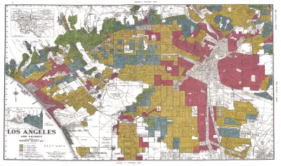
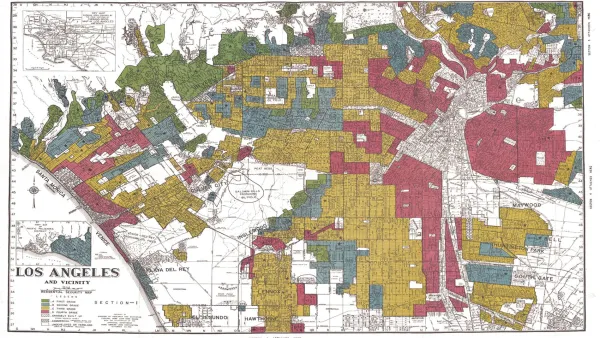
Oscar Perry Abello writes: "A new mapping tool from the National Community Reinvestment Coalition illuminates the consequences of the most important history underlying cities in the United States today: the history of redlining."
"The tool layers data on current income status and minority population on top of maps created using data from the historical redlining maps that were digitized earlier this year by researchers at the University of Richmond," adds Perry Abello.
According to Perry Abello, the new mapping tool offers many lessons about the stories of today's "inner city" neighborhoods. He chooses to dig into the subject of gentrification to exemplify the power of the new tool.
Read the full story: These 5 Neighborhood Maps Show Roots of Gentrification

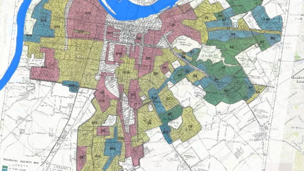
Study: Historical Redlining Maps No Longer a Proxy for Black America
Black Americans have moved on from formerly redlined neighborhoods, and other minorities and whites have moved in. The wave of presidential campaigns that have based housing policy proposals on redlining maps might be misguided as a result.

Reporters Go Undercover to Identify Housing Discrimination
A three-year investigation of the real estate industry on Long Island reveals rampant discriminatory practices and an industry complicit in the segregation of the communities that comprise the region.
Housing Discrimination Still a Vast Problem, Survey Finds
In a survey conducted last October, Zillow found that 27 percent of respondents believe they've experienced housing discrimination. National Fair Housing Alliance president Lisa Rice discusses why that is.

Planetizen Federal Action Tracker
A weekly monitor of how Trump’s orders and actions are impacting planners and planning in America.

Chicago breaks ground on $3 billion megadevelopment
The new neighborhood, titled Foundry Park, will one day host 3,700 residences.
This MA town is drowning in its own sewage — and residents like it that way
Susan Murcott, a waste water expert, said if Carlisle didn't address their leaking sewage, the problem could turn “deadly.”

Feds to more closely scrutinize proposed Amtrak facility’s environmental impact
The Federal Railroad Administration had initially said the facility qualified for a less extensive environmental review.

Boston is hard to build housing in: its chief of planning wants to keep it that way
Chief of Planning Kairos Shen said she would not make changes to Boston’s affordability requirements for new housing, which critics say have slowed down development.

California plans to bury El Niño’s downpour
If the state plays its cards right, it may be able to store a billion acre-feet of El Niño’s water in aquifers.

FREE Course: Walkable City 1: Why Walkability?
After describing his path towards focusing on walkability as the essence of good planning, Jeff Speck marches through his five principal reasons for making more walkable places.
Reinventing Malls: Planning Alchemy—Turning Gray Fields Into Gold
The course focuses on the opportunities and imperatives that shape reinvention of mall sites.

City of Rosemead
Rutgers University, Edward J. Bloustein School of Planning and Public Policy
One Hundred Miles
Hunter College, City University of New York (CUNY)
The Architects Foundation
University of Cincinnati Online
Montrose County
The Pocatello Development Authority
The Urban Renewal Agency of the City of Pocatello