


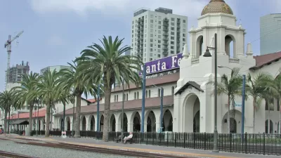
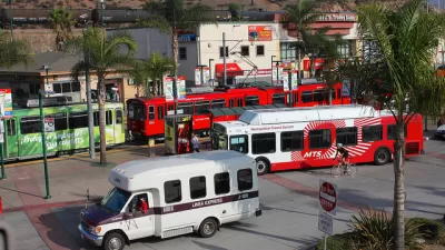
The San Diego Association of Government on October 9 will consider a 35-year regional plan that prioritizes public transit in its management of an expected 1 million new residents.
"A new long-term blueprint from area planners puts skyways and light rail stations in some of the county’s beach communities," reports Joshua Stewart, "making it possible for people who want to get to the ocean to make the trip from most of the county without getting behind the wheel."
That's the lede from a 35-year plan from the San Diego Association of Government (SANDAG). San Diego Forward: The Regional Plan, as its known, plans for the addition of 1 million new residents by 2050.
As for the organizing principles that will shape the region's approach to that growth: "The blueprint is built on the assumption that suburban sprawl will be curtailed, more people will live closer to where they work and along transportation corridors. There will be a significant shift in the number of households in multifamily homes. Neighborhoods will be more densely populated, and it will be easier to use mass transit like trolleys and skyway gondolas."
Also included is a "balanced" approach to transportation needs that would spend about half of an envisioned $204 billion in transportation spending on public transit, "new light rail lines, skyways and buses..." The article goes into a lot more detail about how the plan sets transportation priorities over the next 35 years.
FULL STORY: How we'll travel: Trains, lanes, bikes and gondolas

San Diego High-Speed Rail Plan Counts on Future Density
Despite slowing population growth statewide, officials believe the region will "grow into" the new rail system if cities promote dense development around transit stations.
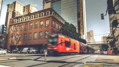
Transit Ridership Up in San Diego
Most of the U.S. saw public transit ridership continue its downward trend last year, but San Diego’s ridership, particularly on light rail, was up.
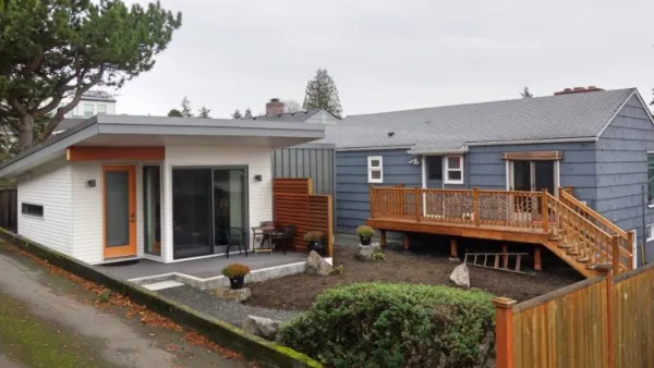
ADUs for Sale? San Diego Could Legalize Backyard Condos
As one of 25 proposed amendments, San Diego may soon allow accessory dwelling units to be bought and sold as individual homes.

Planetizen Federal Action Tracker
A weekly monitor of how Trump’s orders and actions are impacting planners and planning in America.

Map: Where Senate Republicans Want to Sell Your Public Lands
For public land advocates, the Senate Republicans’ proposal to sell millions of acres of public land in the West is “the biggest fight of their careers.”

Restaurant Patios Were a Pandemic Win — Why Were They so Hard to Keep?
Social distancing requirements and changes in travel patterns prompted cities to pilot new uses for street and sidewalk space. Then it got complicated.

Platform Pilsner: Vancouver Transit Agency Releases... a Beer?
TransLink will receive a portion of every sale of the four-pack.

Toronto Weighs Cheaper Transit, Parking Hikes for Major Events
Special event rates would take effect during large festivals, sports games and concerts to ‘discourage driving, manage congestion and free up space for transit.”

Berlin to Consider Car-Free Zone Larger Than Manhattan
The area bound by the 22-mile Ringbahn would still allow 12 uses of a private automobile per year per person, and several other exemptions.
Urban Design for Planners 1: Software Tools
This six-course series explores essential urban design concepts using open source software and equips planners with the tools they need to participate fully in the urban design process.
Planning for Universal Design
Learn the tools for implementing Universal Design in planning regulations.
Heyer Gruel & Associates PA
JM Goldson LLC
Custer County Colorado
City of Camden Redevelopment Agency
City of Astoria
Transportation Research & Education Center (TREC) at Portland State University
Camden Redevelopment Agency
City of Claremont
Municipality of Princeton (NJ)