


New tools and technologies of the so-called Internet of Things are helping cities get a better handle on water scarcity and overabundance.
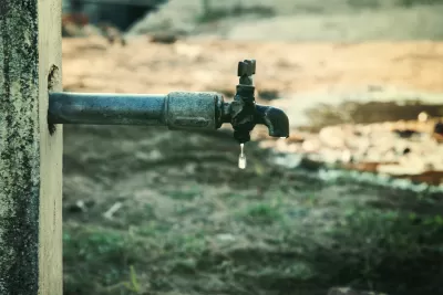
"Whether cities face scarcity or abundance—forced to conserve water or plan for torrential rain—new tools are emerging that leverage the Internet of Things to effectively manage water," according to an article by Laura Adler.
Adler goes on to survey the different types of technologies in use in cities around the country. For instance: " Companies such as Hortau and CropX and nonprofits like Santa Cruz County’s Community Water Dialogue are implementing radio- or cellular-enabled sensor systems that track variables including rainfall, humidity, soil composition, topography, temperature, and sunlight. Coupled with analytics and weather prediction data, this information enables farmers to make smarter decisions about irrigation."
On the drought side of the equation, Adler also mentions technological innovations for irrigation on municipal properties and for preventing leaks from urban water transportation systems.
For managing stormwater, Adler notes that the Internet of Things is helping cities plan for and anticipate heavy rainfall. For instance: "Firms like Opti are helping cities pull together data from water storage facilities and weather predictions to ensure that there is sufficient space to collect and process rainwater runoff. With analytics and smart infrastructure management, cities can plan for maximum runoff capture and processing, with the dual benefit of increasing water harvesting and reducing pollution."
FULL STORY: Come Drought or High Water

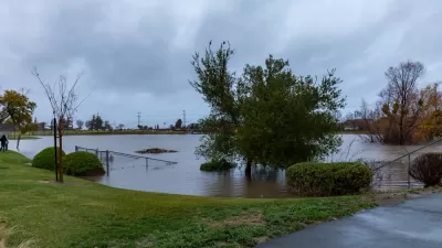
California’s Reservoirs are Filling Up, but For How Long?
Recent storms are bringing plenty of water to parched parts of California, but scientists warn the relief won’t be a long-term solution to longer, drier periods.
The Lesser-Known Programs in the Infrastructure Bill
While the focus has been on flashier components of the infrastructure bill, some smaller initiatives could have outsized impacts by shifting priorities and funding resilience efforts.
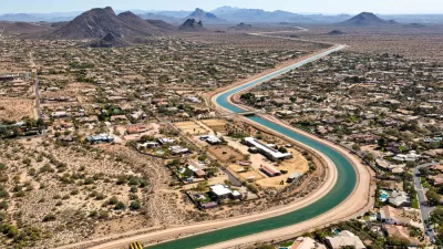
Arizona Governor Pledges $1 Billion to Water Infrastructure
The billion-dollar investment in the state's water supplies sounds good on paper, but lawmakers must also distribute funding effectively to mitigate the state's urgent water shortage.

Planetizen Federal Action Tracker
A weekly monitor of how Trump’s orders and actions are impacting planners and planning in America.

Map: Where Senate Republicans Want to Sell Your Public Lands
For public land advocates, the Senate Republicans’ proposal to sell millions of acres of public land in the West is “the biggest fight of their careers.”

Restaurant Patios Were a Pandemic Win — Why Were They so Hard to Keep?
Social distancing requirements and changes in travel patterns prompted cities to pilot new uses for street and sidewalk space. Then it got complicated.

Platform Pilsner: Vancouver Transit Agency Releases... a Beer?
TransLink will receive a portion of every sale of the four-pack.

Toronto Weighs Cheaper Transit, Parking Hikes for Major Events
Special event rates would take effect during large festivals, sports games and concerts to ‘discourage driving, manage congestion and free up space for transit.”

Berlin to Consider Car-Free Zone Larger Than Manhattan
The area bound by the 22-mile Ringbahn would still allow 12 uses of a private automobile per year per person, and several other exemptions.
Urban Design for Planners 1: Software Tools
This six-course series explores essential urban design concepts using open source software and equips planners with the tools they need to participate fully in the urban design process.
Planning for Universal Design
Learn the tools for implementing Universal Design in planning regulations.
Heyer Gruel & Associates PA
JM Goldson LLC
Custer County Colorado
City of Camden Redevelopment Agency
City of Astoria
Transportation Research & Education Center (TREC) at Portland State University
Camden Redevelopment Agency
City of Claremont
Municipality of Princeton (NJ)