


The famous cruising strip was off-limits to cars during the pandemic. Now, the city is letting vehicles return with some pedestrian-oriented compromises.
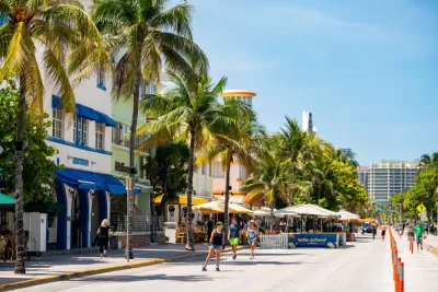
"Like many cities around the world, Miami Beach responded to the Covid-19 crisis by transforming what was once a busy thoroughfare into a car-free space, allowing walkers, bikers and rollerbladers to roam free, and restaurants to expand their outdoor seating offerings." But starting January 24, the city will bring back one-way traffic on a ten-block portion of Ocean Drive, but with some pedestrian-friendly adjustments, reports Sarah Holder. The city is adding two-way bike lanes and keeping one block pedestrian-only.
The transformation of Ocean Drive into a 'slow street' drew both praise and criticism from locals, some of whom expressed the usual complaints about loss of parking and diverted traffic. Yet dire predictions about damage to the strip's vibrant restaurant, nightclub, and luxury car rental industry have not been borne out. In fact, Holder writes, "Resort taxes on food, beverages and room rentals each month of this fiscal year and several months of last have been higher than even pre-pandemic revenues, according to city data published in December 2021." Daniel Ciraldo, executive director of the Miami Design Preservation League, attributes the rise in revenue to the increase in people walking—and noticing businesses—on the street.
As cities begin to dismantle or adapt pandemic-era open streets programs, Miami is developing a long-term plan to prioritize pedestrians on Ocean Drive and the rest of South Beach, increase open space, and allow limited car access to accommodate local needs.
FULL STORY: Miami Beach’s Ocean Drive Revs Up for a Car Comeback

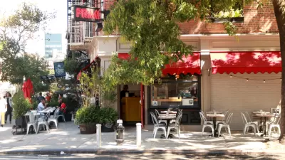
Car-Free Streets Benefit Restaurants, Yelp Survey Shows
Restaurants in areas designated as "slow streets" during the pandemic saw a boost in consumer interest.
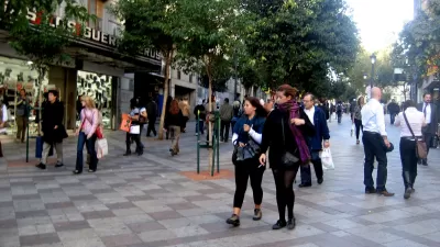
Pedestrian Malls in the 21st Century
The successes and failures of past pedestrian malls can inform the future of pandemic-induced "open streets" programs.
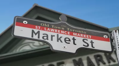
A Car-Free Summer on Toronto’s Market Street
The I Heart Market Street program will allow pedestrians a car-free space adjacent to Toronto’s St. Lawrence Market.

Planetizen Federal Action Tracker
A weekly monitor of how Trump’s orders and actions are impacting planners and planning in America.

Congressman Proposes Bill to Rename DC Metro “Trump Train”
The Make Autorail Great Again Act would withhold federal funding to the system until the Washington Metropolitan Area Transit Authority (WMATA), rebrands as the Washington Metropolitan Authority for Greater Access (WMAGA).

DARTSpace Platform Streamlines Dallas TOD Application Process
The Dallas transit agency hopes a shorter permitting timeline will boost transit-oriented development around rail stations.

Downtown Los Angeles Gears Up for Growth
A new report highlights Downtown L.A.’s ongoing revival through major housing projects, adaptive reuse, hospitality growth, and preparations for global events in the years ahead.

Supreme Court Landlord Appeal Case Could Overturn Tenant Protections
A legal case claiming that COVID-era eviction moratoriums were unconstitutional could spell trouble for tenant protections.

Texas Moves to Curb Orphan Wells, But Critics Say Loopholes Remain
A proposed state law would shift financial responsibility for sealing unused drilling sites from the public to energy operators, though some advocates question its effectiveness due to industry-backed exemptions.
Urban Design for Planners 1: Software Tools
This six-course series explores essential urban design concepts using open source software and equips planners with the tools they need to participate fully in the urban design process.
Planning for Universal Design
Learn the tools for implementing Universal Design in planning regulations.
Municipality of Princeton
Roanoke Valley-Alleghany Regional Commission
City of Mt Shasta
City of Camden Redevelopment Agency
City of Astoria
Transportation Research & Education Center (TREC) at Portland State University
US High Speed Rail Association
City of Camden Redevelopment Agency
Municipality of Princeton (NJ)