


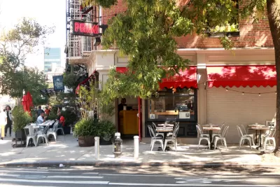
Restaurants in areas designated as "slow streets" during the pandemic saw a boost in consumer interest.
As the country moves toward adjusting to a post-COVID reality, the debate over what to do with pandemic-era installations and programs such as "slow streets" and expanded outdoor dining is heating up. The urgency of the pandemic, writes Laura Bliss for Bloomberg CityLab, gave us a glimpse into "how readily urban space can be repurposed for mobility and play, and how quickly human activity can surge back when cars are removed." In a survey of 43 member cities, "the National Association of City Transportation Officials found that 22 were planning on making Covid-era traffic changes permanent, while 16 more were considering it."
Research from Yelp shows that "slow streets" and car-free zones have had a positive impact on local restaurants. Their study "measured the difference in the share of consumer interest between the sample of restaurants in each slow street zone and all restaurants across each respective city, comparing the start of the pandemic (using March 15, 2020 as a proxy), when these programs weren’t yet in place, to the various time periods when the programs were in swing." According to Yelp, "[e]ateries in car-free areas saw more consumer interest (based on the amount of views, posted photos and user reviews on Yelp listings) when their streets were strictly limited to pedestrians and cyclists."
Justin Norman, Yelp’s vice president of data science, said he hopes their research will help inform the future of car-free streets programs. "As local governments and policymakers carve out policies that enact safer streets, we hope this information adds value to that."
FULL STORY: Where Covid’s Car-Free Streets Boosted Business

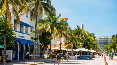
Miami Beach to Reopen Ocean Drive to Cars
The famous cruising strip was off-limits to cars during the pandemic. Now, the city is letting vehicles return with some pedestrian-oriented compromises.
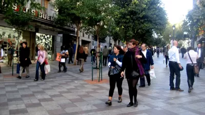
Pedestrian Malls in the 21st Century
The successes and failures of past pedestrian malls can inform the future of pandemic-induced "open streets" programs.
How Oakland Is Fixing its Pandemic Planning Equity Problem
The Oakland Slow Streets program, one of the most controversial developments of the early pandemic, has evolved to become the Essential Places initiative, thanks to new planning practices and a commitment to equity in Oakland, California.

Planetizen Federal Action Tracker
A weekly monitor of how Trump’s orders and actions are impacting planners and planning in America.

Maui's Vacation Rental Debate Turns Ugly
Verbal attacks, misinformation campaigns and fistfights plague a high-stakes debate to convert thousands of vacation rentals into long-term housing.

San Francisco Suspends Traffic Calming Amidst Record Deaths
Citing “a challenging fiscal landscape,” the city will cease the program on the heels of 42 traffic deaths, including 24 pedestrians.

Amtrak Rolls Out New Orleans to Alabama “Mardi Gras” Train
The new service will operate morning and evening departures between Mobile and New Orleans.

The Subversive Car-Free Guide to Trump's Great American Road Trip
Car-free ways to access Chicagoland’s best tourist attractions.

San Antonio and Austin are Fusing Into one Massive Megaregion
The region spanning the two central Texas cities is growing fast, posing challenges for local infrastructure and water supplies.
Urban Design for Planners 1: Software Tools
This six-course series explores essential urban design concepts using open source software and equips planners with the tools they need to participate fully in the urban design process.
Planning for Universal Design
Learn the tools for implementing Universal Design in planning regulations.
Heyer Gruel & Associates PA
JM Goldson LLC
Custer County Colorado
City of Camden Redevelopment Agency
City of Astoria
Transportation Research & Education Center (TREC) at Portland State University
Jefferson Parish Government
Camden Redevelopment Agency
City of Claremont