


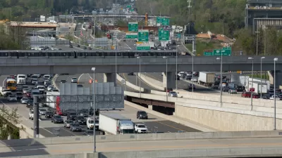
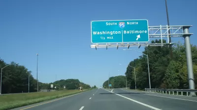
The National Capital Region Transportation Planning Board has almost completed the latest version fo the Visualize 2045 long-range transportation plan, but it is already making plans to add a climate plan to the final product.

The National Capital Region Transportation Planning Board (TPB)—which serves as the metropolitan planning organization for the Washington, D.C. region—recently took the drastic step of deciding to completely redo the process with climate change in mind.
"The agency will proceed with the adoption of its current proposal, titled 'Visualize 2045,' by spring next year, but they also voted to start over and adopt a new vision for the region’s transportation system by 2024," according to Pugh.
"The vote to develop a new plan by 2024 that reduces greenhouse gas emissions follows months of advocacy by smart growth and conservation organizations, and pressure from local elected officials to act," explains Pugh of how the dramatic decision came about. Public comments of the current version of Visualize 2045 "overwhelmingly objected to its lack of commitment to regional climate policies," according to Pugh. Instead, the plan represents a "continuation of massive road and highway expansions."
Pugh's article includes more details on the controversy surrounding the plan, and why TPB has had such a hard time meeting its climate goals through two iterations of Visualize 2045. Pugh is optimistic that the climate addendum will do a better job connecting goals to action because of new leadership and commitment at, and around, TPB.
FULL STORY: The region’s long-range transportation plan will be revamped to prioritize ways to curb climate change

D.C. Region Sets Goal to Reduce GHG Emissions From Transportation 50% by 2030
Transportation is the largest source of greenhouse gas emissions in the D.C. region—and the rest of the country. The D.C. region is committing to drastic actions to change their ways, however.
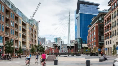
Colorado Could Reject Highway Expansion in Favor of Climate-Friendly Planning
A proposed transportation strategy could shift the state’s focus away from driving and toward incentivizing public transit use, walking, and biking.
Transportation Plan Approved for D.C. Region
Visualize 2045 makes plans for 600 projects totaling $291 billion in investments—there's some serious "blue sky" planning here.

Planetizen Federal Action Tracker
A weekly monitor of how Trump’s orders and actions are impacting planners and planning in America.

Congressman Proposes Bill to Rename DC Metro “Trump Train”
The Make Autorail Great Again Act would withhold federal funding to the system until the Washington Metropolitan Area Transit Authority (WMATA), rebrands as the Washington Metropolitan Authority for Greater Access (WMAGA).

DARTSpace Platform Streamlines Dallas TOD Application Process
The Dallas transit agency hopes a shorter permitting timeline will boost transit-oriented development around rail stations.

Renters Now Outnumber Homeowners in Over 200 US Suburbs
High housing costs in city centers and the new-found flexibility offered by remote work are pushing more renters to suburban areas.

The Tiny, Adorable $7,000 Car Turning Japan Onto EVs
The single seat Mibot charges from a regular plug as quickly as an iPad, and is about half the price of an average EV.

Supreme Court Ruling in Pipeline Case Guts Federal Environmental Law
The decision limits the scope of a federal law that mandates extensive environmental impact reviews of energy, infrastructure, and transportation projects.
Urban Design for Planners 1: Software Tools
This six-course series explores essential urban design concepts using open source software and equips planners with the tools they need to participate fully in the urban design process.
Planning for Universal Design
Learn the tools for implementing Universal Design in planning regulations.
Municipality of Princeton
Roanoke Valley-Alleghany Regional Commission
City of Mt Shasta
City of Camden Redevelopment Agency
City of Astoria
Transportation Research & Education Center (TREC) at Portland State University
US High Speed Rail Association
City of Camden Redevelopment Agency
Municipality of Princeton (NJ)