


Signs of the times, and more evidence of the essential service provided by public transit throughout the pandemic.
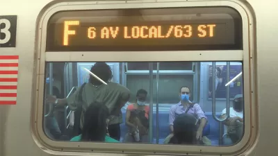
Jose Martinez and Dimitri Fautsch report on the shifting ridership on the New York subway, which during the pandemic has been significantly influenced to public health concerns, stay-at-home orders, and reduced service.
Now, 16 months after the pandemic started to take a toll on the city, subway ridership is shifting in measurable ways—most notably to subway stations in Queens are, for the first time, now among the ten busiest in the city.
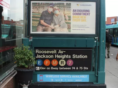
"The Jackson Heights-Roosevelt Avenue/74th Street complex on the E, F, M, R and No. 7 lines and the 7’s Flushing-Main Street terminal round out the top 10 stations in the annual accounting of station-by-station usage — whose top stations have traditionally been in Manhattan," according to the article.
"The figures also show how the pandemic has flattened demand during the traditional rush hours in the subway, a trend that some transit analysts believe could eventually lead the MTA to redistribute subway service throughout the day," add Martinez and Fautsch.
Human experience backs up the data. The article includes a soundbite from one home-health aide, who says, " I don’t have a car, I have to get to work […] I have no other option but the subway and a lot of people [in Queens] kept going to work."
More from Planetizen on the subject of shifting ridership patterns and the essential service of public transit during the pandemic:
- Who's Still Riding Transit During the Pandemic? Evidence From Toronto (April 9, 2020)
- The Geography of Occupations: Some Neighborhoods Will Suffer More Than Others Under COVID-19 (April 10, 2020)
- Opinion: Transit Has Always Been an Essential Service (April 13, 2020)
- Public Transit in Crisis: Low-Income Riders Have the Most to Lose From Service Cuts (August 19, 2020)
- Transportation Equity Lessons from the Pandemic (January 12, 2021)
- The Realities of Pandemic Public Transit Service (March 2, 2021)
FULL STORY: Queens Grabs Bigger Share of Subway Ridership as Pandemic Shifts Commutes


Tracking the New York Subway's Uneven Recovery
Ridership on the New York Subway has a long way to go to return to pre-pandemic normal, and the setbacks of recent months haven't helped the cause.
Overnight Subway Service Returning in New York City
A big piece of the process of reopening New York City for business is scheduled for May 17, but numerous challenges remain in getting the city that never sleeps back on track.

The NYC Subway's Uneven Recovery
As subway riders return in fits and starts, some stations are experiencing a much faster recovery than others.

Planetizen Federal Action Tracker
A weekly monitor of how Trump’s orders and actions are impacting planners and planning in America.

Congressman Proposes Bill to Rename DC Metro “Trump Train”
The Make Autorail Great Again Act would withhold federal funding to the system until the Washington Metropolitan Area Transit Authority (WMATA), rebrands as the Washington Metropolitan Authority for Greater Access (WMAGA).

DARTSpace Platform Streamlines Dallas TOD Application Process
The Dallas transit agency hopes a shorter permitting timeline will boost transit-oriented development around rail stations.

San Francisco's School District Spent $105M To Build Affordable Housing for Teachers — And That's Just the Beginning
SFUSD joins a growing list of school districts using their land holdings to address housing affordability challenges faced by their own employees.

Car-Centric LA Suburb Looks to a Train-Oriented Future
City leaders in Rancho Cucamonga, the future western terminus of the Brightline West rail line to Las Vegas, want to reimagine the city as a transit-oriented, pedestrian-friendly community.

New Alaska Bitcoin Mine Would Burn as Much Energy as the State’s Largest Coal Plant
Fueled by “stranded” natural gas, the startup hopes to become the largest in the US, and to make Alaska an industry center.
Urban Design for Planners 1: Software Tools
This six-course series explores essential urban design concepts using open source software and equips planners with the tools they need to participate fully in the urban design process.
Planning for Universal Design
Learn the tools for implementing Universal Design in planning regulations.
Municipality of Princeton
Roanoke Valley-Alleghany Regional Commission
City of Mt Shasta
City of Camden Redevelopment Agency
City of Astoria
Transportation Research & Education Center (TREC) at Portland State University
US High Speed Rail Association
City of Camden Redevelopment Agency
Municipality of Princeton (NJ)