


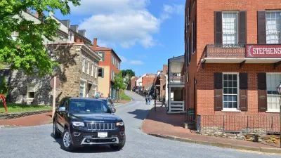
Pedestrian deaths are on the rise in the United States, but cities have been slow to implement effective policies and road design measures to change the trend.

While the number of pedestrian deaths has been dropping in other countries, the United States is projected to reach a high not seen in 30 years, reports a team from the Howard Center for Investigative Journalism at Arizona State University.
Drivers are safer than ever in vehicles outfitted with a number of features to better protect them. However, experts do not agree on the causes behind the increase in pedestrian fatalities. They point to distracted driving and an increase in walking, but these factors do not adequately explain the trends seen here in the United States and other countries.
And a closer look at the data indicates that certain places have been disproportionately affected. "The threat posed by vehicles is exacerbated by road designs in many of the country’s most dangerous locations for pedestrians — mostly low-income, predominantly minority neighborhoods in heavily populated Sun Belt cities, such as Los Angeles, Phoenix, Houston and Orlando, Fla."
Arterial roads in these areas are wide with high traffic volumes and speeds. "Many of these roads, which are designed for vehicle speeds of over 40 mph, are hostile to pedestrians. They have sidewalks that abut the travel lanes with minimal separation and lack median islands or sufficient lighting."
Some cities have adopted Vision Zero initiatives to address road safety, but others—such as Phoenix, which has one of the highest pedestrian fatality rates in the country—have fully rejected such strategies. In addition, the European Union has adopted vehicle safety standards to better protect pedestrians, but the National Highway Traffic Safety Administration says such regulations did not pass a required cost-benefit analysis.
FULL STORY: Pedestrians die every 90 minutes in the U.S., and low-income areas are hurt most

For Transportation Justice, Auto Safety Must Protect People Outside the Car
Light trucks are killing more pedestrians than ever while keeping their drivers and passengers safer. Is it time to reframe safety regulations?
SUVs Kill Pedestrians—and They Have for a Long Time
While much focus is on the future of autonomous vehicles, the increase in pedestrian deaths related to SUVs remains a largely ignored issue.

U.S. Pedestrian Fatalities Rise, While European Pedestrian Fatalities Fall
Europe proves to Americans that when it comes to pedestrian fatalities, it doesn't have to be this way.

Planetizen Federal Action Tracker
A weekly monitor of how Trump’s orders and actions are impacting planners and planning in America.

Congressman Proposes Bill to Rename DC Metro “Trump Train”
The Make Autorail Great Again Act would withhold federal funding to the system until the Washington Metropolitan Area Transit Authority (WMATA), rebrands as the Washington Metropolitan Authority for Greater Access (WMAGA).

The Simple Legislative Tool Transforming Vacant Downtowns
In California, Michigan and Georgia, an easy win is bringing dollars — and delight — back to city centers.

The States Losing Rural Delivery Rooms at an Alarming Pace
In some states, as few as 9% of rural hospitals still deliver babies. As a result, rising pre-term births, no adequate pre-term care and "harrowing" close calls are a growing reality.

The Small South Asian Republic Going all in on EVs
Thanks to one simple policy change less than five years ago, 65% of new cars in this Himalayan country are now electric.

DC Backpedals on Bike Lane Protection, Swaps Barriers for Paint
Citing aesthetic concerns, the city is removing the concrete barriers and flexposts that once separated Arizona Avenue cyclists from motor vehicles.
Urban Design for Planners 1: Software Tools
This six-course series explores essential urban design concepts using open source software and equips planners with the tools they need to participate fully in the urban design process.
Planning for Universal Design
Learn the tools for implementing Universal Design in planning regulations.
Smith Gee Studio
City of Charlotte
City of Camden Redevelopment Agency
City of Astoria
Transportation Research & Education Center (TREC) at Portland State University
US High Speed Rail Association
City of Camden Redevelopment Agency
Municipality of Princeton (NJ)